- Home
- Camino Finisterre
- Camino Finisterre to Muxia Extension
Jump to Camino Finisterre and Muxía Stages
The Camino Finisterre to Muxía Extension, 28.2 Kilometers (17.5 Miles)
~ A Second and True End of the World
Just so you know, the PilgrimageTraveler.com is an associate of Booking.com, Roamless, and Amazon. As an associate of these merchants, we earn from qualifying purchases from our links.
Extending your Camino Finisterre to Muxía, the second, medieval "End of the World," is a rewarding and intense experience, especially if you are seeking more Presence in an intimate place.
As modern measurements now know, Muxía is actually the westernmost point of mainland Europe, not Finisterre, and is the actual "end of the world!" But who actually cares?
"For untold thousands of years we traveled on over rough paths, not simply as peddlers or commuters or tourists, but as men and women for whom the path and road stood for some intense experience: freedom, new human relationships, a new awareness of the landscape. The road offered a journey into the unknown that could end up allowing us to discover who we were." ~ John Brinckerhoff Jackson
🙋♀️ Why Trust Us at the Pilgrimage Traveler?
We’re not a travel agency ~ we’re pilgrims, just like you.
We've walked Pilgrimage Routes Across Europe!
💬 We’ve:
- Gotten lost so you don’t have to. 😉
- Followed yellow arrows in the glowing sunlight, the pouring rain and by moonlight. ☀️🌧️🌙
- Slept in albergues, hostals & casa rurals. Ate and drank in cafés along the way. 🛌 😴
- Created detailed and downloadable GPS maps and eBook Guides, full of must-have information based on real pilgrimage travels. 🧭 🗺️
- Shared our complete journeys, step by step to help YOU plan your own ultimate pilgrimage and walk with your own Heart and Soul. 💙✨
Every detail is from our own experiences ~ no fluff, no AI rewrite. Just fellow pilgrims sharing the way. We add a touch of spirituality, a big dose of ❤️ and lots of wisdom from the road.
Ultreia and Safe Pilgrimage Travels, Caminante! 💫 💚 🤍
If you are planning to walk to the "End of the World" on your Camino de Santiago it is very difficult for many to choose between the two ends of the world: Muxía or Finisterre? Well, I say, walk to both if you have the time! (Muxía is pronounced moo-SHEE-ah).
It matters not from which direction you start this walk, the distance is the same, and it is well waymarked from either direction.
Maps and Stats of the Camino Finisterre to Muxía
Here is my Google map, which I created from my GPS application. I included amenities that pilgrims find useful, however I did not include all the accommodations nor restaurants/cafés in either Finisterre or Muxía. They are just too numerous to add to the map. I did add municipal albergues on the map, as they take no reservations. I also added the places where we have stayed, and can recommend them.
If you are looking for accommodation in Finisterre, click here. If you are looking for accommodation in Muxía, click here. These links will take you to booking.com, where you can reserve ahead. I thank-you for booking through this website. I appreciate your patronage!
I started my GPS at the Baixar Cross, so you may need to add/subtract distance, from the total of 28.2 kilometers, depending on where you actually start. We started from our Hotel Áncora, a few meters more.
The Camino starting in Finisterre, begins as not-too-bad ups and downs as you amble along the coastal hills. As you can see in our elevation profile below, the long hill is saved for last, in the second half of a long day. It is a significant 260 meter climb (850 feet). Fortunately, the climb up is long and gradual, with the steepest part just before the crest, followed by a much steeper decline on the other side.
We still chose to do it in this direction, and were glad. As for me personally, I felt the best was saved for last. I enjoyed Muxía immensely. I felt like it was a more intimate place than Finisterre. Choose your own way! There seemed to be about an equal number of pilgrims traveling in either direction.
Camino Finisterre and Muxía eBook Guide
Our Downloadable Camino Finisterre eBook Guide in PDF Format contains all the valuable information from our web pages, for comfortable reading offline and without ads on your personal device. Don't carry a hard copy guide book to increase your pack weight. Use our digital guides on your next Camino instead!
Our ebook guide is packed with frequently updated information, because a digital format is more nimble than hard-copy publishing. Our eBook Guide is unique because we also entertain and immerse you with our story!
We cover the entire circular route to both Finisterre and Muxía so you can choose to go to either or both! Click here for your copy or BUY NOW!
Jump to Camino Finisterre and Muxía Stages
Photo-Rich Travelogue of the Camino Finisterre to Muxía
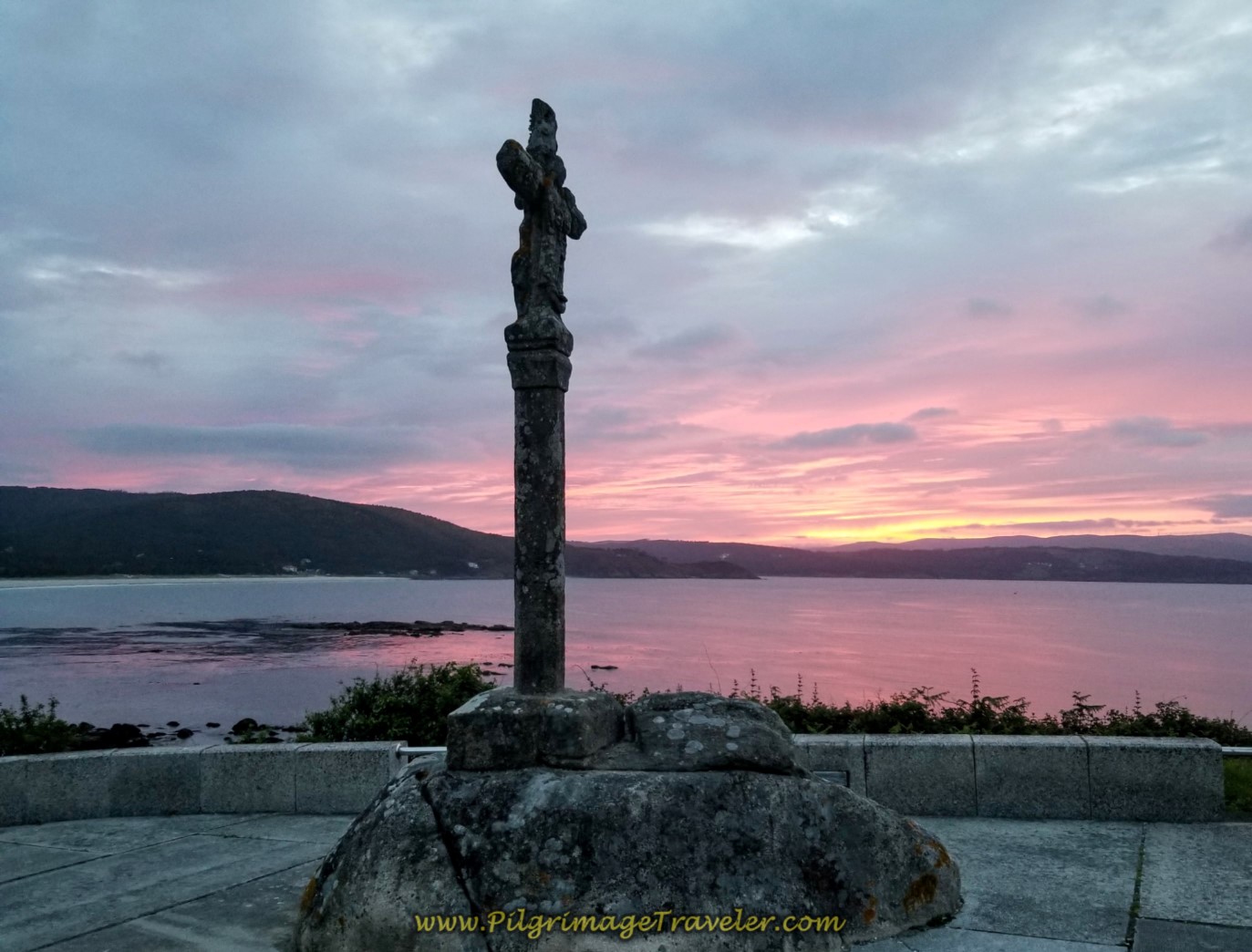
Our Camino Finisterre to Muxía begins at the north end of town by the Baixar Cross, overlooking the long Langosteira Beach.
We were so very fortunate to arrive here at the perfect moment of this vibrant sunrise. I took many photos and paused here a while. What we lacked in the sunset the night before at Cabo Fisterra, we found at sunrise instead.
After locating the cross, stay on the major route north from Finisterre, the AC-445 and turn up the hill, away from the beach. See the sign, below, showing that you are leaving the town of Fisterra.
 Walking Along the AC-445 Through Fisterra
Walk along for about 400 meters and come to this intersection, shown below with the Aldea San Martiño de Abaixo. Here you encounter your first waymark, pointing back the way you came, towards the cross and Fisterra. This waymark is positioned at the best vantage point for pilgrims coming down the hill from the left, walking in reverse, starting in Muxía.
There are separate granite waymarks for Fisterra and Muxía. There are no kilometer indications on these markers, between the towns, only the direction of travel.
If you are following the way to Muxía, as we are here, you follow the waymarks that say, "A Muxía," or "To Muxía," in English. For pilgrims coming from Muxía, they follow the waymarks that say, "A Fisterra" or to Fisterra (Finisterre), like the one shown below. At every intersection, you will find both of these waymarks.
 Reverse Waymark to Fisterra
If you look on the other side of the intersection, to your left, you see the waymark "A Muxía," the one to follow to Muxía, shown in the photo below. And so it is on the Camino Finisterre to Muxía!
 Waymark at the Restaurante Asador in Fisterra
Turn left at the Restaurante Asador and begin climbing the hill towards the town of San Martiño as the name of the road implies, the Aldea San Martiño de Abaixo (San Martiño Low Road).
Lovely views of the beautiful Langosteira Beach and Bay are on your right shoulder for much of the way immediately leaving Finisterre. The day was already overcast. It made for a glorious morning light show.
I could have stayed here for some time, just watching the changing light, but of course, I didn't! I craved the momentum of the journey.
After 3/4 kilometer, enter the town of San Martiño and pass by the lovely little country church, below.
Continue through town and walk parallel to the Praia Langosteira towards the next town of Escaselas.
 Walk Towards Escaselas
After another kilometer, at the intersection in Escaselas, turn left and northward here.
Walk for only 150 meters and turn left again in the direction of the next town of Hermedesuxo. It is a long straight road to the town.
 Long Straight Road to Hermedesuxo
800 meters of walking later, at a total of 3.1 kilometers into the day, you come to a main intersection, and take a right turn on the diagonal (2nd turn from right) onto a secondary road, following the concrete mojón.
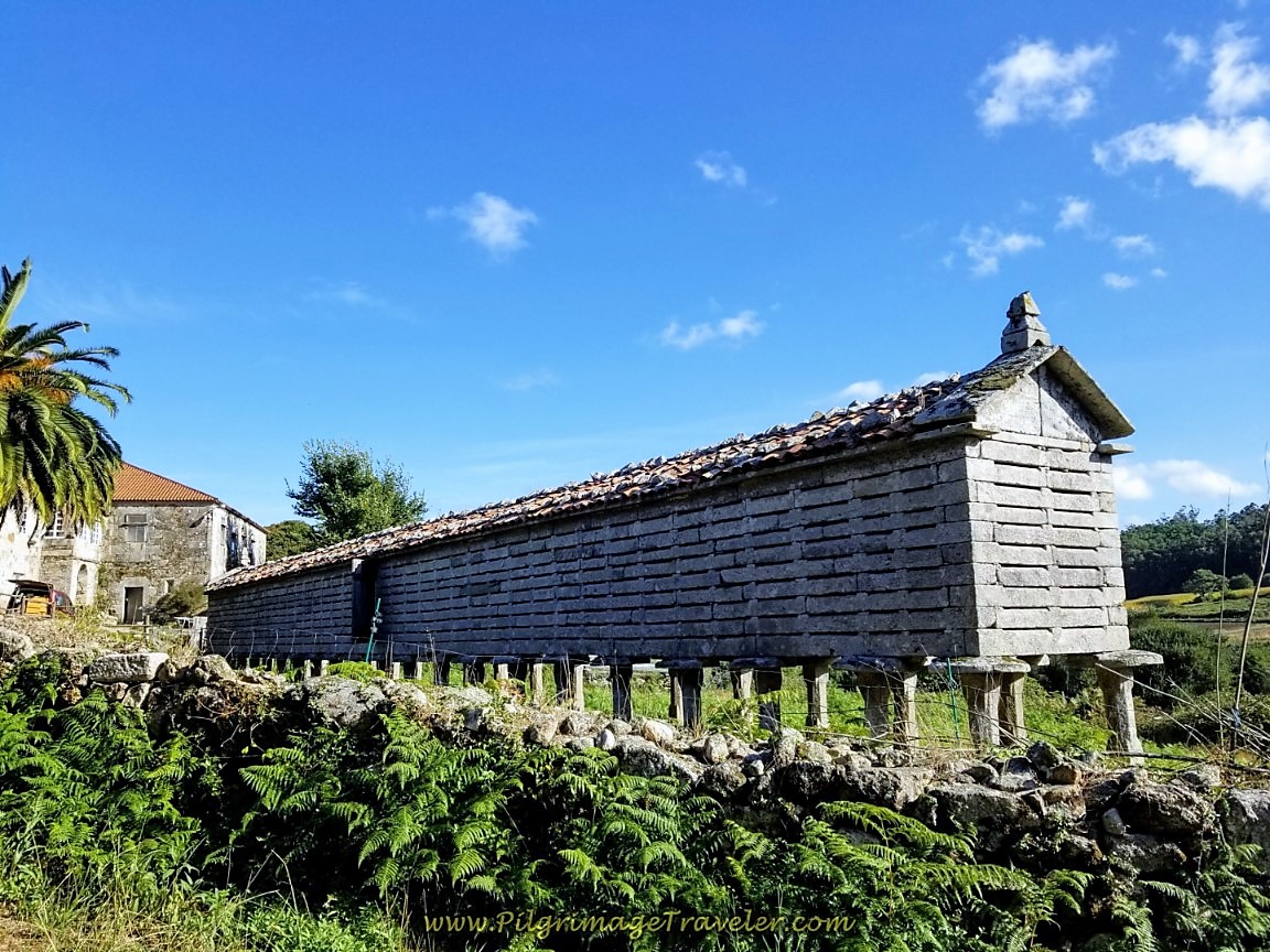
Walk on this secondary road to the north of Hermedesuxo, shown below, and notice a bright blue building with dormers, ahead. This is the Café Bar La Razón. At 3.3 kilometers into the day, it is a few steps off the Camino, about 170 meters onward from the diagonal turn. It is just past a stone hórreo and to the right, also shown in the photo below. We were thrilled to see it open at 8:00 a.m., since we had no breakfast yet. We were there minutes before 8:00 and she was already open!
 Toward the Café Bar La Razón, Past the Hórreo
After our lovely breakfast, we walked along the Camino for another 200 meters, and passed by the Casa Dugium, (not pictured). It looks like a very comfortable place to stay. A few hundred meters onward, the road ends at this hórreo, below and the long off-pavement lanes begin.
From the end of the pavement, the pilgrimage traveler gets to walk on wonderfully rural lanes, through the coastal countryside, climbing up a nice grade. Follow the well-marked lanes for almost 3.0 kilometers, to the next landmark, a wayside rest area for pilgrims, "Descanso Peregrino" in the next town of Buxán.
 Rural Lanes Through Countryside
 It Starts to Rain in the Forest
This lovely place of respite, which is reached after 6.1 kilometers total, was created by a Camino Angel, and she calls it Mi Mansión Perogrulla. Click on the link to read her fascinating story.
 "Descanso Peregrino"
Just beyond the rest area, where we did not linger because of the rain, the road becomes paved as you enter town. Ahead is this lovely intersection, where the Camino goes to the left at these stone hórreos. One hórreo was even still in use, as its original intent! Take an almost immediate right, heading west through town.
100 meters onward through Buxán, a right turn takes you by this lumber mill.
 Right Turn at Lumber Mill
After the lumber mill, enter a beautiful cultivated pine forest, continuing to walk on narrow pavement as the road leaves town. It is through here that if you stay alert and look around instead of at your feet, as we are all prone to do, that you will catch glimpses of the wild and distant beach, the Praia do Rostra. The walk is downhill from Buxán, towards the beach.
Jump to Camino Finisterre and Muxía Stages
It Can Happen ~ A Thoughtful Diversion
Keeping your eyes open to look left and right, instead of down at your feet, is so important, or the pilgrim misses this view!
Reminds me of one of my favorite songs from the band, Yes, "It Can Happen:"
"Look up, look down
Look out, look around
Look up, look down
There's a crazy world outside...
This world I like
We architects of life
A song, a sigh
Developing words that linger
Through fields of green through open eyes
This for us to see...
It can happen to you
It can happen to me
It can happen to everyone
Eventually"
Keep looking, pilgrim, for your crazy world!
Jump to Camino Finisterre and Muxía Stages
Back on the Camino Finisterre to Muxía
And then the cultivated forest opens and the beach comes into full view, despite the mist and rain.
After 650 meters on the narrow road, turn left onto another paved road, admiring the beach for another 150 meters as you walk along this road. Then the Camino Finisterre to Muxía turns left on yet another gravel lane by a cluster of homes in an area called Suarriba. The road ahead is clear. The long gravel lane leads you to the next beach hamlet of Castrexe, after 7.85 kilometers into the day.
 Road Towards the Beach is Clear Ahead
After 600 meters, the lane ends in town, turns right and onto the pavement briefly.
Just before the turn and hórreos, above, is another rural guest home called the Casa Costureiro, (+34 687 44 77 030). Another option for the pilgrimage traveler to shorten the Camino from Finisterre to Muxía.
After walking in town on pavement for 100 meters only, take a left back onto unpaved country lanes. Then, it's onward and upward on these muddy lanes toward the next village of Canosa.
 Continue on Lanes Toward Canosa
After 650 meters turn right at a T-intersection to briefly join the pavement. Then in less than 200 meters, come to another T-intersection, take a left turn, 75 meters later take another left onto a lane and its back into the verdant forest. Everything was so green in the drizzling rain.
We were more protected from the rain in the forest, but in the open it felt like the rain was coming down sideways from all directions!
 Two-Track Lane Near A Canosa
It is about 2.0 kilometers farther, on these off pavement tracks when you arrive in the town of Canosa, after 10.8 kilometers. Meander through the town for about 250 meters, following clear waymarks. There are no services in this very small town.
 Stay Left in Canosa
On the north side of town, after walking through it and its small cluster of buildings, as you are leaving, pass a very nice picnic area and a fountain. Then head out on the open road again, onward toward Lires.
 Nice Picnic Area and Fountain in Canosa
 Stay Right After Fountain in Canosa
 Leave Canosa on Secondary Road
The pavement gives way to forest roads as the Camino bends northward.
After the forest section, the Camino Finisterre to Muxía meanders on a path as it follows the river, the Rego da Carbaliza. You can see Lires ahead.
The path bends, crosses the river and comes to a T-intersection in town. Turn left and head towards the town church, below. It is about 2.0 kilometers from the center of Canosa to the center of Lires.
Jump to Camino Finisterre and Muxía Stages
The Halfway Point at Lires
After the church, the Camino turns to the right and begins to climb a steep hill. You have to work for your midway break. The Café and Pensión As Eiras Lires is just up the hill and to the right, not quite 1/2 kilometer from the church. They also have an Albergue As Eiras here.
It was about 13 kilometers into our Camino Finisterre to Muxía, a little less than the halfway point, when we arrived at the café. As the elevation map at the top of the page shows, this a great refueling stop, just before the long, long 8.3 kilometer hill climb to the top on Monte Facho de Lourido in the second half of the day.
When we stopped here in Lires by 10:30 in the morning, the place was already bustling with pilgrims. There are several more cafés from which to choose and you will see plenty of signs guiding you there, as you walk up the hill.
There is a picnic area on the other side of town as you are leaving Lires, if you prefer your break there, and if the weather is nice.
You can make the choice to do this camino in two stages, and stop here for the night as many pilgrims do. There are many more accommodations here than in the past. On your way through town, the Camino passes by the Casa Raúl, the Aparthotel Ría de Lires, the Casa Lourida Lires, the LiresCa and the Casa Luz (+34 981 74 89 24), on the way to the café.
Steps to the east of the cafe is the Apartamentos Casa Enrique, the Fragas da Canteira, the Casa Jesús and the Cabañas de Lires. The Cabañas da Ría are to the north side.
It is about 15 kilometers more to get to Muxía from Lires, or about a 3-4 hour walk.
After our break, we headed northward through town, bending to the right after a few meters, to pass by the aforementioned picnic area, with a fountain. Turn right again after the picnic tables and after a few more meters, the pavement turns to a lane, lined with pavers that descend to the Río do Castor after a bit more than 1/3 kilometer total. Cross the river on a nicely paved footbridge, shown below.
This nicely paved path continues for about 1/4 kilometer as it climbs up from the river. Where it ends, the Camino turns to the left onto a dirt road. For another 1/3 kilometer it follows the dirt road, coming to a T-intersection with a paved road. Turn left here. The long, straight paved road leads you one kilometer onward and into the next town of Frixe.
 The Next Town of Frixe Ahead
It was a bit difficult to get my momentum going again, after lunch, for the long climb, but soon I was into the rhythm of walking once again. The rain did seem to abate a bit while we were in the café, so that was helpful.
I put my head down, and went into a rhythm of breath and footfalls, finding that stillness of mind and heart within the action of my body.
It is a de-efforting of the mind, and an allowing of the body to flow on its own. It is a sweet place - one that I try to teach my yoga students, and despite the climbing I felt a new freedom.
When you arrive at the first intersection in Frixe, take the street on the diagonal, up the hill, shown in the photo below.
 Take Diagonal Street Up Hill in Frixe
Pass by a very convenient sheltered rest area with beverage vending machines, after about 15 kilometers total. Take note of this great area that would be a reprieve from the rain if you need it! We kept going.
If you want to stay here there is a rural guest home called the Casa Ceferinos, about 1/2 kilometer to the east, off the Camino Finisterre to Muxía, in town.
The paved secondary road becomes a dirt forest lane, shortly after leaving Frixe.
 Pavement Becomes Dirt Forest Lane
It is all forest lanes, crossing paved roads along the way, for the next 2.4 kilometers of gradual climbing to the next town of Guisamonde. It continued to rain lightly throughout our walk.
 Cross Over to Another Forest Lane
 Cross Over Again on the Camino Finisterre to Muxía
 Nearing Guisamonde
In Guisamonde, after 17.4 kilometers, the Camino turns right onto the pavement, shown below. We hooked up with a young man from Germany, and here is Rich walking and chatting with him. The town is only a cluster of buildings and you walk very quickly through it.
 Walking Through Guisamonde
After Guisamonde, the Way starts seriously climbing on pavement for 1.6 km towards the next town of Morquintián.
Walking in the rain, with Rich and the German chatting away up ahead, allowed me the space to ruminate and process all the happenings along the Camino. You may find yourself doing the same especially as your journey comes closer to the final steps. My thought processes were not all that happy on the long hill climb. Of course, I just wanted it to be over.
My knee was giving me some issues, and while I was walking OK, I was worried because it was stiffening up at night. The long hill slog did not ease my worry. It was about 18 kilometers into the day and I knew I was almost at the end.
Noticing your tendencies is an important function of any inward journey, and I was indeed getting to know myself on this Camino from Finisterre to Muxía. For the great wise Spirit always sends us many situations for growth.
Having the long, open road and the rain helped me to take a closer look at myself. I often wish that I didn't have to process thoughts and feelings so much, but on this day, with the ambiance of Presence, I was indeed discovering just another aspect of myself. I tried to be at peace with my process, since it was only me judging, and in this moment I detached from judging myself for once!
As it is said, the outward journey prepares one for the inward journey. We journey onward, as pilgrimage travelers, to open our hearts to this very possibility.
 The Steep Pavement Climb Begins
Enter Morquintián at the large hórreo, below, and in a few meters pass the town cross and a fountain, pictured next.
 The Town of Morquintián
About 200 meters after the fountain and cross in Morquintián, there is a the Bar O Camiño Marisol, after 19.1 kilometers total, just in case you need sustenance for the final 100 meter, 2K push to the top!
There is more walking on pavement beyond Morquintián on the Camino Finisterre to Muxía.
 Climbing Out of Morquintián
We could see the windmills up ahead, and I knew that the high ridge where they lived was our destination! You can barely make out the windmill through the mist in the photo below.
After about one kilometer after leaving Morquintián, come to a T-intersection and turn right onto another paved secondary road. It is a steep climb on this road, shown in the photo below, for another 1/3 kilometer, before the Camino goes to the left onto a dirt road, towards the mountain-top at Facho de Lourido.
 Left Turn Towards Facho de Lourido Ahead
Climbing in Galicia is always towards the ridge line and the windmills, and today on the Camino from Finisterre to Muxía was no exception! It is about one kilometer of climbing to the top, on the dirt road, pictured below.
 Weather Worsens in the Open Exposure - Is That Sleet?
Just when you think you are at the top, the road bends, and now follow the line of high power lines, to climb a bit more.
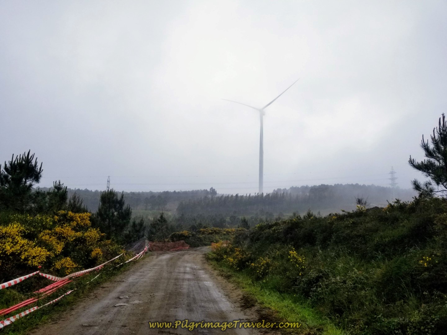 Windmills Close to the Top
And suddenly we were at the top. The rain was still coming down, at times in more frozen form!
After about 21.5 kilometers into the day, at the top, where the road bends to the right and away from the windmills on the ridge, as shown in the photo above, look for a right-hand turn. Take it!
After the turn, the road descends quite steeply and in a more easterly direction. As you can see the roadway was just being improved when we walked through this time.
 Continue the Steep Descent Towards Xurarantes
After 1.5 kilometers from the top, the Camino takes a right turn, then an immediate left, to join this tractor lane, shown below, towards the next town of Xurarantes.
 A Break in the Trees Ahead
After a total of 2.0 kilometers from the top, enter the town of Xurarantes as the sign below announces on the Camino Finisterre to Muxía.
Take a left hand turn in the center of town, which is only a cluster of buildings, and walk on pavement toward Muxia! The center of Xurarantes is a distance of 2.0 kilometers from the top and almost the end of the steep descent. The town of Muxía is still 3.2 kilometers away from Xurarantes, and the 0.0 kilometer waymark is yet another 1.0 kilometer, for a total of about 4.0 km left to go from here.
Continue to descend steeply on the road leaving Xurarantes, and in just less than 1/2 kilometer, turn right onto the DP-5201 at the intersection shown at a distance in the next photo. Is that the coast coming into view?
 Right Turn Ahead Onto DP-5201
Descend steeply on the DP-5201 as it makes a hard bend to the left at the bottom of the hill and through a roundabout. You are still about 2.0 kilometers from Muxía here.
Continue walking on the shoulder of the now-wider road for the final 2k to town. Pass by the lovely Playa de Lourido, shown below. Our day, still rainy, was anything but a beach day, so onward quickly we went. In fact, out on the wide-open road it seemed to be raining harder again!
 Follow the Long DP-5201 Towards Muxía
After Lourido Beach, the route turns northward and becomes a coastal road. We passed a large soccer field on the left, and next, we passed the small kilometer marker below, that says one kilometer! My tiring body was happy to see it. We were being pelted with rain along the Costa da Morte! At least there is a nice sidewalk and shoulder to walk upon!
Along here the coastline is rocky and rugged. It is easy to see how it got the name, "Costa da Morte" or Coast of the Dead. Walking along it gave me feelings of wildness and freedom. The sun was even trying to break through!
And finally, we arrived in Muxía, at our albergue along the western coastal road, the same DP-5201, after almost exactly 3.2 kilometers from the town of Xurarantes.
I did not take a photo of the very nice albergue and pension where we stayed, the Muxía Mare, but I did take a photo of the coastline right in front of it, shown below.
The Muxía Mare is a small and intimate place, and I love the ladies that run it. I have stayed here twice, and will go back again. Click on the link to book it. We always get a double room, but the albergue is very nice, clean and with privacy curtains by each bunk.
I have also stayed at the Albergue Bela Muxía and would recommend it as well. It is on the north end of the peninsula, closer to the point.
There are many, many places to stay in Muxía, including the municipal, Albergue Público de Peregrinos de Muxia which I placed on our interactive Google map, above. I also placed all the private albergues on the map, the Albergue Da Costa Muxia, the Albergue Arribada, the Albergue@Muxía and the Hostal La Cruz. To see additional choices of hotels, click here.
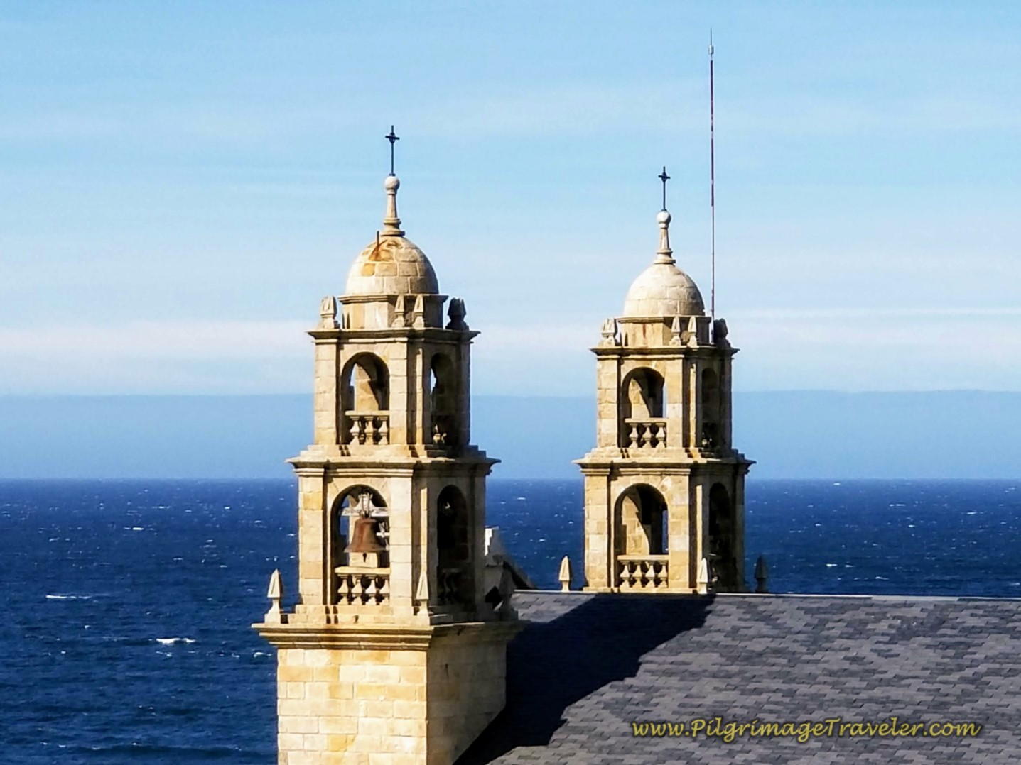
After joining up with our friends who had done the northern extension to Muxía, we set out in the evening together for the final one kilometer walk to the 0.0 kilometer marker and the Nosa Señora da Barca church. Here is where the church meets the sea at the wild rocky coastline.
From the DP-5201, in the center of town, you come to a very small park, after about 27 kilometers. It is here that you follow the waymarks and turn off the highway, onto the Rúa Coido, to the left.
It is essentially a straight shot north from here, for the full kilometer, taking no turns, as the street becomes the Rúa Virxe da Barca (Virgin of the Boat Street) as it nears the famous church.
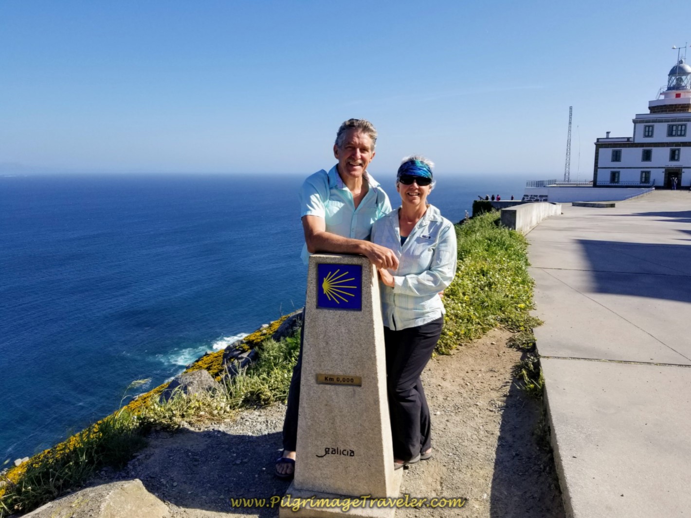
Here is Rich and I below, at the final "End of the World," posing by the zero kilometer waymark, with the Monument to the Prestige oil spill behind us and the famous Nosa Señora da Barca church at the bottom of the hill in the distance.
The Prestige Monument is in honor of where an oil tanker leaked 70,000 gallons of oil into the Atlantic in November of 2002.
Still considering our Camino Finisterre eBook Guide? Would a money-back guarantee and free updates for a full year help with your decision? Click the link in this box, OR BUY NOW. You will not regret reading this comprehensive guide!
Jump to Camino Finisterre and Muxía Stages
Reflections on the Camino Finisterre to Muxía
There is a different energy here, along the wild Costa da Morte, one of freedom, accomplishment, inner reflection and great satisfaction that accompanied me on this beautiful walk.
For more photos of this fabulous place, see my Muxía article.
This day was fraught with rain, yet we carried on, meeting the walk with gusto and perseverance. It was not my best day, yet it carried insights and new awareness. My walks never cease to help me understand myself better and better. The forward momentum has a way of providing this. I have always said that moving the body, also moves the heart and the soul. You just never know exactly how!
Salutation
May your own Camino from Finisterre to Muxía bring you intense experiences, freedom, new human relationships, and a new awareness of the landscape. May you find your own true self, on your own Camino de Santiago very soon!
Camino Finisterre and Muxía Stages:
Booking.com
Please Consider Showing Your Support
Many readers contact me, Elle, to thank me for all the time and care that I have spent creating this informative website. If you have been truly blessed by my efforts, have not purchased an eBook, yet wish to contribute, I am very grateful. Thank-you!
Search This Website:
🙋♀️ Why Trust Us at the Pilgrimage Traveler?

We’re not a travel agency ~ we’re pilgrims, just like you.
We've walked Pilgrimage Routes Across Europe!
💬 We’ve:
- Gotten lost so you don’t have to. 😉
- Followed yellow arrows in the glowing sunlight, the pouring rain and by moonlight. ☀️🌧️🌙
- Slept in albergues, hostals & casa rurals. Ate and drank in cafés along the way. 🛌 😴
- Created detailed and downloadable GPS maps and eBook Guides, full of must-have information based on real pilgrimage travels. 🧭 🗺️
- Shared our complete journeys, step by step to help YOU plan your own ultimate pilgrimage and walk with your own Heart and Soul. 💙✨
Every detail is from our own experiences ~ no fluff, no AI rewrite. Just fellow pilgrims sharing the way. We add a touch of spirituality, a big dose of ❤️ and lots of wisdom from the road.
Ultreia and Safe Pilgrimage Travels, Caminante! 💫 💚 🤍
Follow Me on Pinterest:
Find the Pilgrimage Traveler on Facebook:
Like / Share this page on Facebook:
Follow Me on Instagram:
***All Banners, Amazon, Roamless and Booking.com links on this website are affiliate links. As an Amazon associate and a Booking.com associate, the Pilgrimage Traveler website will earn from qualifying purchases when you click on these links, at no cost to you. We sincerely thank-you as this is a pilgrim-supported website***
PS: Our eBook Guide books are of our own creation and we appreciate your purchase of those too!!
Shroud Yourself in Mystery, along the Via de Francesco!
Walk in the Footsteps of St. Francis, and Connect Deeply to the Saint and to Nature in the Marvelous Italian Countryside!
Need suggestions on what to pack for your next pilgrimage? Click Here or on the photo below!
Carbon fiber construction (not aluminum) in a trekking pole makes them ultra lightweight. We like the Z-Pole style from Black Diamond so we can hide our poles in our pack from potential thieves before getting to our albergue! There are many to choose from! (See more of our gear recommendations! )
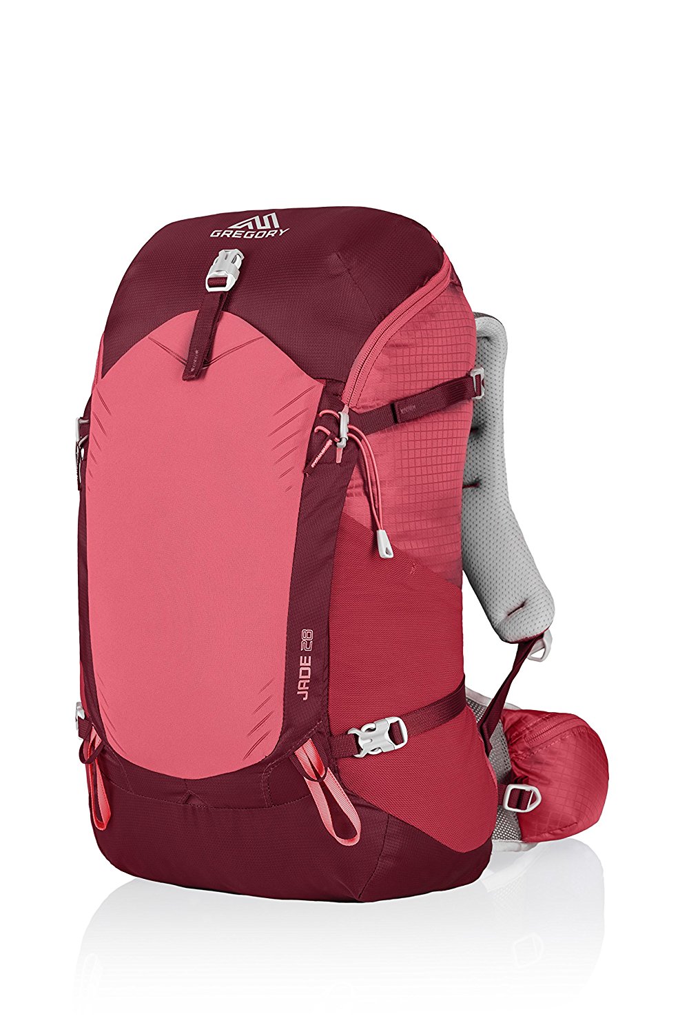
Gregory BackPack - My Favorite Brand
Do not forget your quick-dry microfiber towel!
Booking.com
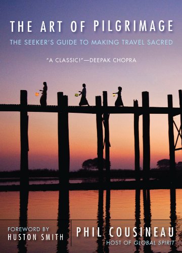
My absolute favorite book on how to be a pilgrim:










Your Opinion Matters! Comments
Have you had a similar experience, have some advice to give, or have something else you'd like to share? We would love to hear from you! Please leave us a comment in the box below.