- ~ Home
- Hiking the West Highland Way
Hiking the West Highland Way
Disclosure: the PilgrimageTraveler.com is an associate of Booking.com, Roamless, and Amazon. As associates of these merchants, we earn from qualifying purchases from our links.
Hiking the West Highland Way is a representative slice of all things Scottish, traversing 96 miles (154 kilometers) from Milngavie, just north of Glasgow to Fort William, in the highlands. It offers a journey, first through the rolling hills of the lowlands, passing a whiskey distillery along the way, then through ancient and verdant forests, next, along famous and serene lochs, and finally, through the mystical moors and ridges of the rugged highlands.
While the West Highland Way is not itself a pilgrimage, at least in the traditional sense, any long distance walk carries similarities. In fact, the lines are often blurry between recreational and spiritual or religious walks. Not only are the physical demands similar, there are always opportunities for personal reflection and if desired, making connections from fellow hikers from around the world.
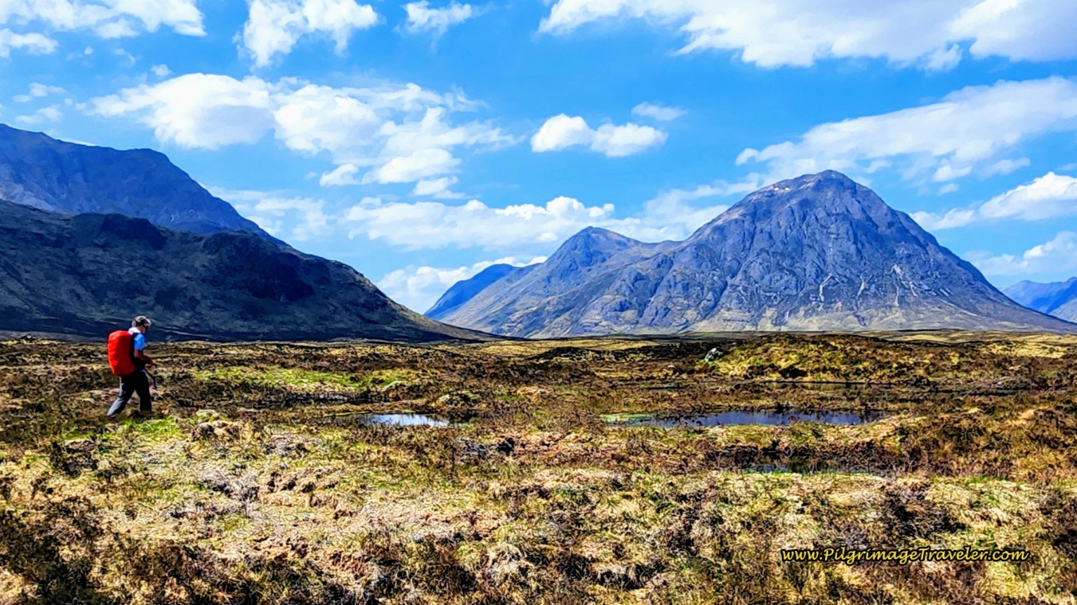 The Iconic Buachaille, in Glencoe
Clearly, both types of journeys provide a profound sense of accomplishment, the potential for personal growth, and a deep appreciation for the natural world. These similarities exist, whether or not one is driven by spiritual motives, or the desire to see and experience new landscapes, or by purely physical goals.
“Climb the mountains and get their good tidings. Nature's peace will flow into you as sunshine flows into trees. The winds will blow their own freshness into you, and the storms their energy, while cares will drop away from you like the leaves of Autumn.”
~ John Muir, The Mountains of California
 Approaching Conic Hill
🙋♀️ Why Trust Us at the Pilgrimage Traveler?
We’re not a travel agency ~ we’re fellow pilgrims! (See About Us)
We've trekked Pilgrimage Routes Across Europe since 2014!
💬 We’ve:
- Gotten lost so you don’t have to. 😉
- Followed waymarks in the glowing sunlight, the pouring rain and by moonlight. ☀️🌧️🌙
- Slept in albergues, hostels & casa rurals. Ate and drank in cafés along the way. 🛌 😴
- Created comprehensive and downloadable GPS maps and eBook Guides, full of must-have information based on real pilgrimage travels. 🧭 🗺️
- Shared our complete journeys, step by step to help YOU plan your ultimate pilgrimage and walk with your own Heart and Soul. 💙✨
Every detail is from our own experiences. Just fellow pilgrims sharing the Way. We have added a touch of spirituality, heartfelt insights and practical guidance from the road ~ offering a genuine connection to the spirit of pilgrimage. Tap into the wisdom of seasoned pilgrims!
Ultreia and Safe Pilgrimage Travels, Caminante! 💫 💚 🤍
The West Highland way was established in 1980 as Scotland's first designated long distance walk. If they only knew what was to come! The success and current popularity of this route now necessitates a full year of planning ahead!
And it's no wonder that this route has become so popular, as it encounters the most iconic Scottish landmarks such as the Glengoyne Distillery, Conic Hill, Loch Lomond, the haunted Drovers Inn, Rannoch Moor and Lairig Mor, and the towering peaks of Buachaille Etive Mòr, the guardian of the Glencoe Valley and Ben Nevis, the UK's highest peak.
If the magic of the Scottich highlands is calling you, keep reading to see the logistics for planning your own journey, hiking the West Highland Way!
How Difficult is the West Highland Way?
Many of the miles of the WHW are along historic military roads, making passage all that much easier. The route is not at all technical, but will require a level of fitness that exceeds the ordinary daily stroll, especially on the days that require significant elevation changes.
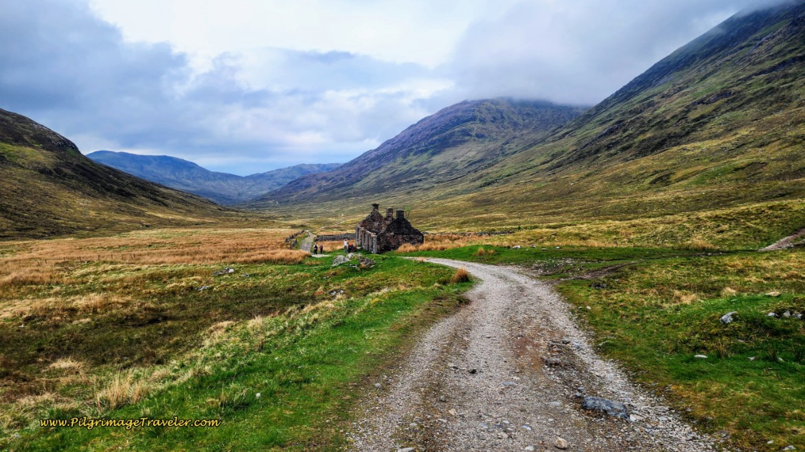 WHW Frequently Using Old Military Roads
Start your training by hiking at least a five mile trail. See how you feel. You can add a few miles at a time, each day. If you can hike 10 miles on the flats, add in some elevation change.
When you are at 10 miles with about 1000 feet (300 meters) of incline, you are ready for hiking the West Highland Way!
This long-distance hike is great in that the first day is essentially flat. The second day has the steep Conic Hill. The third day, while it appears to be flat, is the hardest day, in my opinion, because of the constant, little ups and downs on rocky paths along Loch Lomond, even adding in ladders, elevated bridges and rock steps. The hardest climb is not until the section from Kingshouse to Kinlochleven, climbing the Devil's Staircase, the highest point on the entire Way.
 Entire WHW Elevation Profile, from Official WHW Website
Basically, there is at least one hill climb on every stage, as you can see, so it won't be easy. But with proper preparedness, it won't be difficult either! A strong determination to succeed is also very, very helpful!
When is the Best Time of Year for Hiking the West Highland Way?
The best times, in the opinion of most, are the spring and fall. The season usually opens in April and ends in October. Make sure your accommodations are open if you plan to walk during the off-season.
The most weather stable month of the year in the highlands is May, and as a result it is the busiest month! We actually had an unprecedented eight full days with only a few minutes of drizzle when we walked!
The springtime wildflowers in May were fabulous. The famous bluebells or "fairy flowers" as they are known in folklore, carpeted the slopes along Loch Lomond. However, the heather blooms later in the summer, creating another spectacular event. Usually the plants have two blooms in early summer and again in late summer. I was disappointed that we missed it!
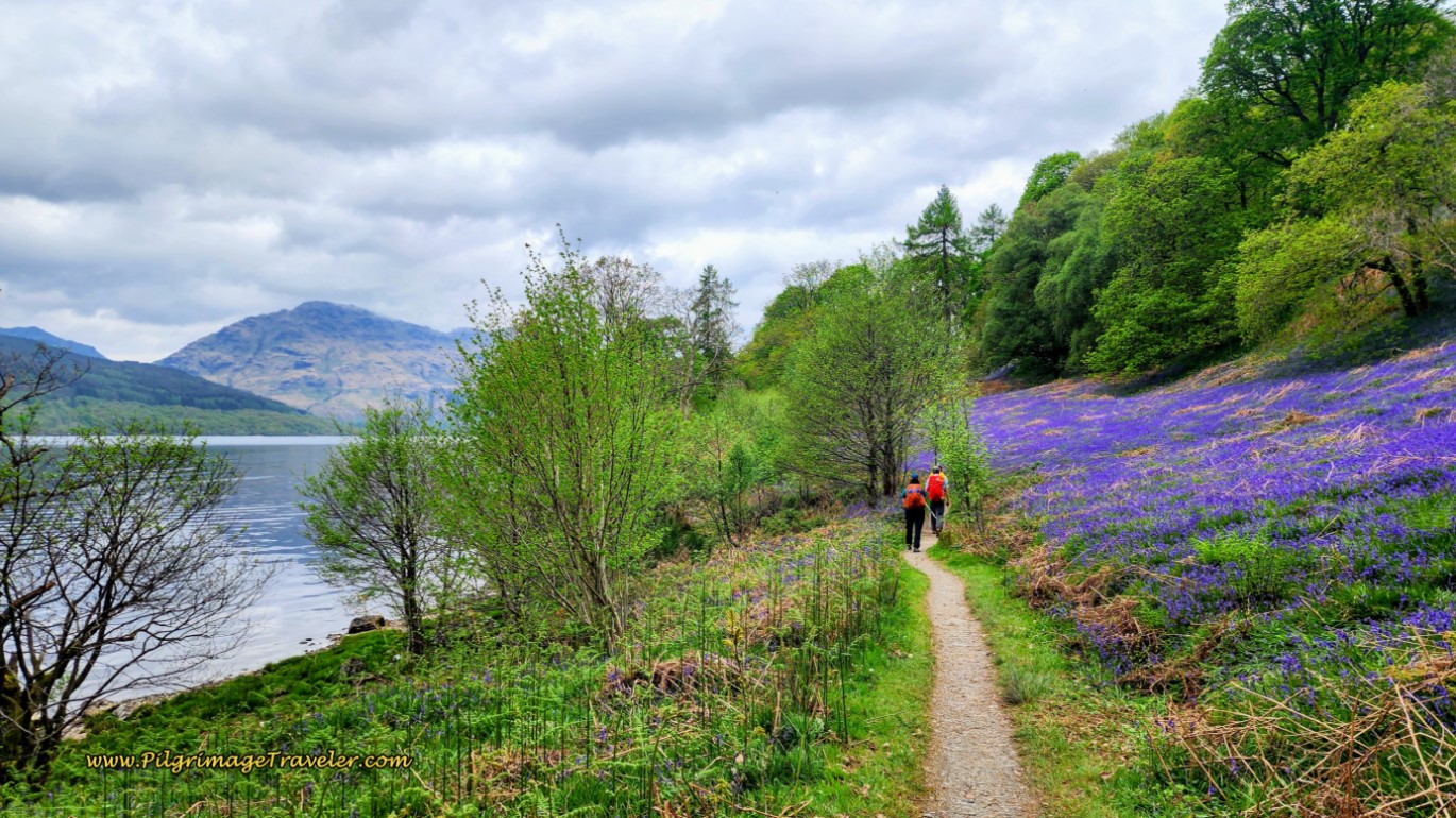 Springtime Bluebells Along Loch Lomond
Just as June, July and August are warmer, so they steadily become rainer too. If you look at WeatherSpark, you can get averages for this area to help you plan. I searched the weather for the city of Fort William, but you can plug in any other city instead as it will differ a bit from south to north along the Way.
The other reason May is so popular, is this is the month when the nasty little biting midges are least likely to be out and about. If you are unfamiliar with midges, they are small biting flies that can ruin your trip. Midges like lowlands with lots of moisture, and no wind. The season for them is mid-May to mid-September. We saw no midges in early May.
The best way to deal with midges is similar to dealing with mosquitos. Cover up, use insect repellent with DEET, avoid being out at dusk and dawn when they are most active and wear a silly-looking, but very effective head net. Yes, that is what you have to do! For a midge forecast, you can go to the Smidge Website, from a popular British midge repellent maker.
How Long Will it Take to Hike the West Highland Way?
Below are the classic stages for the WHW, depending on how many days you wish to take to do it. Indeed, these are suggestions from the WHW official website, but it is possible to take shorter stages, with more days, if desired.
We did it in 8 days, and were very happy with this itinerary. We loved having long afternoons to hang out in the pubs and get to know the culture after an adequate work-out. Since we are long-distance walkers, this was not a huge challenge, and being from Colorado, we were all used to the elevation changes. But, assess your own abilities carefully!
The 5-day itinerary is quite industrious, for the super-fit only, especially because the 13-mile section from Rowardennan to Inverarnan is the hardest, by most peoples' judgment. As noted above, this stage requires careful footing on slick rock steps, ladders, elevated bridges, many jutting tree roots, and persistent ups and downs. Then to add six more miles to that length, would have been well beyond our group's sensibilities!
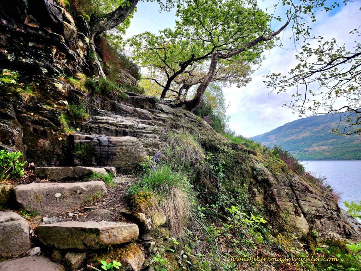 Precarious Rock Steps Along Loch Lomond
Both the towns of Bridge of Orchy and Inveroran have very few beds, which is why I give both options for days five and six, in the 8-day itinerary below. We took the Bridge of Orchy option, which made our day five almost a rest day, with a bit less than seven miles, which we enjoyed very much, halfway through the walk. We hung out on the beautiful River Orchy banks, imbibed at the Bridge of Orchy Hotel and napped after the happy hour!
|
Day 1 |
8-Days: Milngavie to Drymen, 12 Miles |
7-Days: Milngavie to Drymen, 12 Miles |
5-Days: Milngavie to Balmaha, 19 Miles |
|
Day 2 |
Drymen to Rowardennan, 14 Miles |
Drymen to Rowardennan, 14 Miles |
Balmaha to Inverarnan, 19 Miles |
|
Day 3 |
Rowardennan to Inverarnan, |
Rowardennan to Inverarnan, |
Inverarnan to Bridge of Orchy, 19 Miles |
|
Day 4 |
Inverarnan to Tyndrum, 12 Miles |
Inverarnan to Tyndrum, 12 Miles |
Bridge of Orchy to Kinlochleven, 20 Miles |
|
Day 5 |
Tyndrum to Bridge of Orchy (or Inveroran), 7 Miles (or 9 Miles) |
Tyndrum to Kingshouse, 18 Miles |
Kinlochleven to Fort William, 16 Miles |
|
Day 6 |
Bridge of Orchy (or Inveroran) to Kingshouse, 12 Miles (or 10 Miles) |
Kingshouse to Kinlochleven, 9 Miles | |
|
Day 7 |
Kingshouse to Kinlochleven, 9 Miles |
Kinlochleven to Ft. William, 16 Miles | |
|
Day 8 |
Kinlochleven to Ft. William, 16 Miles |
My Map for Hiking the West Highland Way
I have created a Google Map from my own GPS tracks, which I hope you will find useful! I included accommodations, landmarks and features on the map as well. The map below is fully interactive. Just click on a feature to see more information, and for direct links to accommodations, etc.
Click here for a directly shared link to this WHW map, if you wish to open and retain it on your own device while you walk. The map that opens on your device will have all these same features you will need to plan a successful walk!
🌍 Map Like a Pro: Step-by-Step Guide to Using My Interactive Maps*
On a Laptop:
- Initial View: Click "View larger map" (upper-right).
- Re-access: Go to maps.google.com → "Saved" icon (left taskbar) → "Maps" (far right).
On a Mobile Device (Google Maps App - Recommended):
- Initial View: Tap "View larger map" (upper-right). May open in app or browser. Tap "Save" if your browser asks.
- Re-access: Open app → "You" or "Saved" (bottom taskbar) → scroll down → "Maps" (lower right).
On a Mobile Device (Browser):
- Initial View: Tap "View larger map" (upper-right). May open in app or browser. Tap "Save" if your browser asks.
- Re-access: Go to maps.google.com → dropdown under "Google Maps" → "My Maps."
💡 PRO TIP: Using My Interactive Google Map for GPS Navigation
- Jump to this page for downloading instructions.
- Jump to this page for uploading instructions.
*Note that my maps are not offline maps, but you will need to have a data plan for full functionality. However, you can use them offline. For instructions on how to do that, please click here.
Staying Connected with an eSIM:
If your wish is to stay connected and your mobile device supports eSIMs, it’s the easiest way to go. No need to swap physical SIM cards—you just activate a virtual one on your phone. eSIMs let you buy data plans online, so you're connected the moment you arrive. It is so simple!
Why I Recommend Roamless:
I personally use Roamless for its pay-as-you-go model and seamless global coverage. The inexpensive data never expires, making it perfect for long or multi-country trips. Activate it only once and never have to swap physical cards or eSIMs ever again, even when traveling to multiple countries across multiple dates. Find out more by clicking here and be an informed pilgrimage traveler!
Waymarking Along the West Highland Way
If you are worried about finding your way on the West Highland Way, you shouldn't be! While I love following GPS tracks, to see my time and distance, you truly will not need them to find the route itself. There is no trail that I have been on that is better way-marked than the WHW! You would have to have your eyes closed to get lost!
Here is Rich and I (Elle) at the official start, an obelisk, with the special insignia, unique to the West Highland Way.
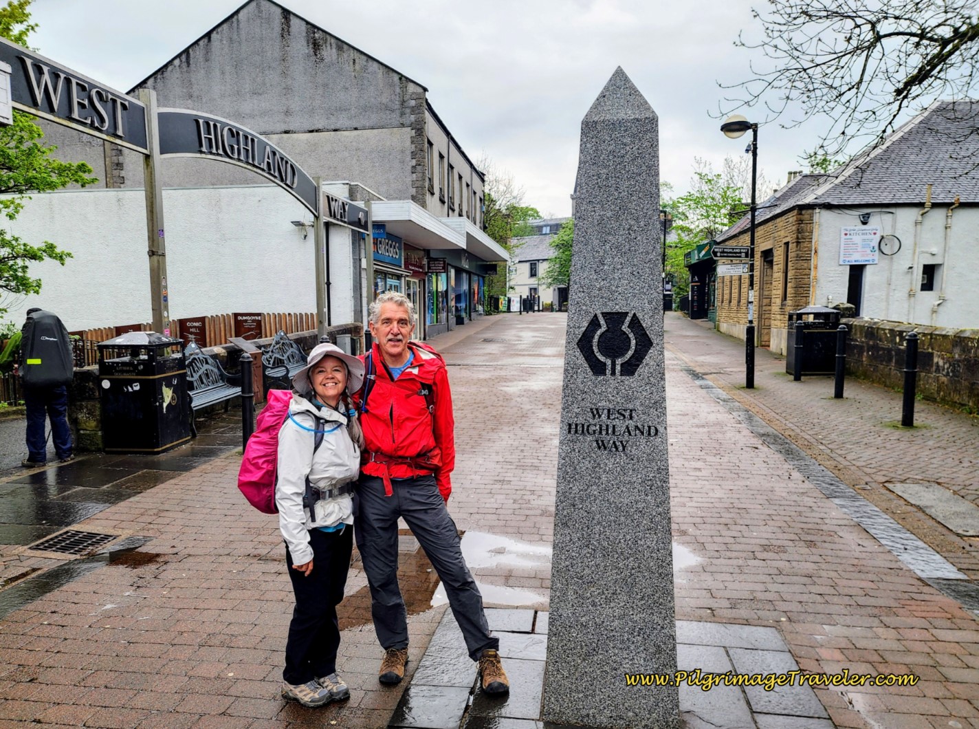 WHW Official Start at Obelisk
You will see posts like this frequently, as you are hiking the West Highland Way, with the signature trademark:
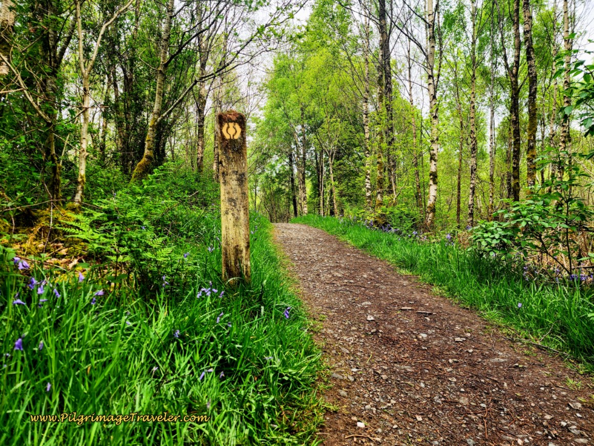 WHW Typical Waymark Post
And larger signposts like this:
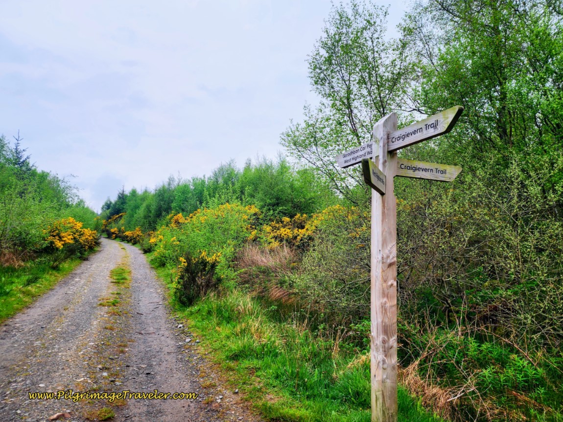 WHW Signpost
So relax, and enjoy hiking the West Highland Way!
Accommodations on the West Highland Way
It is rather expensive to book accommodations on the WHW, especially if you are used to the Camino de Santiago! However, there are bunkhouses that are more economical, but those are also relatively expensive, compared to the Camino. Expect to pay about £35 - £55 per person for bunkhouses!
There are also designated wild camping sites. The are usually well-signed, as well as areas where camping is not allowed. We saw a lot of campers, which surprised me, but which I suppose is due to the high cost of accommodations.
I placed established campgrounds on the map above, that supply varying services from composting toilets and no showers, to full amenities. For a cost of course.
Please see each individual day on the thumbnails, below (coming soon!) for all the possible accommodations, including more information on wild camping. Or, just click on the link to my map above! After opening the map, just click on each icon for more information!
For a taste of what the WHW offers, here is the haunted and hoary Drovers Inn, established in 1705. When we arrived, I asked for a room that wasn't haunted and the desk clerk responded, "It's a little late for that now, isn't it?" Too funny! I laughed out loud. Despite the dead, stuffed animals everywhere, I had a wonderful time at the pub and a wonderful night's sleep. To read about their ghosts, click on the link! To get into this famous place, book well in advance!
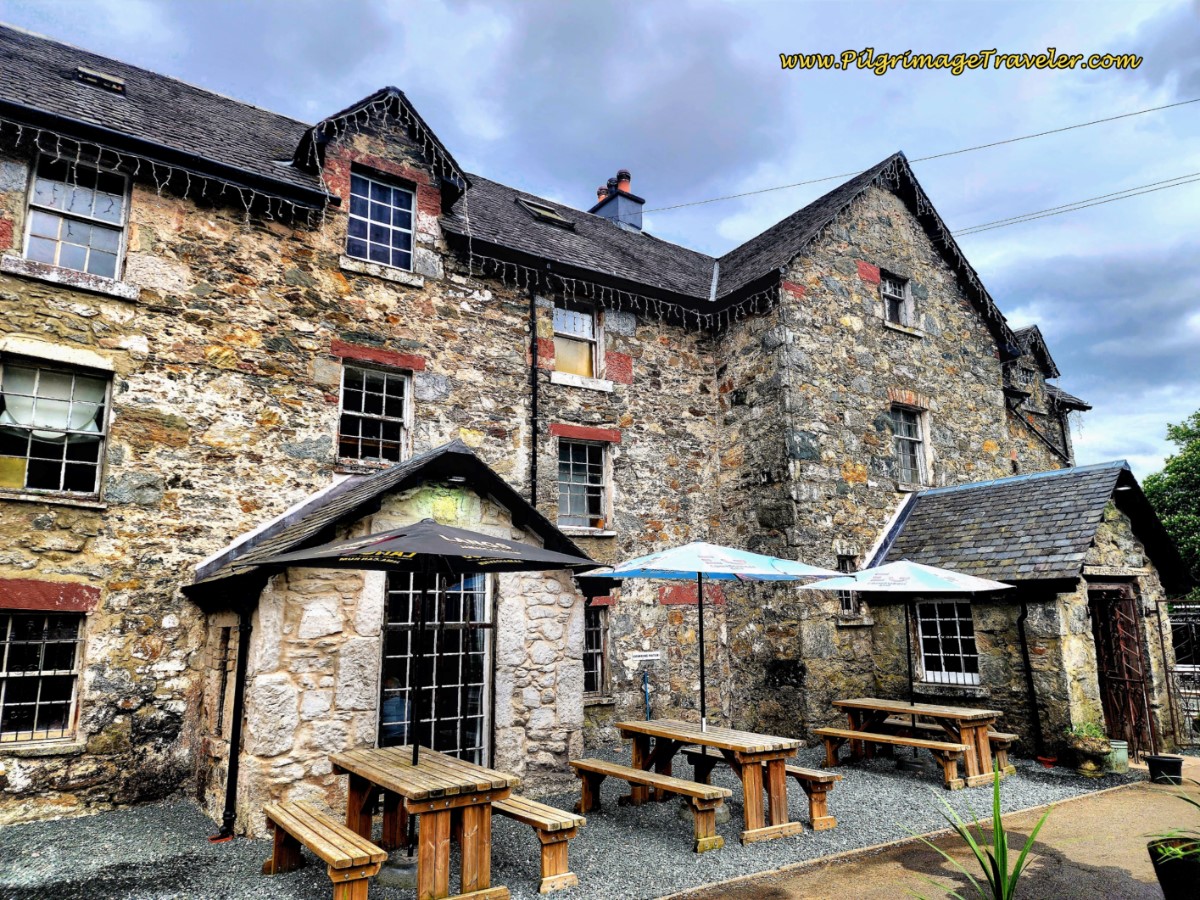 Drovers Inn, Inverarnan
And here is the historic, but updated and idyllically located Kingshouse Hotel, at the start of Glencoe, in the shadow of the most-photographed mountain, the Buachaille Etive Mòr. The hotel was a bit rich for our budget, but we did splurge for a meal in the restaurant with amazing views of the mountain. The private bunkhouse room we had was lovely, and adequate, and wild campers were allowed to camp just across the river from the establishment.
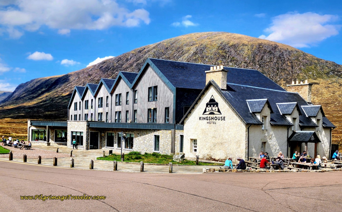 Kingshouse Hotel and Bunkhouse
For your convenience, I have listed each major town/city along the route, and where there are possibilities for accommodation for you to search on Booking.com (these are affiliate links). This list is not exhaustive. Again use my Google map above!
Glasgow: Milngave: Drymen: Balmaha: Rowardennan: Inversnaid: Crianlarich (Less than 1/2 mile off route): Tyndrum: Bridge of Orchy: Kinlocheven: Glencoe (off route, necessitating a shuttle/taxi): Fort William.
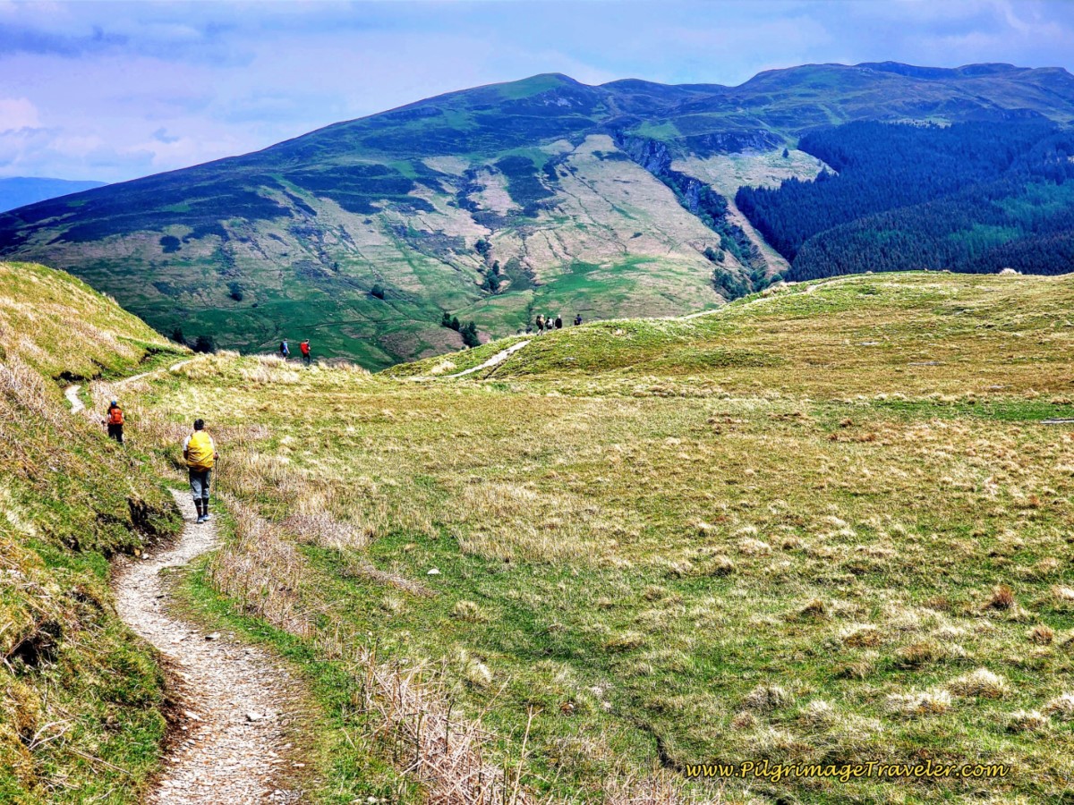 Approaching the Western Shoulder of Ben Nevis
Salutation
My wish for this brief introduction to hiking the West Highland Way, is to inspire you to just get out there and do it. If you walk it, you may just find yourself longing to come back to this wildly beautiful land!
Please Consider Showing Your Support
Many readers contact me, Elle, to thank me for all the time and care that I have spent creating this informative website. If you have been truly blessed by my efforts, have not purchased an eBook, yet wish to contribute, I am exeedingly grateful. Thank you!
Search This Website:
🙋♀️ Why Trust Us at the Pilgrimage Traveler?

We’re not a travel agency ~ we’re fellow pilgrims! (See About Us)
We've trekked Pilgrimage Routes Across Europe since 2014!
💬 We’ve:
- Gotten lost so you don’t have to. 😉
- Followed waymarks in the glowing sunlight, the pouring rain and by moonlight. ☀️🌧️🌙
- Slept in albergues, hostels & casa rurals. Ate and drank in cafés along the way. 🛌 😴
- Created comprehensive and downloadable GPS maps and eBook Guides, full of must-have information based on real pilgrimage travels. 🧭 🗺️
- Shared our complete journeys, step by step to help YOU plan your ultimate pilgrimage and walk with your own Heart and Soul. 💙✨
Every detail is from our own experiences. Just fellow pilgrims sharing the Way. We have added a touch of spirituality, heartfelt insights and practical guidance from the road ~ offering a genuine connection to the spirit of pilgrimage. Tap into the wisdom of seasoned pilgrims!
Ultreia and Safe Pilgrimage Travels, Caminante! 💫 💚 🤍
Follow Me on Pinterest:
Find the Pilgrimage Traveler on Facebook:
Like / Share this page on Facebook:
***All Banners, Amazon, Roamless and Booking.com links on this website are affiliate links. As an Amazon associate and a Booking.com associate, the Pilgrimage Traveler website will earn from qualifying purchases when you click on these links, at no cost to you. We sincerely thank you as this is a pilgrim-supported website***
PS: Our eBook Guide books are of our own creation and we appreciate your purchase of those too!!
Shroud Yourself in Mystery, along the Via de Francesco!
Walk in the Footsteps of St. Francis, and Connect Deeply to the Saint and to Nature in the Marvelous Italian Countryside!
Need suggestions on what to pack for your next pilgrimage? Click Here or on the photo below!
Find the Best Hotel Deals Using This Tool!
Carbon Trekking Poles ~ My Favorites!
Carbon fiber construction (not aluminum) in a trekking pole makes them ultra lightweight. We like the Z-Pole style from Black Diamond so we can hide our poles in our pack from potential thieves before getting to our albergue! There are many to choose from! (See more of our gear recommendations! )
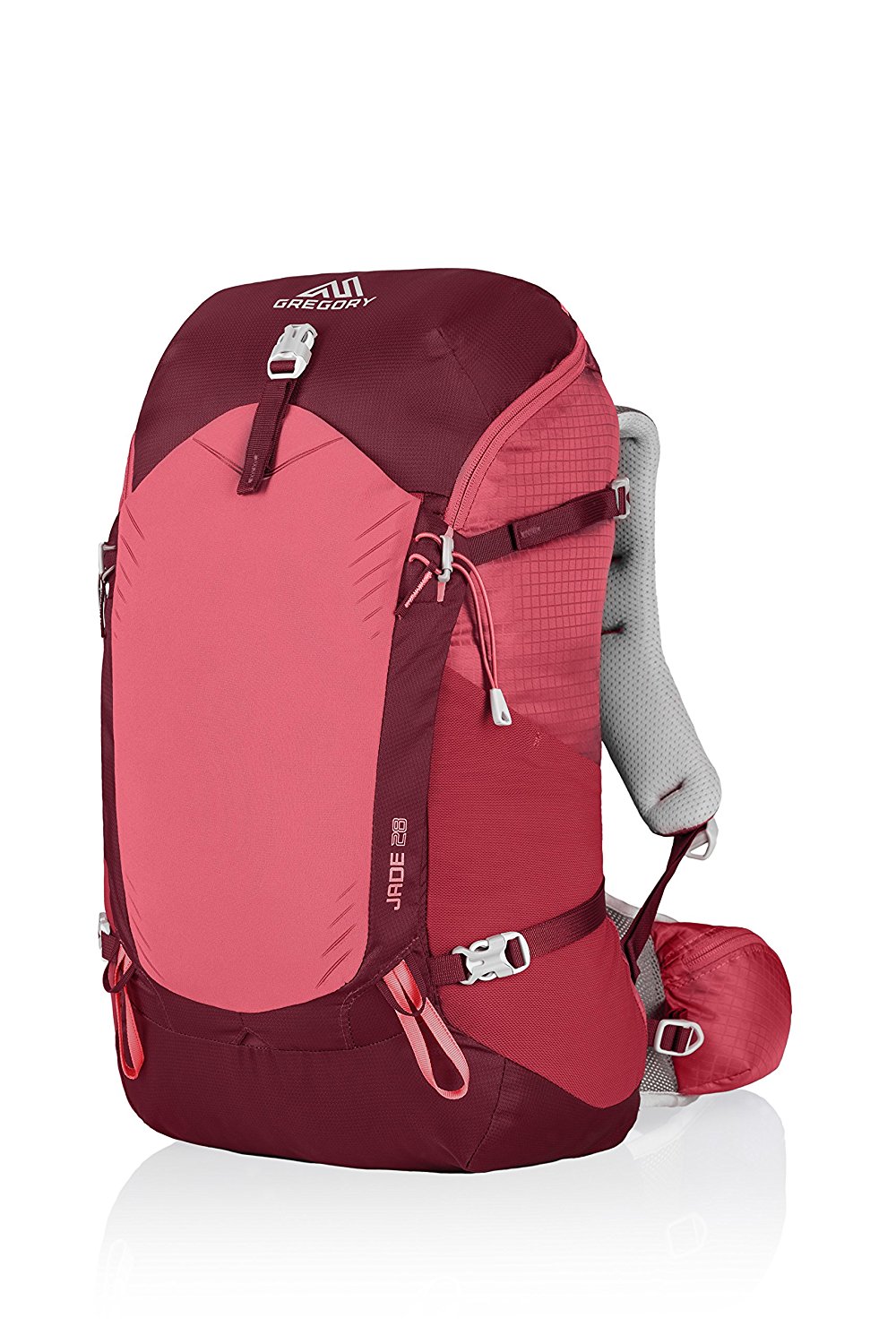
Gregory BackPack ~ My Favorite Brand
Do not forget your quick-dry microfiber towel!




Your Opinion Matters! Comments
Have you had a similar experience, have some advice to give, or have something else you'd like to share? We would love to hear from you! Please leave us a comment in the box below.