- ~ Home
- ~ Camino de San Salvador (The Way of the Savior)
- Day Five, Campomanes to Mieres del Camino
Jump to Camino de San Salvador Stages
Day Five on the Camino de San Salvador, Campomanes to Mieres del Camino, 20.7 Kilometers (12.86 Miles)
Disclosure: the PilgrimageTraveler.com is an associate of Booking.com, Roamless, and Amazon. As associates of these merchants, we earn from qualifying purchases from our links.
Day Five on the Camino de San Salvador is a long jaunt down two river valleys, first the Río Lena and next, the Río Caudal. On the way, you pass many historic places, the most significant being the 9th century UNESCO world heritage site of the Iglesia de Santa Cristina de Lena.
While this day was not my favorite, since it is almost entirely on pavement and the Camino roads parallel the noisy A-66 highway almost the entire way, it is at least a gentle downhill stroll and not too lengthy.
"What is more beautiful than a road? It is the symbol and the image of an active, varied life." ~ George Sand
🙋♀️ Why Trust Us at the Pilgrimage Traveler?
We’re not a travel agency ~ we’re fellow pilgrims! (See About Us)
We've trekked Pilgrimage Routes Across Europe since 2014!
💬 We’ve:
- Gotten lost so you don’t have to. 😉
- Followed waymarks in the glowing sunlight, the pouring rain and by moonlight. ☀️🌧️🌙
- Slept in albergues, hostels & casa rurals. Ate and drank in cafés along the way. 🛌 😴
- Created comprehensive and downloadable GPS maps and eBook Guides, full of must-have information based on real pilgrimage travels. 🧭 🗺️
- Shared our complete journeys, step by step to help YOU plan your ultimate pilgrimage and walk with your own Heart and Soul. 💙✨
Every detail is from our own experiences. Just fellow pilgrims sharing the Way. We have added a touch of spirituality, heartfelt insights and practical guidance from the road ~ offering a genuine connection to the spirit of pilgrimage. Tap into the wisdom of seasoned pilgrims!
Ultreia and Safe Pilgrimage Travels, Caminante! 💫 💚 🤍
Most of us who have walked many kilometers on the Camino de Santiago would agree with the above quote from the 19th century French novelist. A road is beautiful because it takes you somewhere, isn't that so?
Perhaps the novelist never actually walked a long road, such as we did on day five of the Camino San Salvador or perhaps the above quote may have been different? Regardless of how beautiful the road, walking a Camino certainly provides the "symbol and image of an active and varied life!"
Maps and Stats of Day Five on the Camino de San Salvador
While Campomanes at the start of this day is a small town, within 7.0 kilometers of leaving it, many services abound. Here is our Google map, and you can see your varied choices of where to stay and where to eat along the way.
There are two alternative routes on this day. The first avoids 2.2 kilometers of walking on the busy AS-375 highway from Villallana, halfway into the day. However, if it is really raining or muddy, I would still advise that you take the road, instead of the slippery and rougher alternative path through the woods. The second is a short detour from the center of Ujo, along the riverwalk, on what used to be the standard route.
If you choose to stay in Pola de Lena, there is the municipal Albergue de Peregrinos San Martín (+34 985 49 22 47), and many other accommodations, including the private Albergue Roma if you prefer alternatives to the municipal albergue. Click here to see them.
If you decide to go all the way to Mieres, there is a temporary albergue in the University of Mieres, the Nel Campus Universitario, on the south side of town, in the Residencia Universitaria, a student’s dormitory. You MUST call and make a reservation to stay here, (+34 625 18 53 01). This albergue is available only until a new municipal albergue is completed. The university accommodation is a few steps off-Camino (see the northern red alternative on the map below). This is your only choice for inexpensive accommodation at 22 Euros/per person/night.
If you wish to stay within the city of Mieres, click here to see your options.
Or you can walk an additional 2.0 kilometers and stay at the hostal in La Peña, The Orange Teddy Bear Hostel, or an additional 3.7 kilometers to the donativo, Casa Alba (+34 624 83 34 03), in El Rollu. Both are viable options to extend this shorter day, and make the final day to Oviedo less strenuous.
In addition, if you really want to shorten your day into Oviedo, you can walk all the way to Olloniego to the Albergue Luz (+34 686 044 979), another 9.3 kilometers, for a very short 9.0 kilometer walk the next day. That would lengthen day five to almost 30 kilometers if you started in Campomanes.
The elevation profile shows one small hill climb at the beginning of the day. This is to the hilltop where the UNESCO world heritage church resides, the Santa Cristina de Lena, (+34 609 94 21 53). I feel this church is a must-see!
The rest of the day is a downhill glide, with not even a 200 meter (650 feet) change in elevation.
And if you choose to walk the alternative route, halfway into the day, you can see the climb up in the middle of this 2.3 kilometer Camino. If you compare this below, to the elevation profile above, the section from mile 10-12.5 you will see the difference. It is significant, but not that bad.
 Elevation Profile, Day Five, 2.3 Kilometer Alternative From the Frontage Road
👣 Camino de San Salvador EBook Guide
Walk smarter with our ad-free, beautifully formatted and downloadable Camino de San Salvador eBook Guide in PDF Format ~ perfect for offline use in the mountainous and remote areas along the Way. Includes daily stage details, alternative routes and stunning photos! Our eBook Guide is unique because we also entertain and immerse you with our story!
Don't carry a hard copy guide book to increase your pack weight. Use our digital guide on your mobile device on your next Camino instead! Now, you can walk with clarity and confidence in the Cantabrian mountains.
📲 Instant download. 💸 Money-back guarantee. 🔄 Free updates for 1 year.
👉 Click here for more information, or BUY NOW.
Jump to Camino de San Salvador Stages
Photo-Rich Travelogue for Day Five on the Camino de San Salvador
We started out our day in Campomanes, from the Hospedaje Senda del Huerna (+34 675 65 45 50), a few meters off-Camino, at daybreak. It was a misty and cool September morning.
We found an early café bar open, a few blocks from the Hospedaje. It was fabulous to have an early coffee with milk and pastries.
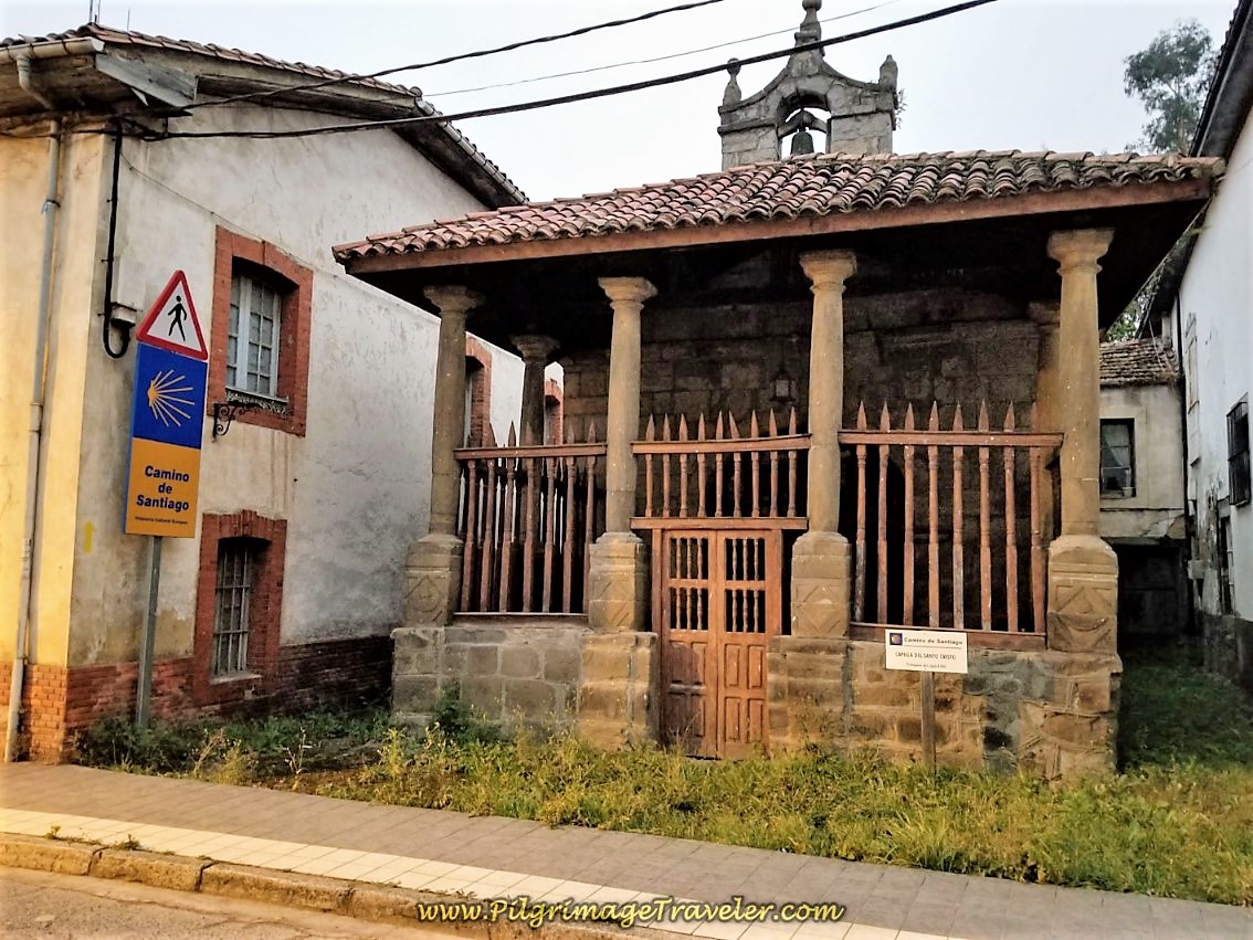
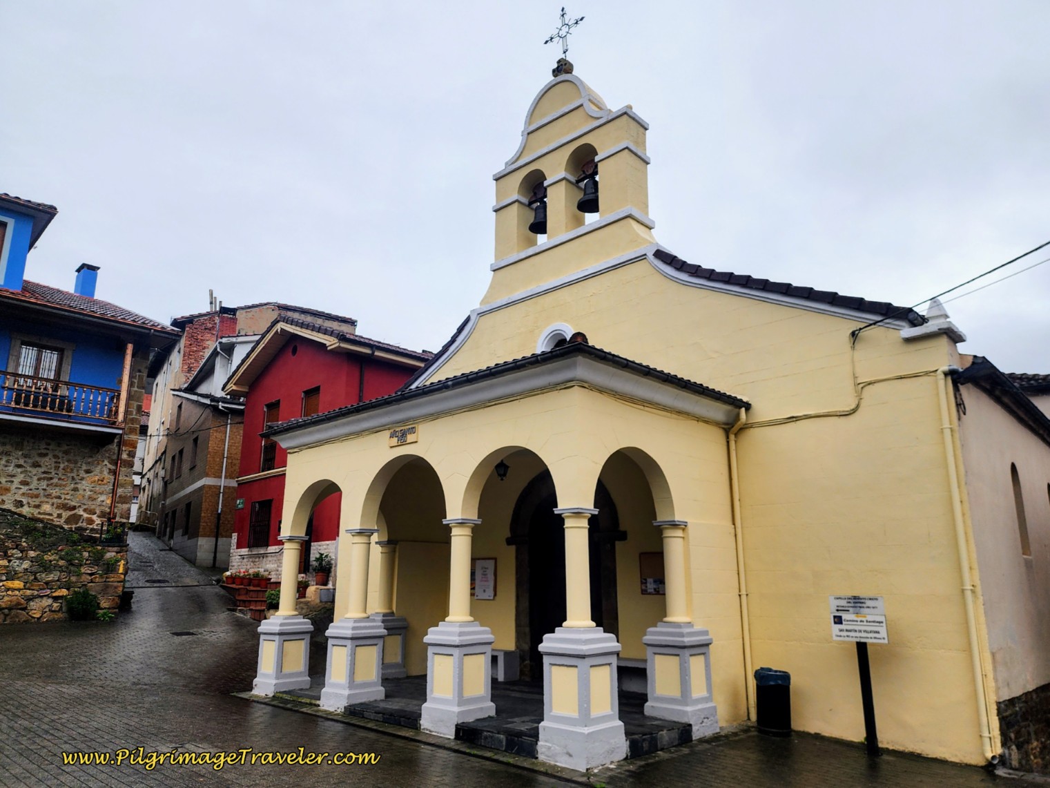
After filling our bellies, we set off. The Camino no longer directly passes by the lovely little Capilla del Santo Cristo, shown below, so if you haven't already seen it and want to, you will need to find it a few meters from the main intersection in the center of town, along AS-375. It is a lovely little historic pilgrim’s church. I said a prayer of gratitude, as I always do as I approached. I was grateful for my knee to be actually working this morning! I hoped it would last for the day!
After visiting the chapel, retrace your steps back to the intersection of the AS-375 and the LN-8 in the center of town and turn left, eastward, onto the LN-8. If you are walking through Campomanes and coming from the south, this is where you will turn right, or eastward onto the LN-8. You continue walking about another 200 meters, crossing the N-630 and farther along, also crossing the Río Pajares.
After the river crossing take the first left turn that descends and reverses back sharply toward the river, then bends to follow the river on an asphalt pathway with a lovely wooden fence line to your left, pictured below.
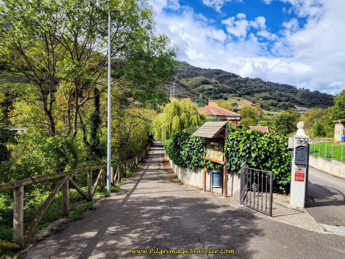 Río Lena Riverwalk, Campomanes
The Río Pajares joins the Río Lena here and the path along the river continues for about 1.5 kilometers on a long, easy descent.
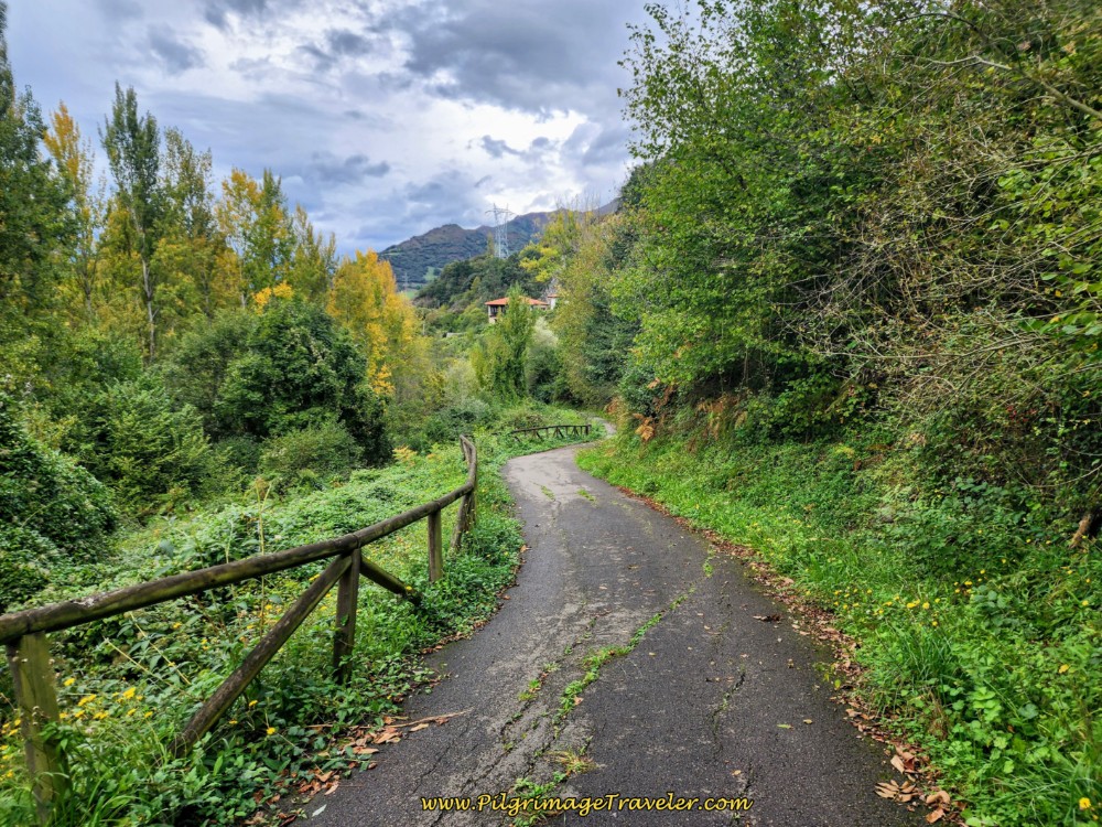 The Rio Lena Riverwalk Continues
When the asphalt path turns to a gravel road it now follows the not-so-pleasant A-66 highway, below. Fortunately this unpleasantness only lasts about 800 meters.
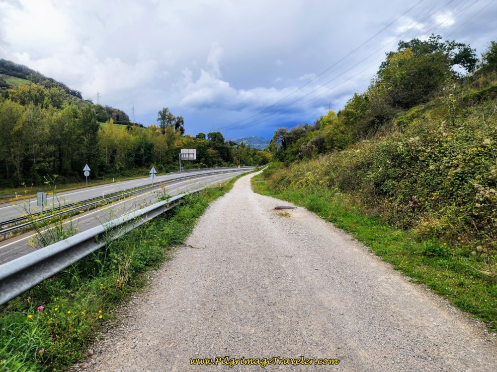 The Way Joins the A-66 Highway
After a few meters on the gravel road and after rounding the first big bend, you can actually see the Santa Cristina de Lena church on the hill above you, in the distance! Keep you eye out for it!
When you see a foot bridge ahead, crossing the highway, not pictured, the road bends to the right and comes to a T-intersection, after approximately 2.6 kilometers total into the day. This is where you turn to the right onto the LN-4 shown below. The railway bridge is just ahead, and I was able to capture a train on it, just before we walked under it!
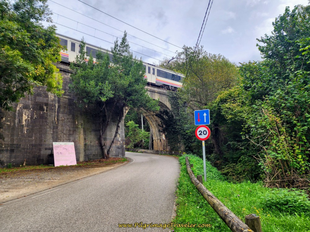 Right Turn Onto the LN-4 Towards Railway Bridge
After walking through the tunnel, immediately come to this information board and a stone wall with a yellow arrow, directing you onto the path to the left and up the hill and to the pre-Romanesque church.
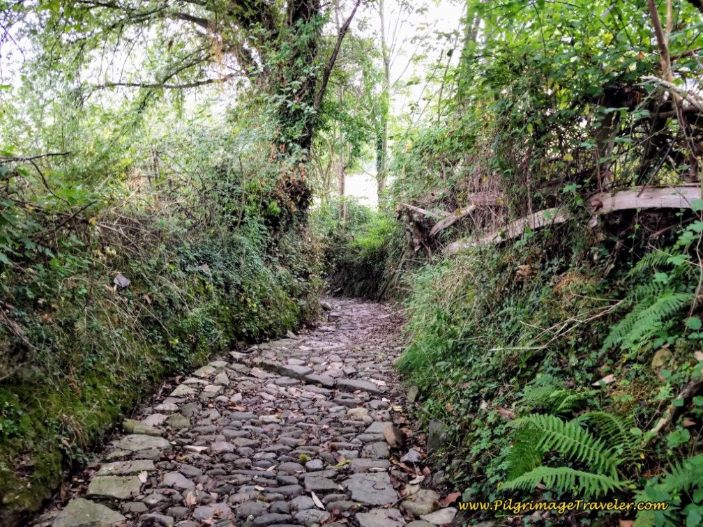
Begin the short steep climb on the ancient road.
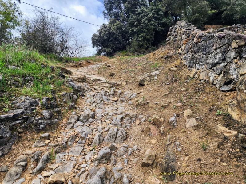 Steep Short Climb to the Hermitage
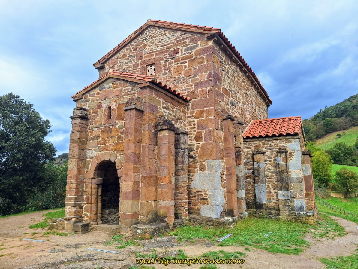
The rocky path peters out and becomes a pleasant dirt path through the trees. It is a short 200 meter climb up this hill to the hermitage. It is after about 2.8 kilometers into day five, that suddenly, the small church looms above you on your right. The road arrives at the rear end of the church first, pictured below.
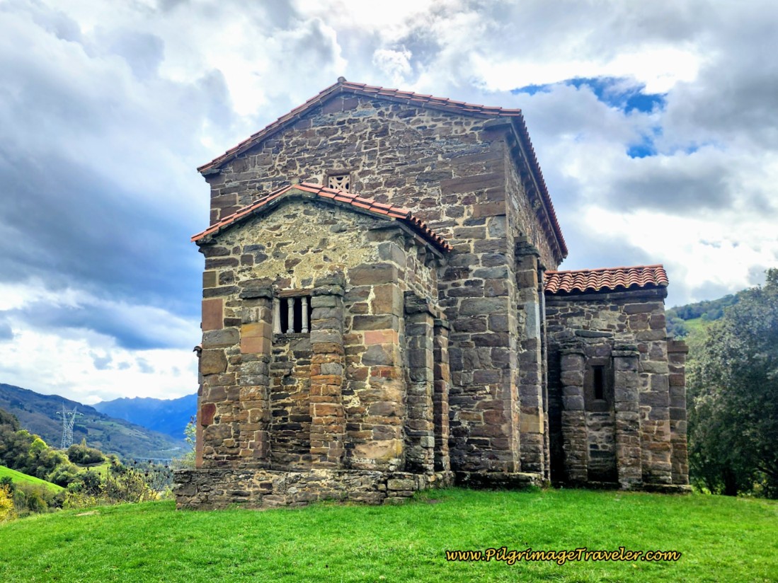 Santa Cristina de Lena Rear View
The hermitage of Santa Cristina de Lena (+34 609 94 21 53) was built in the 9th century on top of a prior Visogoth church and is of the pre-Romanesque style. Click on the Asturian link for more information on this ancient place. You will see a brief description of the history, its admission price and current hours of operation. As a general rule, it is always closed on Mondays, and opens 11-13 in the morning and again at 16-16:30 to 18-18:30 depending on the season. What is posted on the website is different from what is posted on the door, so it may be wise to call first! Plus, it is closed from 3 November to 4 December!
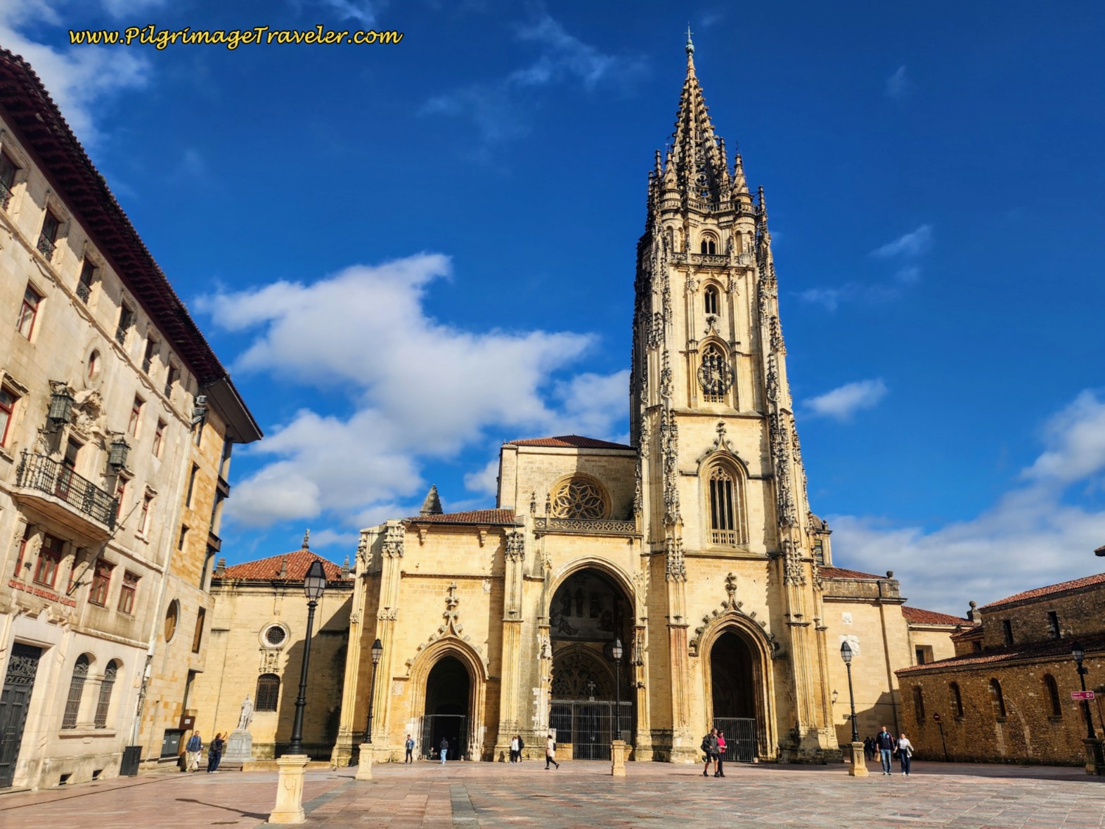
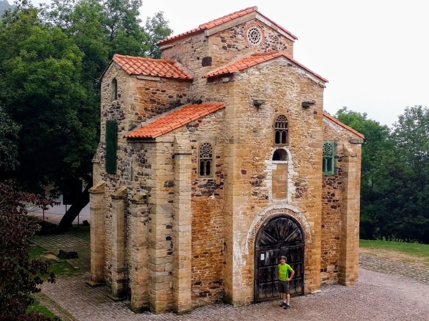
Santa Cristina is one of five UNESCO world heritage churches in and around Oviedo. It is closely related in style (pre-Romanesque) to the two churches at the Naranco site on a hill just west of the city, the Oviedo cathedral's ancient center remnants called the Cámara Santa, and the fifth is the San Julián de los Prados Church, also in Oviedo proper.
If you are interested in seeing all five of these churches, you can see the remaining four once you reach Oviedo. Click on the links to my articles for photos and more information. These are fascinating historic places.
The church sits on its own little serene hilltop where the surrounding views are phenomenal. The morning mist during our first visit added to the mystique of the place.
Unfortunately, when we were there about 9:45 in the morning, all you could hear was the rush of traffic from the A-66 below. I could only imagine when the original builders chose this amazing spot, how much more tranquil it must have been!
Once inside the church, there is still something ethereal about this site and its interior. Pause here, take the tour of the church and reflect on its amazing energy.
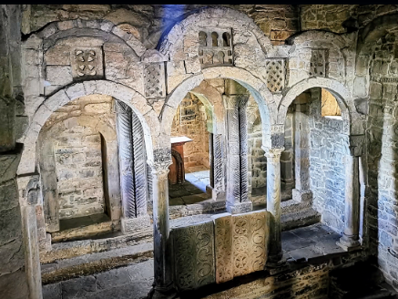 View of the Interior of the Santa Cristina Church
Jump to Camino de San Salvador Stages
Looking northward from the hermitage, you will see a gravel road. Walk toward it, but find the path going down the hill to the left. It is by the gate shown in the photo below. Take this inviting path instead. It is marked with yellow arrows.
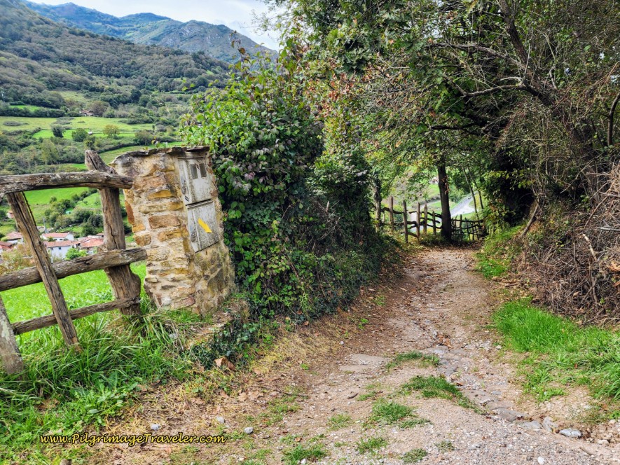 Find Ancient Road Leading Down the Hill on Opposite Side
This lovely path winds down the hill for 400 meters, on the ancient road, towards the next town of Cobertoría.
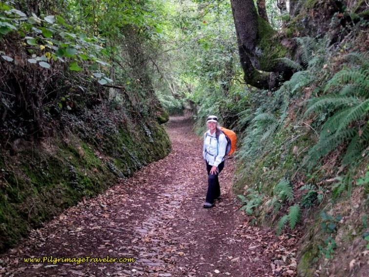 Elle on Downhill Path from the Hermitage
Once again, though brief, this downhill was very hard on my left knee. I needed to do my half-march again, picking up my left knee as if in a march, to avoid the extension that caused it so much discomfort. I also heavily relied on my hiking poles to reduce the weight on my legs. I was quite a sight, going down the hill!
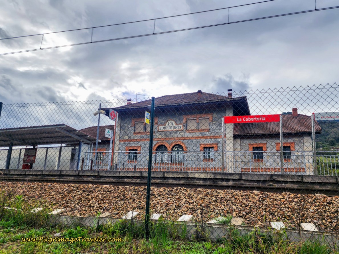
And then through the trees, as they begin to open up, you will see the old train station of La Cobertoría, which is now used as a museum and interpretive center for pre-Romanesque art.
Walk on the road by the railroad tracks, and after passing the train station, cross a stream on a bridge and come to a T-intersection in town. Turn right and up the hill. Take your first left, in town, and continue the strong climb up the hill.
There are no services here in this small town.
Be sure to look back at the top of the hill and catch your final views of the hermitage, and the train station below. The view is worth the pause.
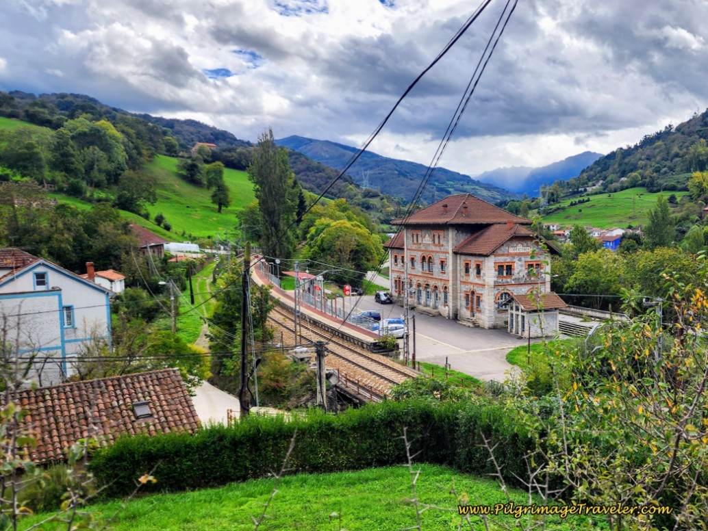 Look Back at Santa Cristina and the Train Station
Continue climbing up and out of Cobertoría. The climbs felt good on my left knee, and I felt strong. However, on the downhills, even though mild on this day five of the Camino del Salvador, my knee continued to give me discomfort once again.
You continue on the very narrow road with no traffic for about 1.14 kilometers.
While the Camino is very rural here, you can constantly hear the traffic of the A-66 in the valley below and to the left; not too great, for sure.
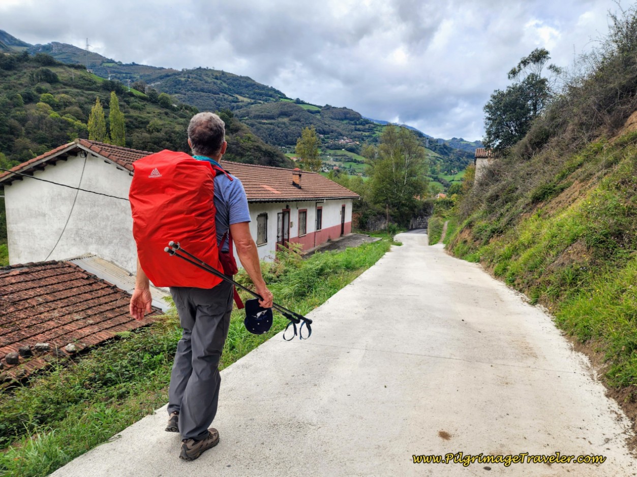 Rich Walking Along Rural Road
After about 4.4 kilometers into day five, come to this footbridge shown below, and take it to cross the Río Lena again to continue on the Camino del Salvador.
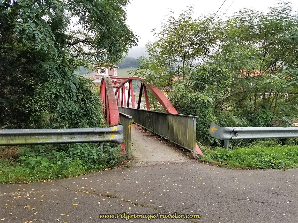 Cross the Río Lena on Footbridge
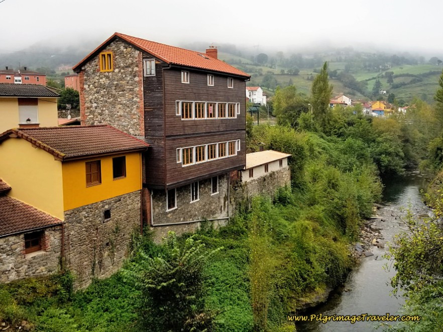
This is a photo that shows the attractive old stone homes that line the river banks on both sides.
Turn right after the bridge in the town of Vega del Ciego, by the Iglesia de Santa María. You can see the top of the church, the cupola, above the arches of the bridge in the above photo of the footbridge.
Continue walking on a frontage road paralleling the A-66, shown below, for just over 200 meters then turn left through a tunnel that now walks under the A-66, shown next.
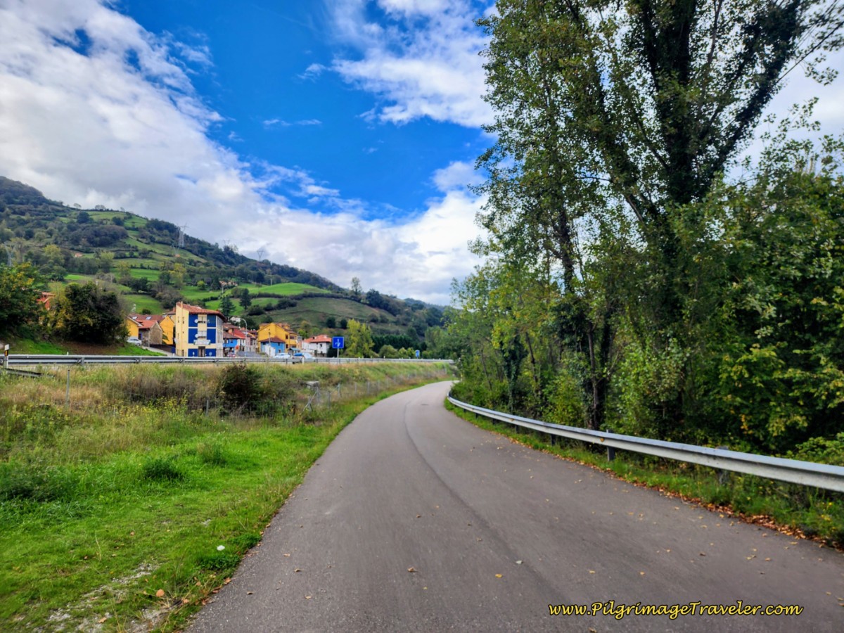 Frontage Road Parallels the A-66
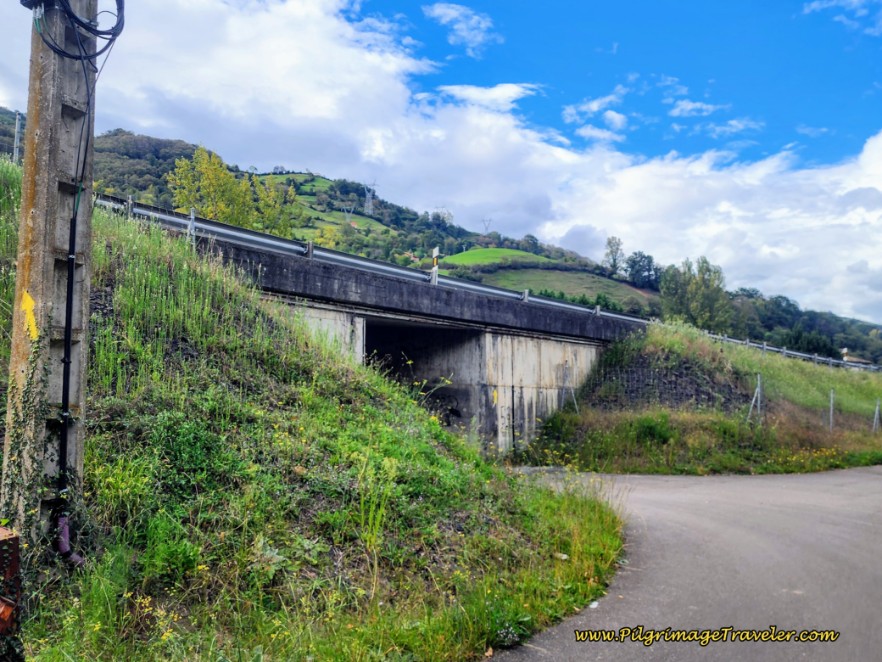 Walk Under the A-66 Bridge
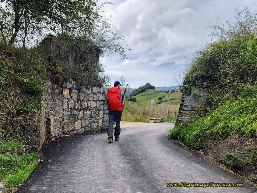
After the tunnel, the Way takes a left at the wall shown in the photo below and an immediate right onto the AS-375 at the T-intersection.
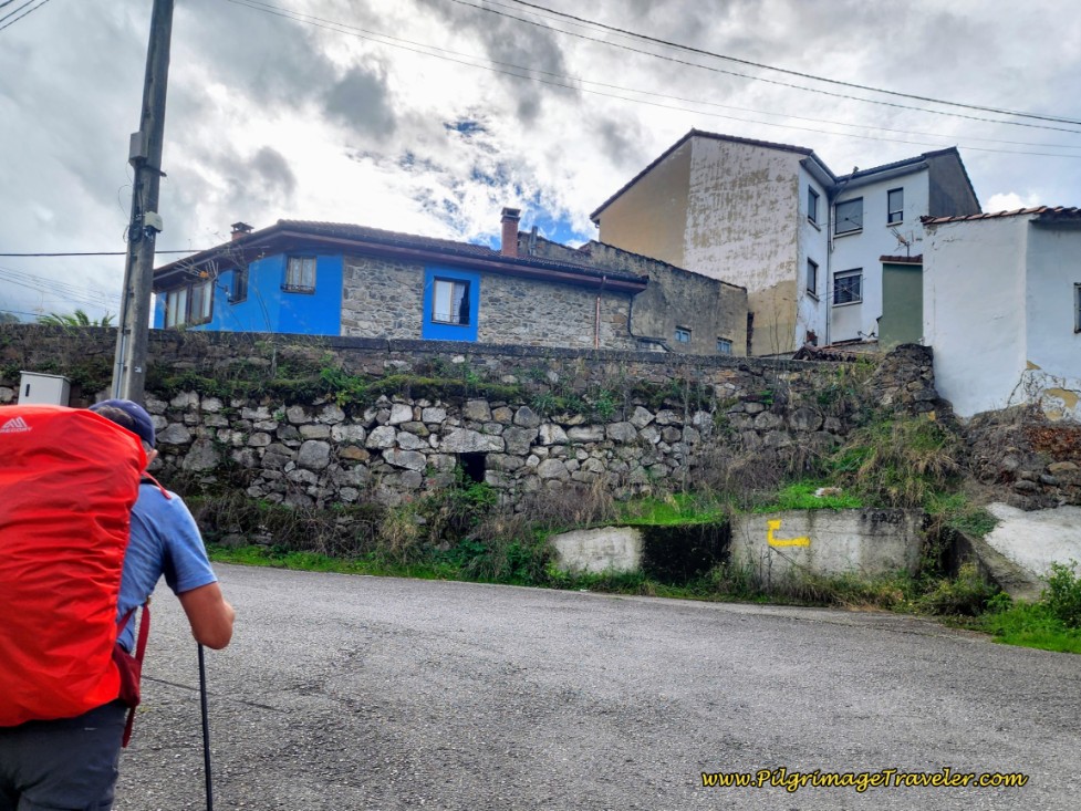 Approaching the AS-375 from the Tunnel
You will now follow this road all the way through Vega del Ciego, picking up a side road to the right, to pass the historic Capilla de Santa Rita after almost 5.0 kilometers.
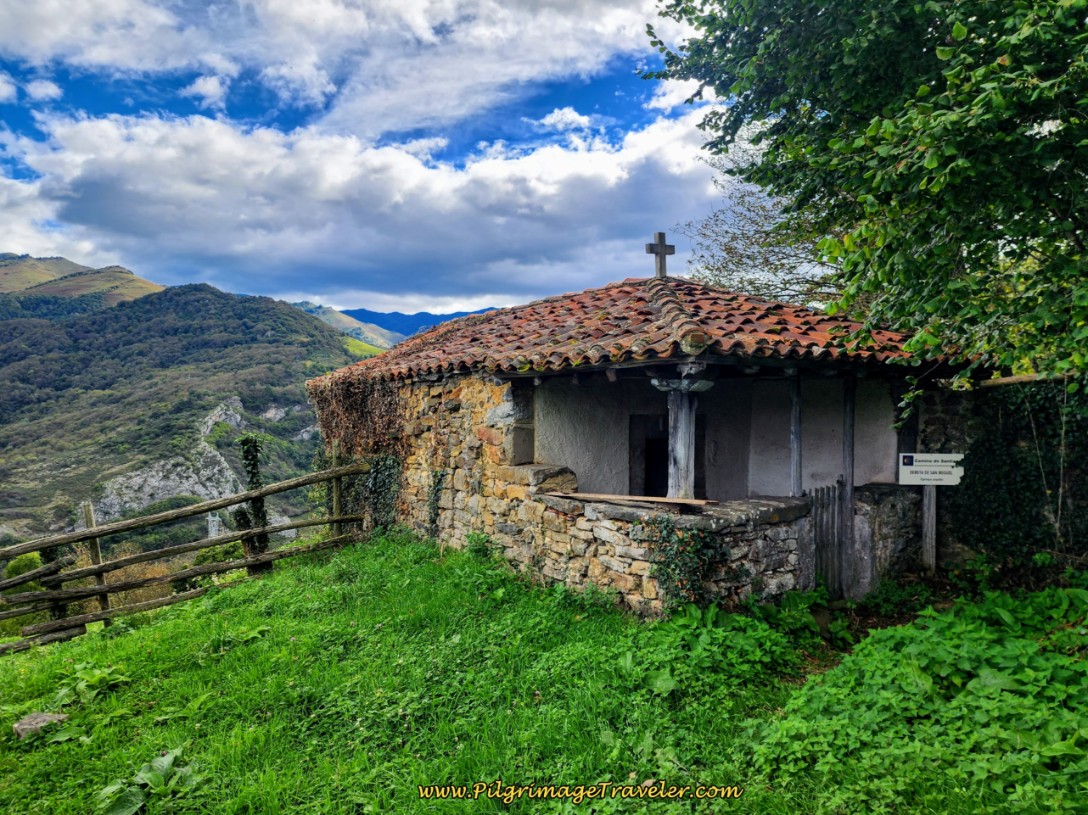
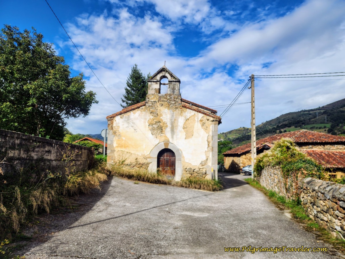 The Capilla de Santa Rita, Vega del Ciego
After passing the chapel, the short side road ends and the Camino sign directs the pilgrimage traveler to the left side of the highway, where there is a sidewalk to stay safe.
One-half kilometer past the Capilla, come to a large roundabout with a huge Mercadona supermarket to the right side. Continue onward a few more meters to yet another large roundabout with bronze sculptures of traditional Asturian Zamarrones, called the Zamarrones Monument. Click on the link for an explanation of this traditional annual celebration.
Immediately after this roundabout, come to the sign welcoming you to Pola de Lena after 5.6 kilometers. This is a big town with lots of services. The main drag through the center of town is a bit more than a kilometer long, and you will encounter everything you need.
Pass the Minymas market next and replenish your pack if needed. A few meters onward we stopped for a coffee break after barely 6.5 kilometers. We decided to take advantage of the opportunity, after having many days with almost no services!
Almost halfway through town, after about 6.8 kilometers, you come to the town hall. It is the yellow building in the photo below. Just before it, are the yellow arrows painted on the wall, letting you know this is the turn for the municipal Albergue de Peregrinos San Martin (+34 985 49 22 47). You can see the yellow "A" painted on the wall next to the arrow on the left. Turn here if you plan to complete your day in La Pola de Lena.
The albergue is 200 meters from the town hall. After the turn to the left, walk for 200 meters to the first intersection, then take the second right and the albergue is 100 meters further on the right. Look for the small blue signs to guide you.
The actual Camino continues on the main street, as you can see by the arrow pointing to the right.
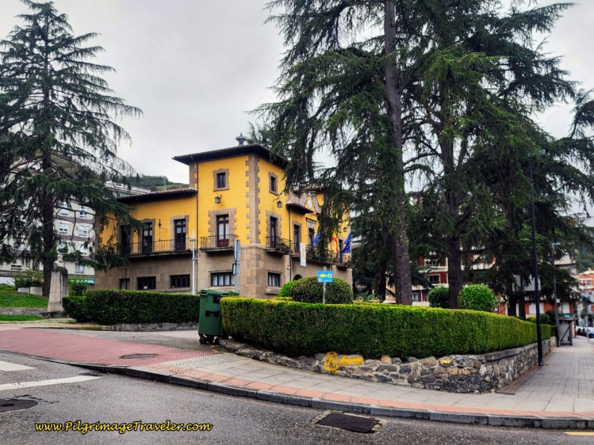 Town Hall with Yellow Arrow to Albergue
A new private, Albergue Roma is close by the municipal, a few meters to the south. They also have private rooms.
There are many more choices of accommodation in La Pola de Lena, if you choose to end your day here, including the economical Hotel La Payareta, (+34 985 493 975), a few blocks east of the Camino in the center of town. This hotel is just beyond the turnoff to the albergue. There is also the economical Hotel Lena (+34 985 49 32 34), on the south side of town along the river.
We stayed in the Hotel Lena our second time through and it is clean and comfortable.
Jump to Camino de San Salvador Stages
Continuing onward through town, after another 1/2 kilometer from the town hall, you turn right here, at this tall building, pictured below. The turn is just after an open plaza area shown in the photo, with a green floor and wind barriers, also just before the Día supermarket, the red sign that you can barely make out in the photo, and after walking by the college, Colegio Sagrada, a prominent institutional red brick building.
We found the waymarks hard to find at this intersection, so if you have read this, you will know where to look. There is a concrete waymark at the corner if you look closely in the photo.
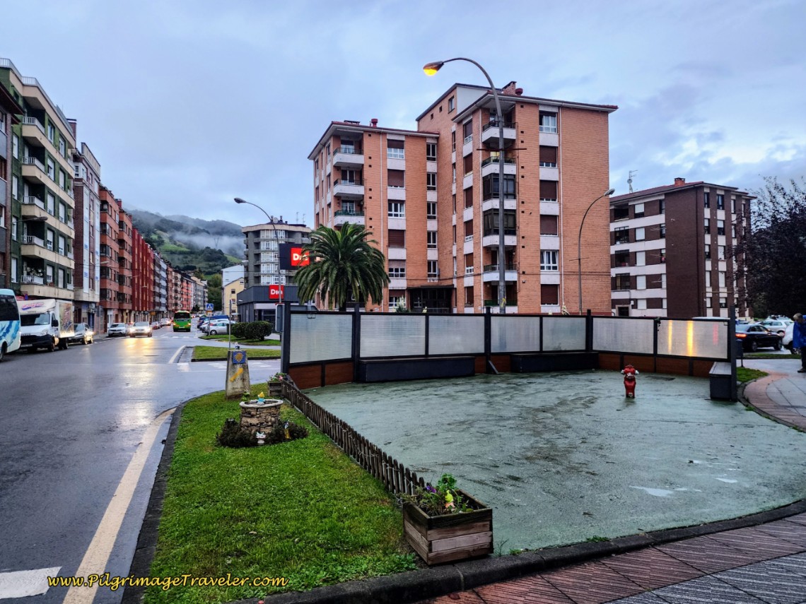 Right Turn at Tall Building Before the Dia Supermarket
We were setting a pretty slow pace for the day, after our marathon the day before.
After the turn, cross to the left (north) side of the street. It will be easier to see the yellow arrows, as you first walk through a large roundabout and cross a bridge over the Río Lena once again.
Ahead, at the interchange with the A-66, the Camino del Salvador turns to the left and picks up the frontage road, shown in the photo below.
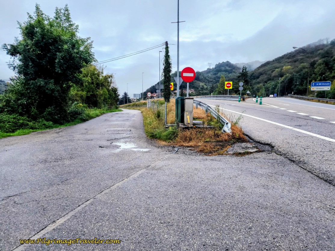 Left Turn Onto Frontage Road
I think I said out loud, "Are you serious?" I was really hoping the Camino would drop down by the river, or something else, other than walking by the noisy A-66 again!
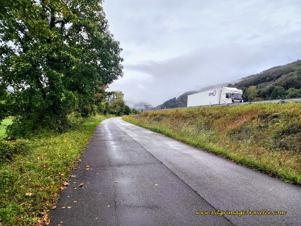 Follow the A-66 Now to the East
You have to walk on this frontage road for a full 2.25 kilometers! When you come to a row of long industrial buildings, below, you know you are nearing the end of this section.
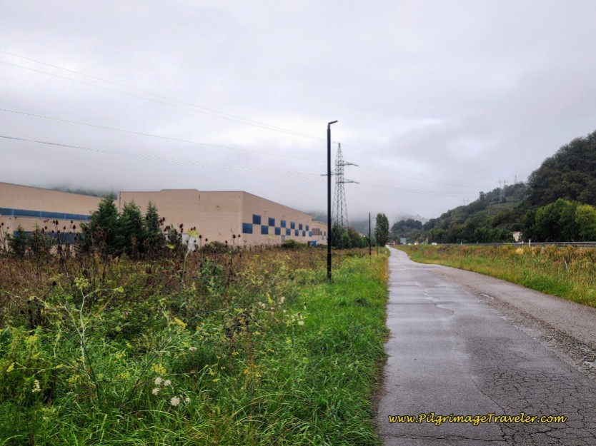 Pass by Industrial Building on Frontage Road
This frontage road brings you to your next decision point, after about 10 kilometers into day five on the Camino de San Salvador.
There is an alternative here, if you want to avoid the upcoming 1.8 kilometer stretch along the busy asphalt of the AS-375, after walking through the next town of Villallana. This portion of the highway has no safe shoulder to walk upon and the buses and trucks come awfully close to pilgrims walking along.
You will stumble onto the turn for the alternative, at this tunnel, below, with a huge yellow arrow on the side, pointing the way to the right and through the tunnel.
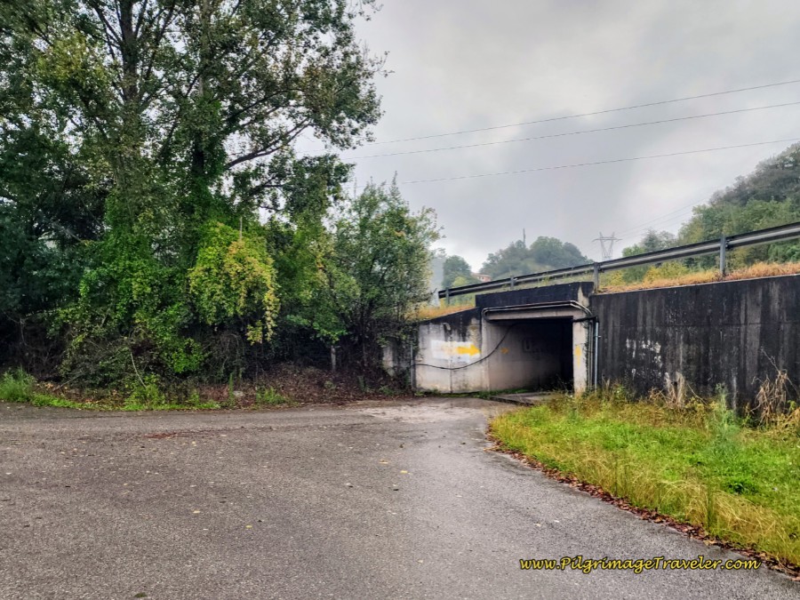 Alternative Off-Pavement Route Through Tunnel
This looks to be the only route, but if you are astute, to the left, just before the tunnel, there is a small concrete structure that I found, pictured below, with a yellow arrow, indicating the direction to be straight onward! It looked like the weeds in front of the structure had just been mowed, so it may be impossible to see this arrow.
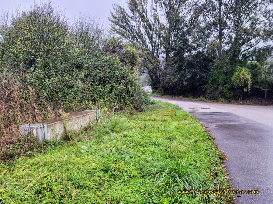 Yellow Arrow Points Straight Ahead for Standard Route
I am not sure why the official route that continues on straight is not better marked, if this is intentional or not. This is clearly the easier route, especially if it is rainy and muddy. Plus, if you choose the alternative, you will miss the historic pilgrim’s hospital in Villallana (or Villayana), if that is important to you.
The off-pavement alternative is a bit shorter, but requires an 80 meter climb up from the A-66, then necessitating an equally steep drop through the forest and back down to follow the highway very closely on the east side instead of the west, eventually rejoining the official route after 2.3 kilometers.
If you choose the official, main route, continue straight, past the tunnel, and ignore the next turn to the left, but continue onward toward the Cepsa station, shown below. (You can actually take this side road to the left and go around the back of the Cepsa station - it ends at the same place - by the bridge that crosses the Lena River. See the very short red alternative on the map above.)
After the side road and before the gas station, there is a yellow arrow painted on the brick wall of the next building, again pointing you toward the station. There is a small shop in the Cepsa where you can get coffee, snacks and sandwiches.
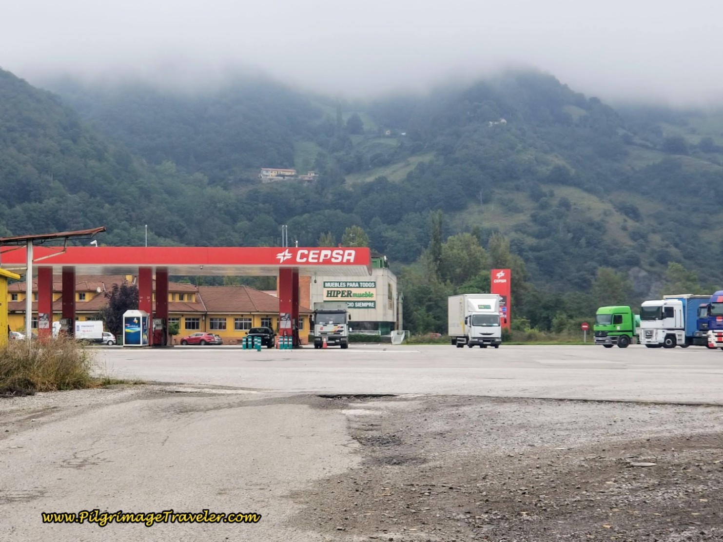 Cepsa Gas Station and Truck Stop
The next yellow arrow is a bit difficult to find, it is at the furniture (muebles) store just beyond the gas station, pictured below. You can see the yellow arrow below the fence, painted on the concrete if you look closely in the photo, pointing to the left.
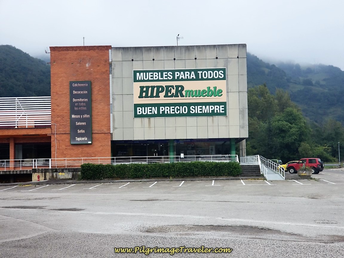 Turn Left Just Before the Furniture Store
Turn left by the furniture store and onto a road that bends strongly to the left. Take the first right turn towards town and cross the Río Lena again, shown below.
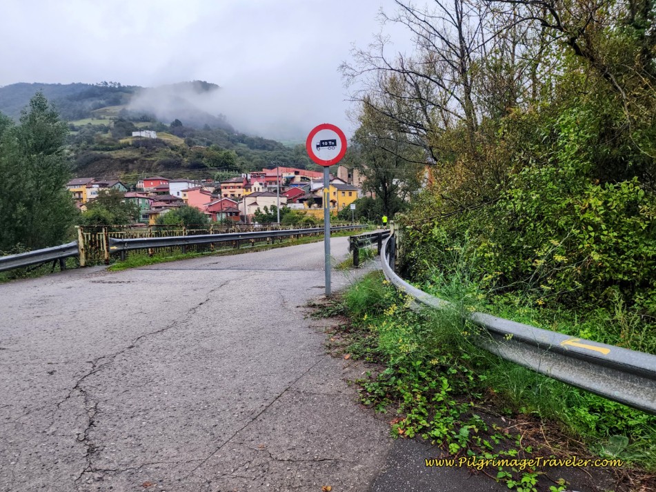 Cross the Río Lena Towards Villallana
Take the next right after entering town and come to the Plaza de Cristo and the town church.
Pass the church, and walk up the hill to join the AS-375 in a few meters. The Camino turns right here and onto the AS-375, but if you look to your left, you will see the old 16th century pilgrim's Hospital de Nuestra Señora de la Alberguería, built in the 16th Century. You will have to take a few steps to the left to identify the building by the sign in front of it, shown in the next photo.
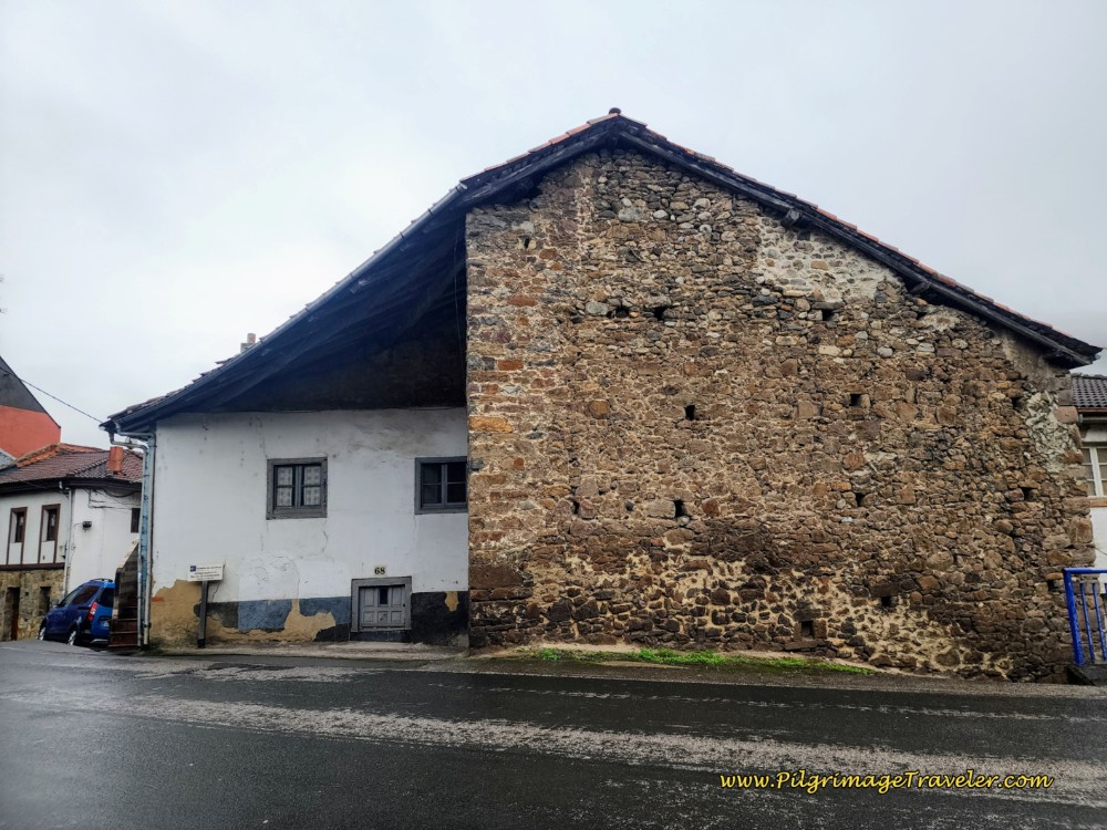 Hospital de Nuestra Señora de la Alberguería, 16th Century
Jump to Camino de San Salvador Stages
After turning right onto the AS-375, you will be rewarded with a blue Camino de Santiago sign assuring you that you are on the path.
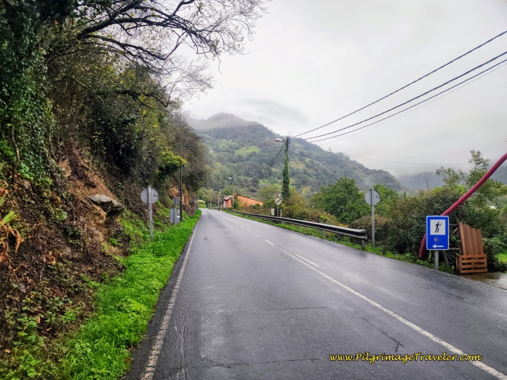 Along the AS-375
After leaving the hospital, it is a gentle glide down the AS-375 for approximately 1.8 kilometers. You will see plenty of yellow arrows and concrete waymarks along this stretch. Exercise extreme caution on this busy road! There is no shoulder at all!
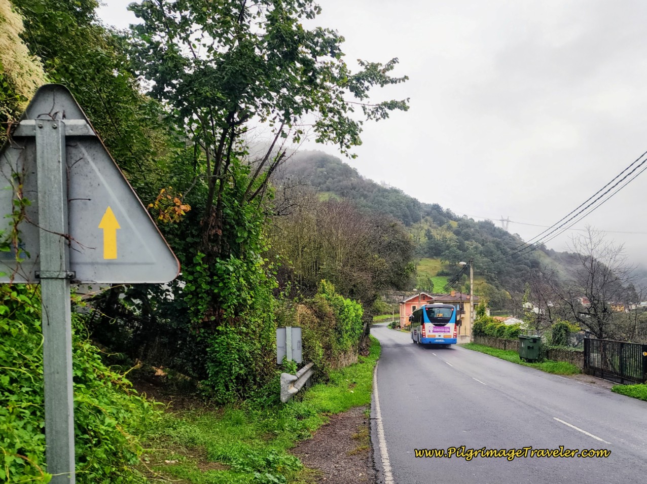 Leaving Villallana with Big Busses and Trucks!
After walking by a large industrial building on your right, followed by a big bend in the road to the left, look carefully for a cluster of old stone buildings for the next turn.
There is an attractive, small, old, stone chapel-like structure right by a pedestrian bridge, below. The goal is to find the footbridge that you can see on the right side of the photo, to cross the Río Lena and the highway again. You reach this bridge after approximately 12.3 kilometers, total.
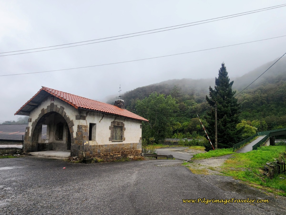 Right Turn at Yellow Arrow on Church-Like Structure
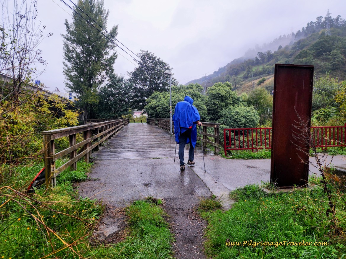
Coming down the opposite side of the footbridge, the Way joins a nice dirt lane. This is where the alternative route joins the official route. The photo, below, is of the footbridge after it crosses the A-66 to the other side. This view is as you would see it, coming from the south and from the alternative path, just before the footbridge joins it. As you can see, it was raining and the dirt road was sloppy and wet.
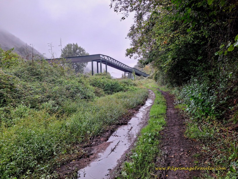 Cross Río Lena on Footbridge
Jump to Camino de San Salvador Stages
Alternative Path from the Decision Point by the Cepsa Stations
If you choose the path to the right from the decision point, you will turn right at the tunnel referenced above, crossing under the A-66. On the other side of the tunnel, immediately take the paved road to the left and walk about 100 meters. When the road ends at a fenceline, turn right and follow the fenceline that leads behind the Cepsa station, see photo below. (Yes, there are two - this one is on the other side of the highway).
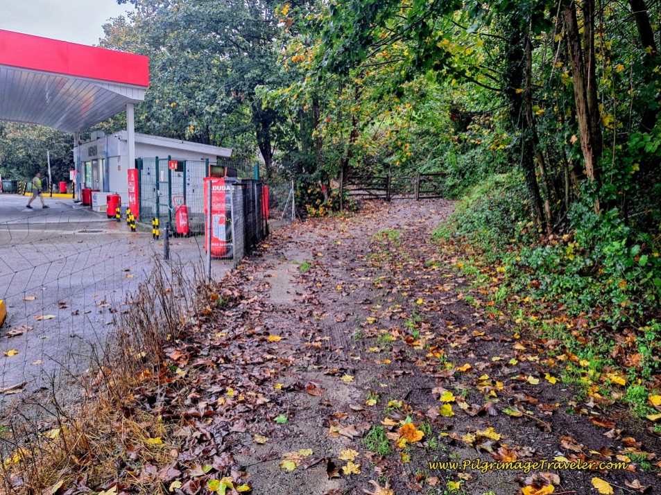 Walk Along Fence Line to the Cepsa Station
Walk around the back side of the station, following a wide path, below.
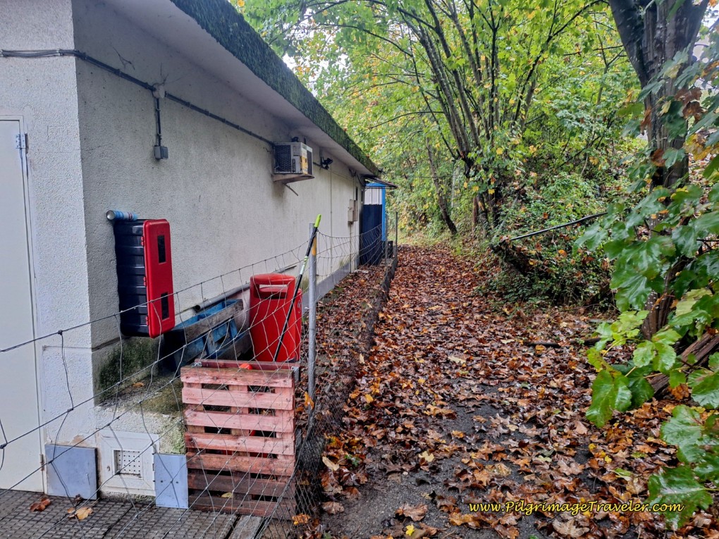 Walk Behind the Cepsa Station
This path begins to climb up and away from the highway, see photo below, joining a long set of stairs up the hill, next photo.
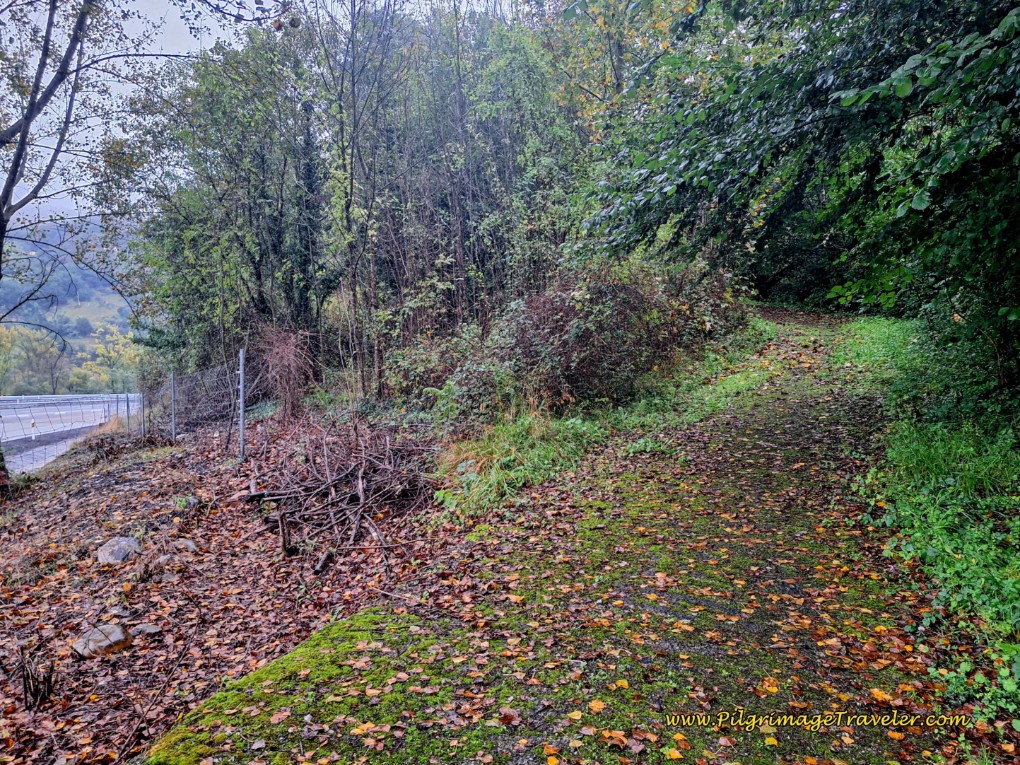 Wide Pathway Climbs Up from the A-66
This path appears to be an old roadbed, now with a fenceline and stairs for a "sidewalk."
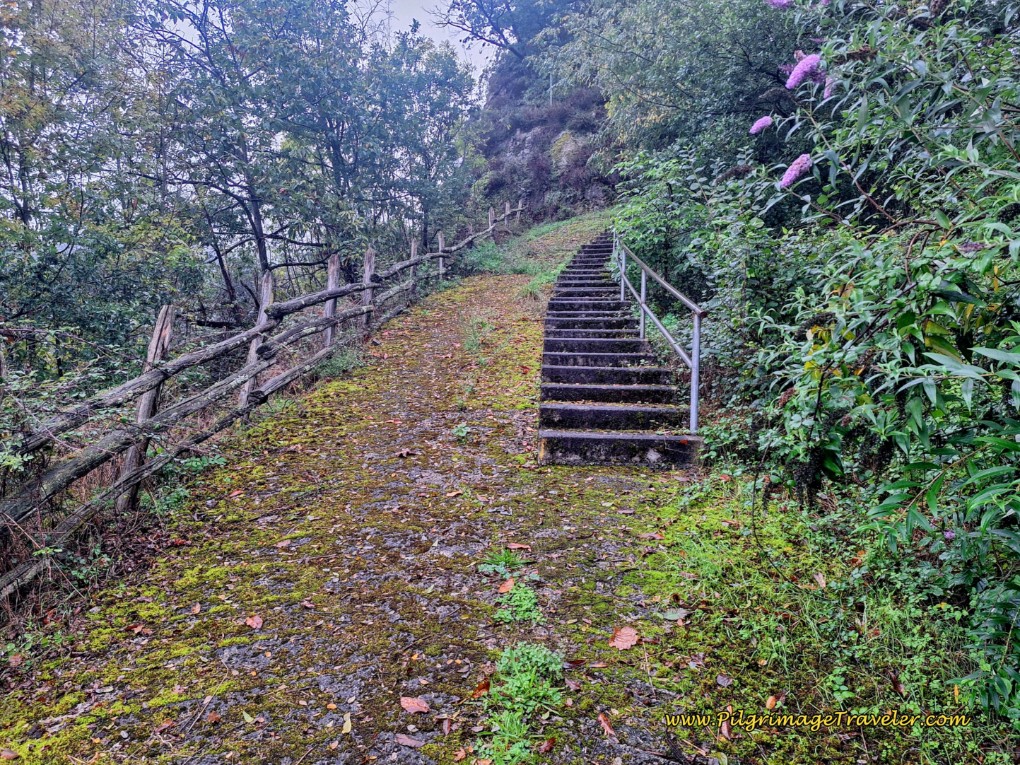 Old Roadbed Joins Stairway at Fence Line
As the old road bed climbs up, it eventually turns to asphalt, walking past a row of houses.
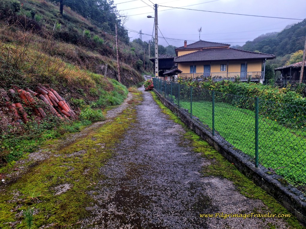 Old Roadbed Turns to Asphalt
A few meters later, you will come to a T-intersection, where the Camino goes left to follow the LN-1. There is a casual path to the left of the guardrail as you can see in the next photo.
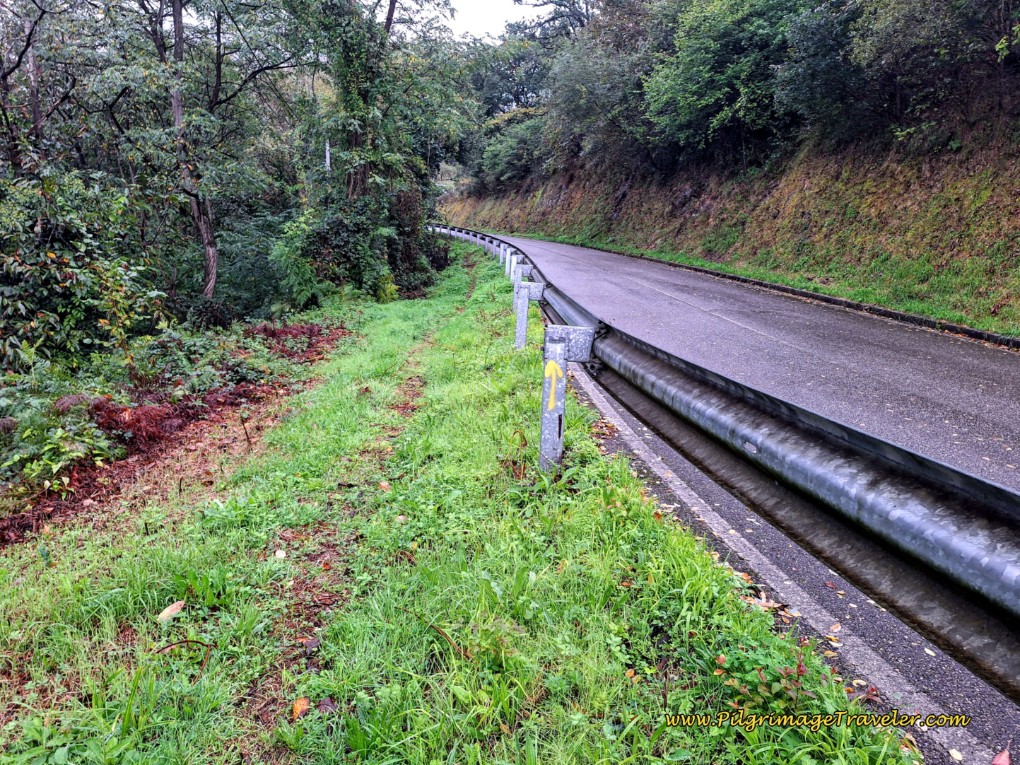 Walk Left of Guardrail Along LN-1
After only a bit more than 100 meters on the LN-1, you will take a path that veers off to the left and into the forest, taking strong switchbacks after about 200 meters, to go back down the hill.
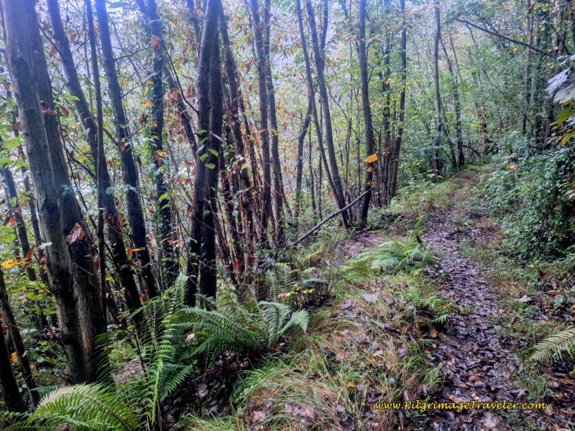 Trail Switchbacks Down the Hill
The descent leads you back towards the A-66 highway. But it is dense and cool along the way.
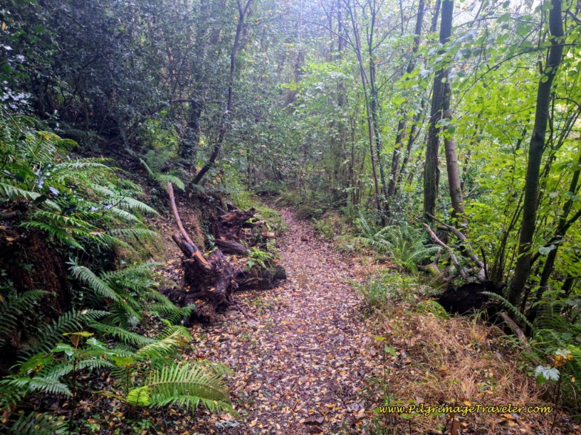 The Dense, Cool Forest Path
After only about 500 meters through the forest, you are right back along the A-66.
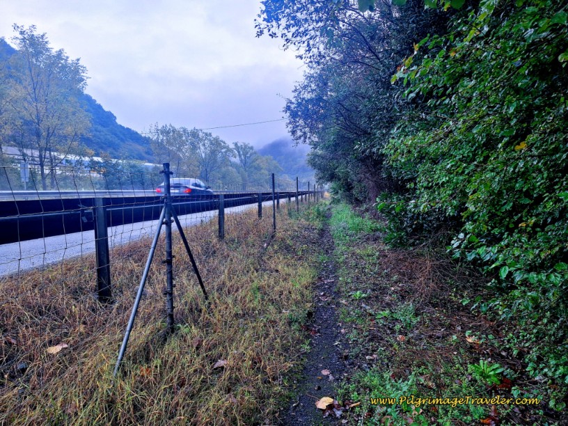 Path Joins the A-66 Again
The path widens to a double-track lane.
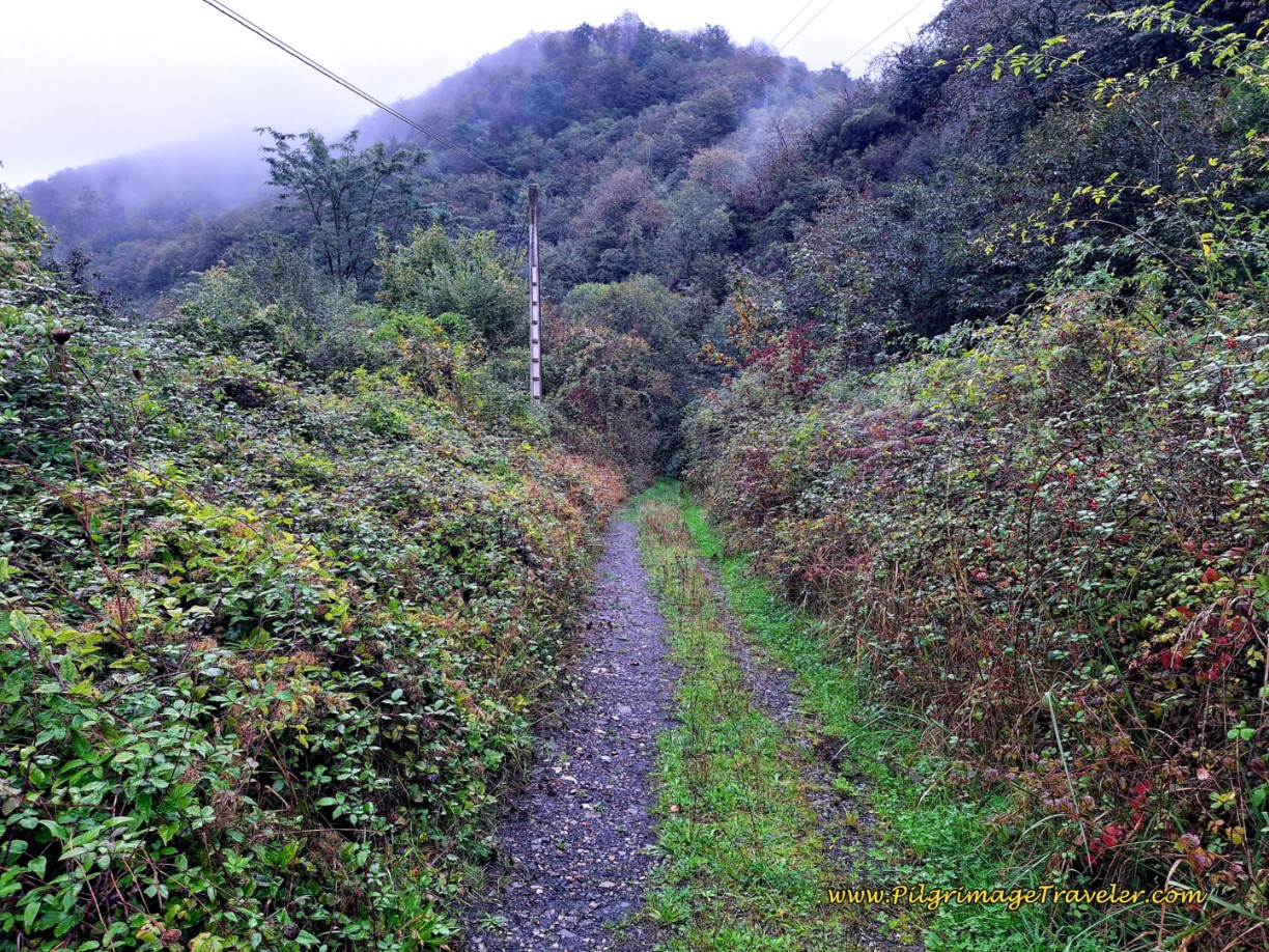 Double Track Along the A-66
And as noted above, on the standard route, when the lane meets the footbridge, the two routes converge once again.
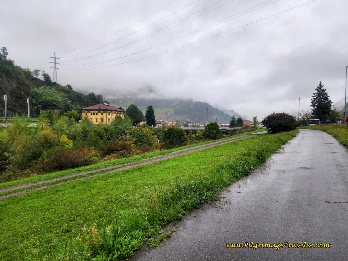
Unfortunately, after the footbridge, the dirt lane doesn't last for very long, and it soon turns to pavement. It is a walk of about 1.1 kilometers along this road. The road would be much more pleasant if it didn’t follow along the A-66 again!
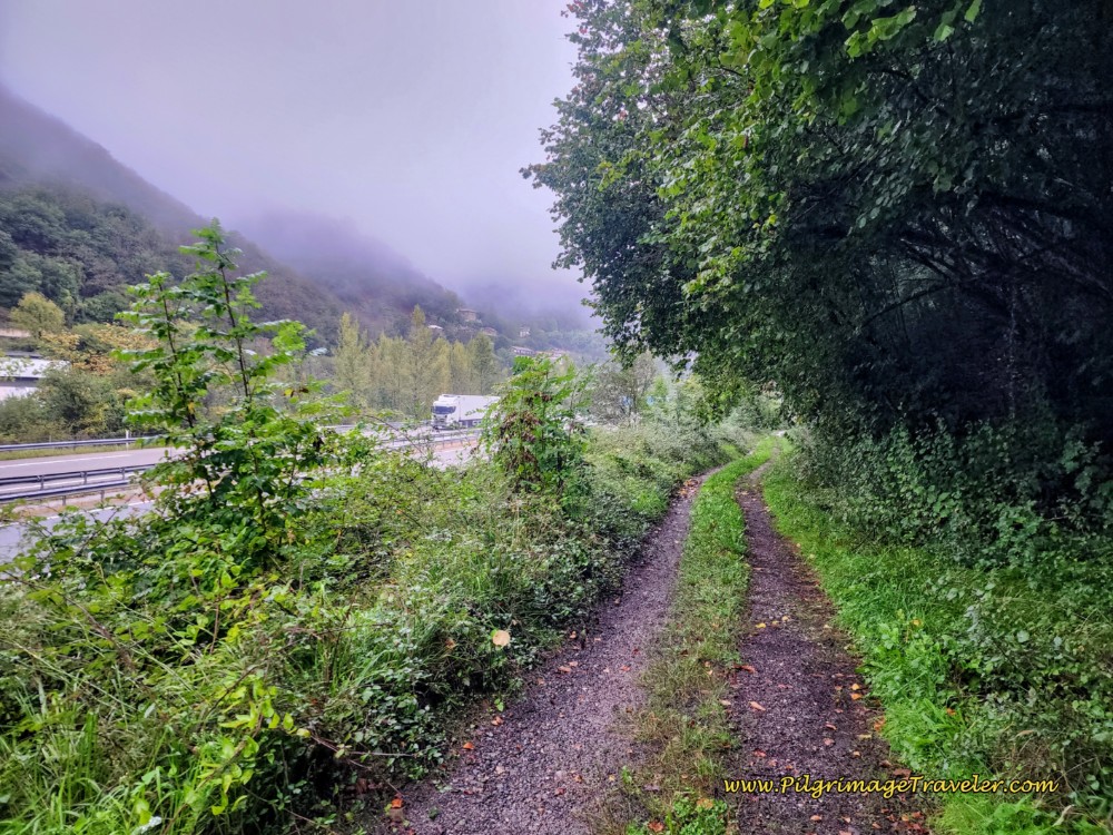 Frontage Lane After Footbridge
After joining the pavement, walk by a row of buildings, and notice a water fountain on your left.
After passing the buildings, stay to the left at a Y-intersection and pass a tunnel, below, keeping straight on this road, continuing to follow the A-66 on your left.
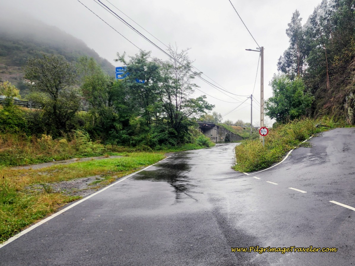 Straight On at Tunnel
The road brings you to a huge Starglass building, where you cross another street and continue straight onto a path, continuing to follow the highway. The roadway is elevated to your left, and you pass an old thermoelectric station, on your right.
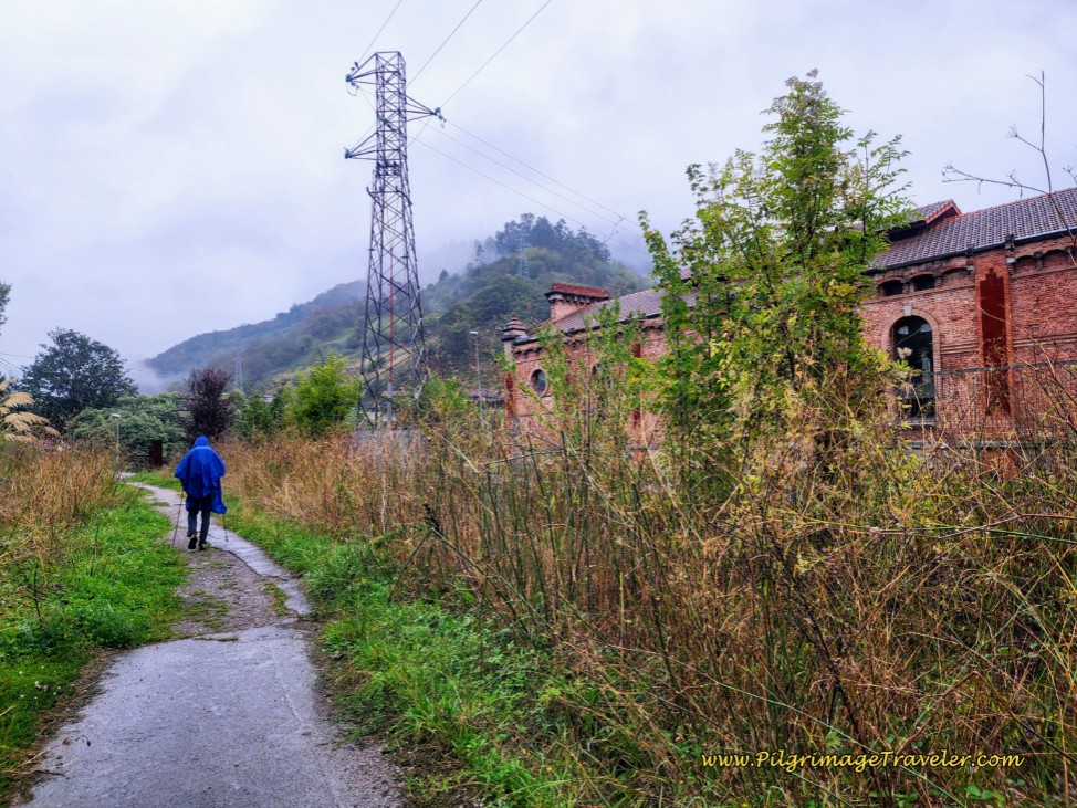 Pass Old Thermoelectric Station
After about 13.5 kilometers into day five, the Camino de San Salvador joins a river trail system of the Río Aller, and crosses the river on this wooden footbridge, below.
While you have been walking along the Río Lena from the south, you have now crossed the Río Aller, coming from the east. Here is where the two rivers join to become the Río Caudal. It will now be the Río Caudal's valley that you will follow all the way into Mieres del Camino, for a total of more than six kilometers.
Continue along the Caudal River trail system after the wooden footbridge that first walks you under the A-66 and through a park area, bending to the north.
After 380 meters through the park, (you can choose either path through the park, the upper or the lower one that you can see in the photo) and after coming to an intersection with the highway, turn left. Cross the bridge over the Río Caudal to enter into the town of Ujo (or Uxo) after approximately 14 kilometers from Campomanes.
Below is the signage that you will encounter after crossing the bridge. It seems clear that you will turn right before the historic building seen here, the 1921 Chalet de los Geólogos.
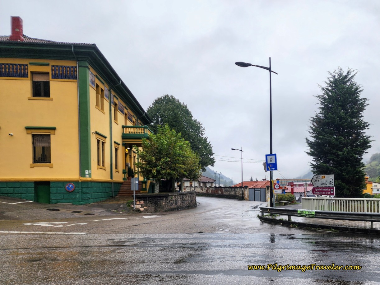 Right Turn Here, After Bridge in Ujo
But when you look at the close-up of the sign, below, you can see that there is a yellow arrow pointing left, placed over the white arrow of the original sign, pointing to the right! What’s a pilgrim to do?
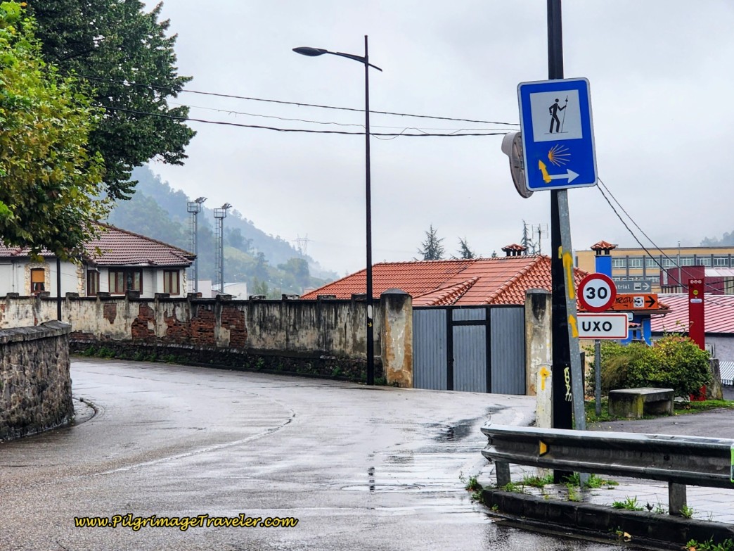 Close-Up Camino-Sign After Bridge
This is a classic for the ever-changing Camino routing.
What you need to know is that while it is not clear, you do need to turn right, a hard right, immediately after the bridge, initially staying on the riverwalk on the other side. A few meters later is where you have a choice, and either way you choose, is just fine. It used to be that the only signed way was to stay to the far right along the riverwalk, now on the west bank of the Río Caudal, avoiding the town center of Ujo altogether. The concrete waymarks are still along the riverwalk if you choose this way.
Now, there are so many yellow arrows after the turn, pointing to the left, that it seems as if this is now the “official” route. However, if you do not need anything in town, and if you don’t care to visit the 12th century Romanesque Iglesia de Santa Eulalia de Ujo, you can definitely shorten this day by a few steps and just stay along the river. It is nice enough. But the town is quite nice too, and the bakery by the church is clearly a reason to go into town the few extra steps!
At this concrete waymark, pictured below, right after the turn off from the bridge, the yellow arrow points to the left. The arrow is new. The old Asturian signage would have you go toward the center of the rays, or to the right. If you want to stay on the riverwalk, that’s it on the right side of the photo, just continue on straight.
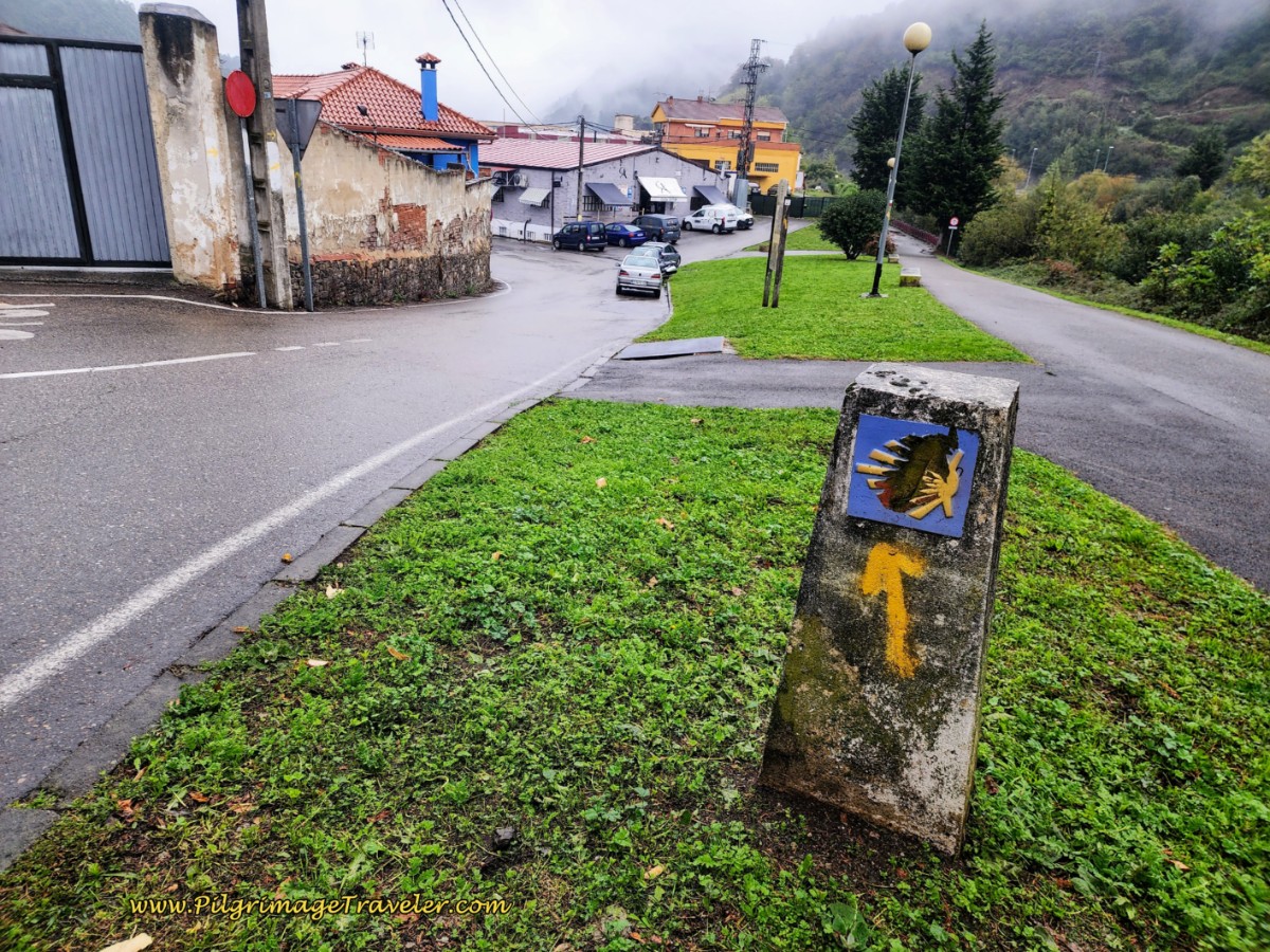 Riverwalk to the Right, Official Route to the Left
The official routing takes you to the next left (not onto the main road), between the blue building and the garage, shown below, just before the gray building which is a bakery/restaurant.
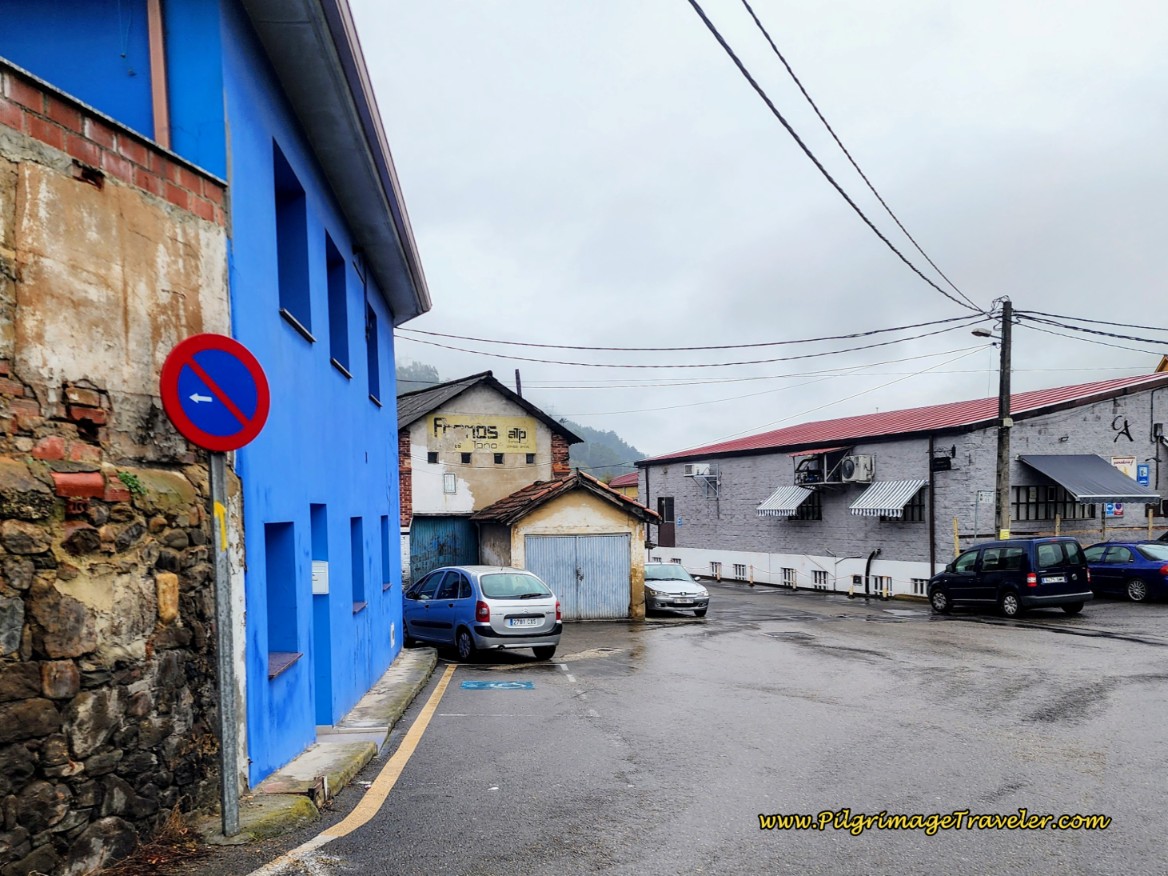 Left Turn Before Restaurant
What you are aiming for is this alleyway, pictured next, with the wall covered in yellow arrows!
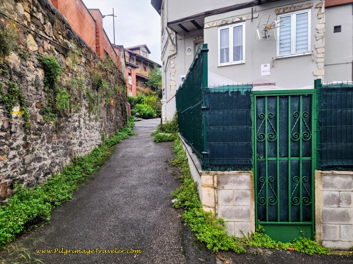 Alleyway Covered in Yellow Arrows
Continue onward, about 180 meters until this alleyway joins the main road through town, the Carretera General Uxo. Below is the street as it approaches the Iglesia de Santa Eulalia de Ujo.
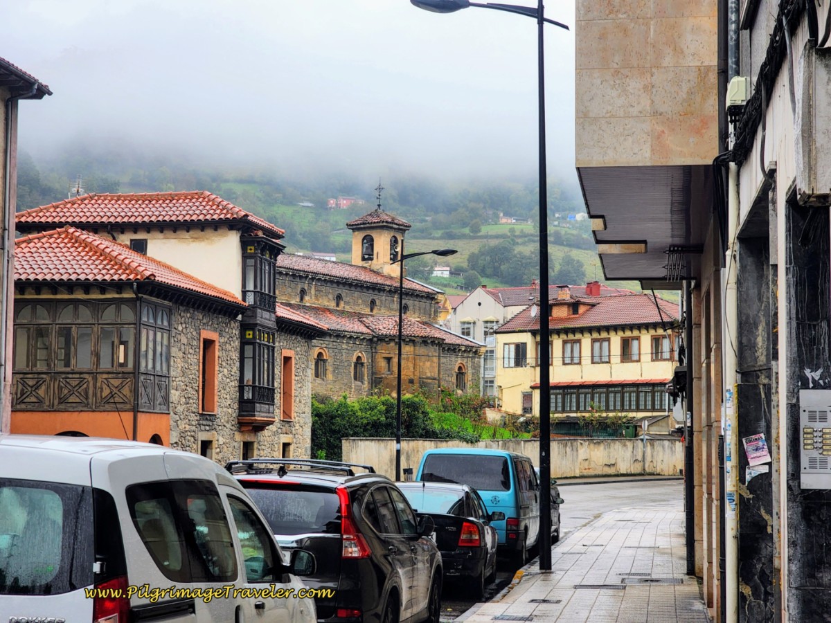 Main Street Towards the Church
The church is worth a visit, in my opinion. It originated in the 12th century and is of the Romanesque style. Here is the full view of it from the front, after you turn left from the main road and a few meters later walk into the town square.
Jump to Camino de San Salvador Stages
The church was radically re-done in 1920, when the railroad came through and the church needed to be moved to make way for it! Its history is fascinating and the caretaker will be happy to inform you.
We arrived in the square just before the church opened and were very happy to wait in the bakery on the same square. I highly recommend the Cafetería L'Artesa and I hope it will survive for many years.
After your stops in town, continue along the General-Uxo Street and take any street to the right, or east to go back to the riverwalk. The official route takes you all the way to the Bo. la Vega street on the north side of town but it truly does not matter which street you take.
There are many cafes in Ujo, but there are no accommodations.
Once joining the riverwalk, you will be walking along it for about the next 5.0 kilometers until the center of Mieres del Camino.
There are more cafés along this stretch as you near the large city of Mieres, but many are difficult to reach because of fence-lines and the parallel railroad tracks. Plan on waiting until you get closer to the center of Mieres for a stop, if you have waited. It is a pleasant enough walk along the river, if rather boring, as you can see from the next photos. The Way is easy and all downhill.
Pass by several interesting geographical features. While the photos look relatively serene, the constant noise of the highway echoing through the valley continues to be your background music.
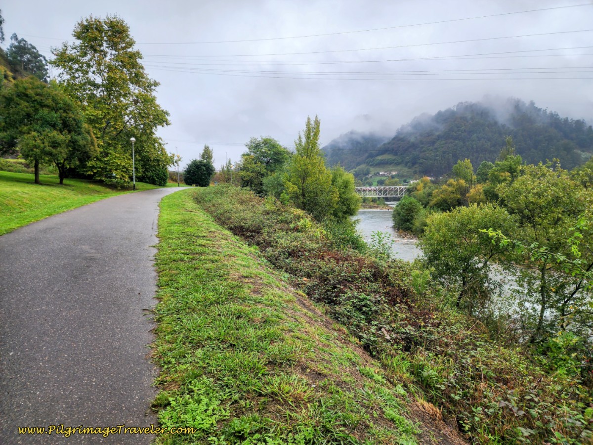 Pass Bridge on the Río Caudal
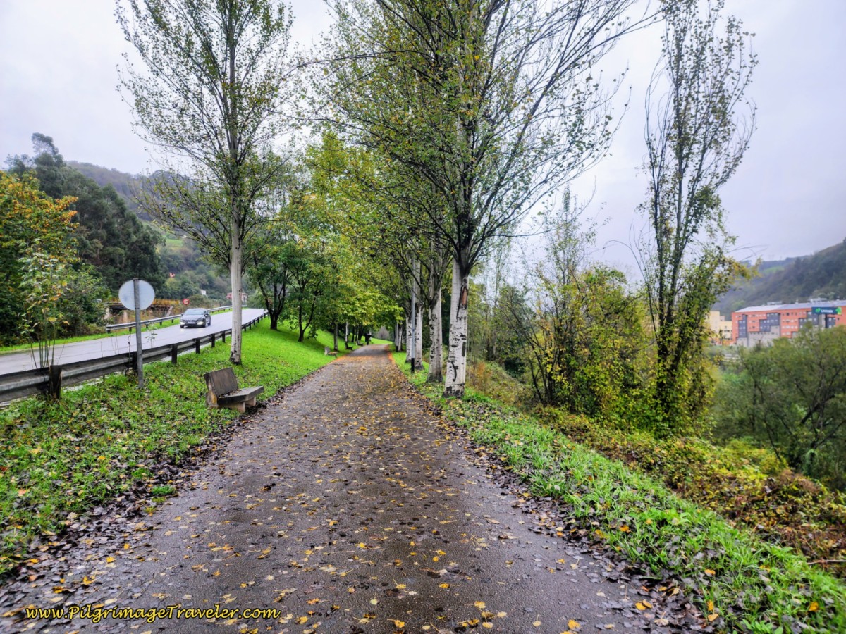 Along the Río Caudal
This long riverwalk is popular with the locals as an exercise trail.
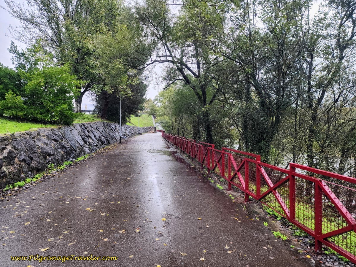 Attractive Fencing Along the Riverwalk
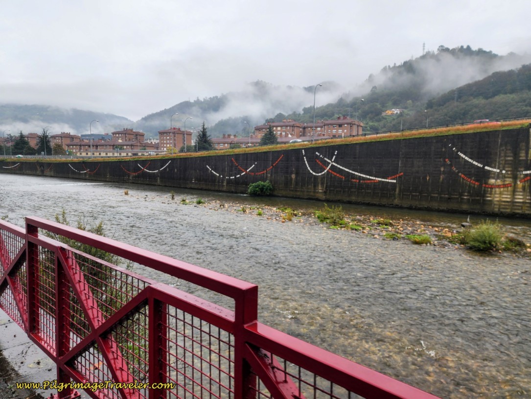
You will know you are entering the main part of Mieres, when you come to this decorated part of the riverwalk.
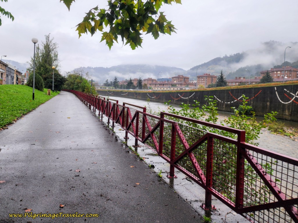 Close-Up of Decoration Along the Caudal River
Here is a close-up of the decorated walls. It is a nice feature to jazz up the elevated roadway.
The footbridge to the University Albergue is near! As you enter town, you will see a long row of commercial buildings on your left. After about 1/2 kilometer, look for the business called the "Carpintería Metálica Valle del Caudal." Just a few meters after this business, after about 19 kilometers, there is a very obvious criss-crossing pedestrian way to the right, up and over the river and the highway, the A-66. If you wish to get to the University albergue, take this foot bridge.
It will bring you out to the other side to the east, and onto a pathway that leads you to an intersection with the Calle los Llerones and the Calle Vega de Arriba. Cross the Calle los Llerones and take the narrow Calle Vega de Arriba straight on, past tennis courts on your left, and walk for another block. This street will bring you out to the Calle Gonzalo Gutiérrez Quirós, and the Residencia Universitaria (+34 625 185 301) is almost directly across the street from you. You must cross a parking area, and a traffic circle is to the immediate left of the Residencia. You must call ahead to make a reservation if you want to stay here and you must arrive before 5:00 pm. Click on the link to see a photo of the building, so you know what to look for. This place is not exactly an albergue, but individual rooms with a private bathroom at 25 euros/per person.
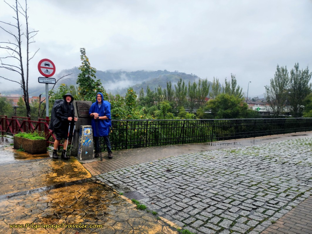
Otherwise, continue on the Camino river walk. Finally after about 19.9 kilometers into day five on the Camino del Salvador, come to this intersection with a pedestrian bridge, telling you to turn right and enter into the center of town.
First walk across the Caudal River on the pedestrian bridge. On the other side, take a set of stairs down and cross under the A-66. And finally, take another pedestrian bridge to walk up and over the railroad tracks and descend to the street, the Calle Manuel Llaneza, below.
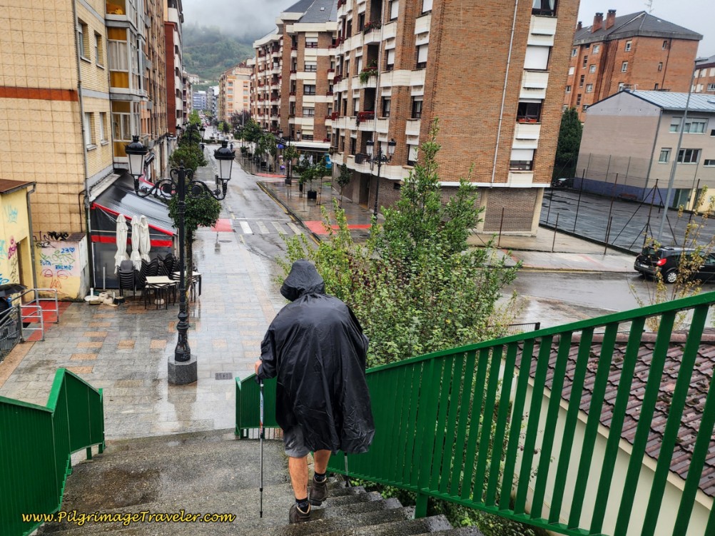 Heading for the Calle Manuel Llaneza
After crossing the bridges, you stay straight on and eastward, picking up the street, the Calle Manuel Llanesa. Immediately, you are greeted by tapas bars. At the first roundabout, if you look to your right, you will see a diagonal street leading to the Old Vasco train station (Antigua Estación del Vasco) where the new municipal albergue will reside! However, the work on the albergue has not yet begun!
Continue walking through the center of town on the Calle Manuel Llanesa, shown below. The street glimmered in the rain.
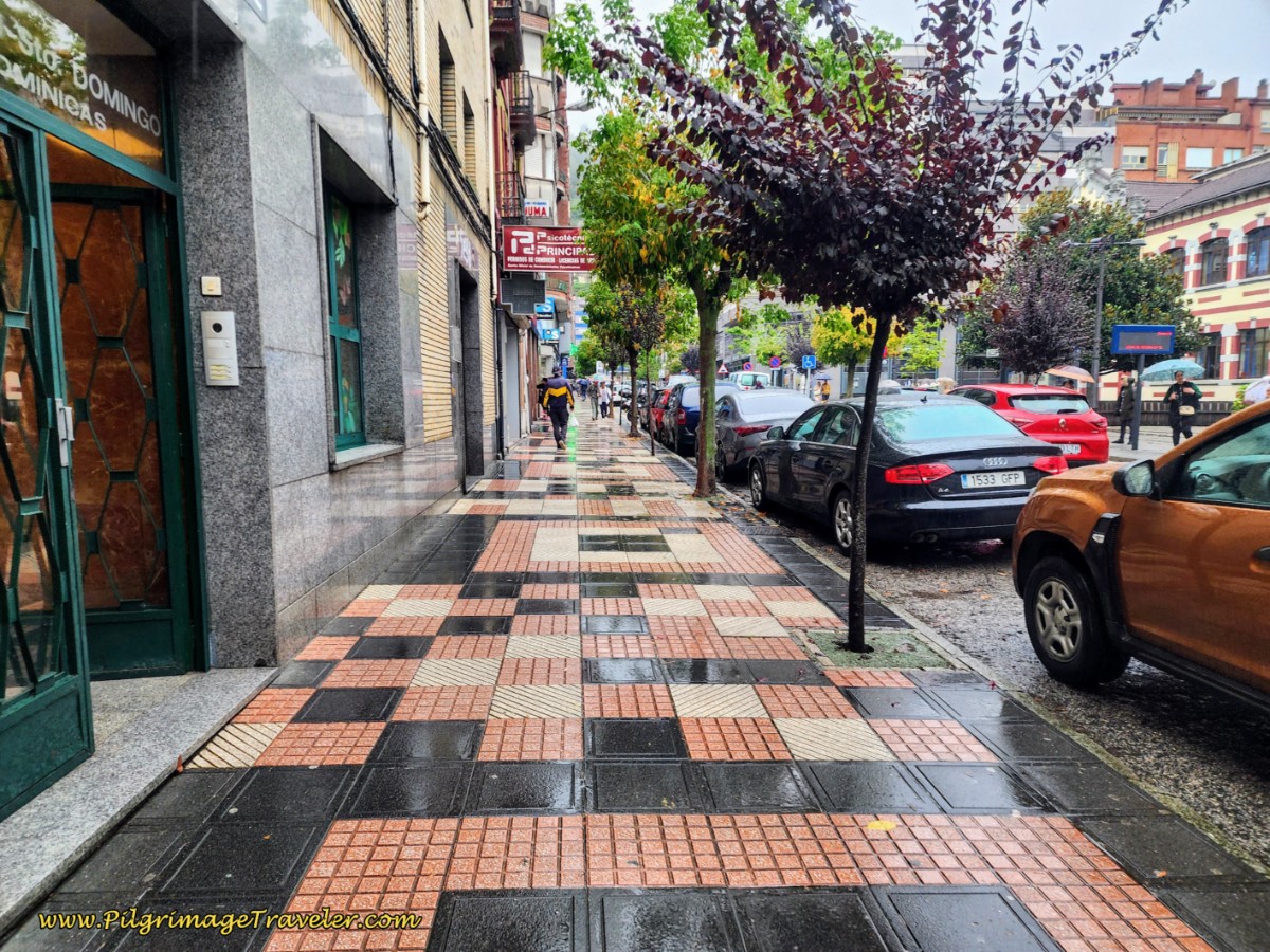 Along the Calle Manuel Llaneza
You will walk by a large park and the Hostal Pachín is just after the park, a few steps off the Camino, if you are interested in staying in town.
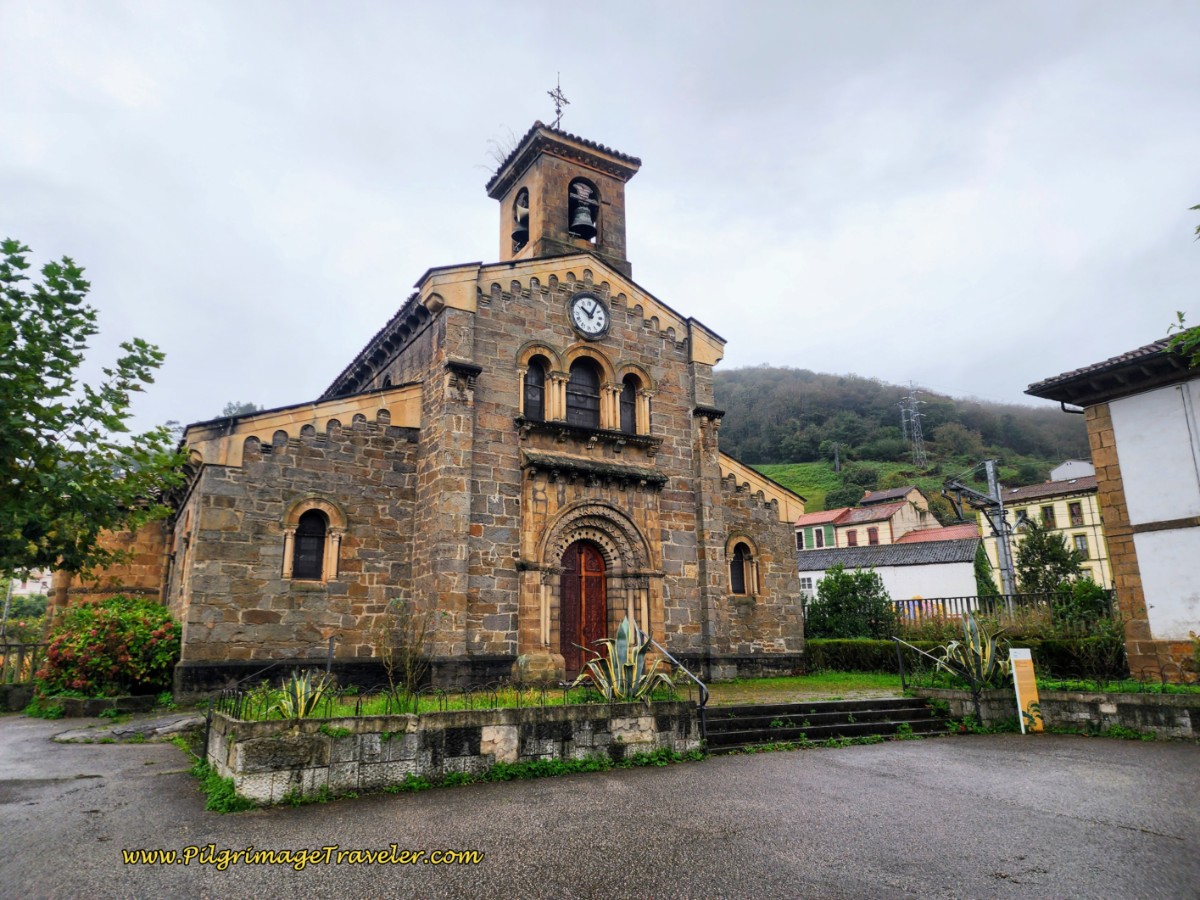
After 650 meters on the Calle Manuel Llanesa, make a left turn northward and onto our old friend, the AS-375. The street is called the Calle Teodoro Cuesta and you can see the prominent church ahead, the Parroquia de San Juan Bautista. Here is a photo of it.
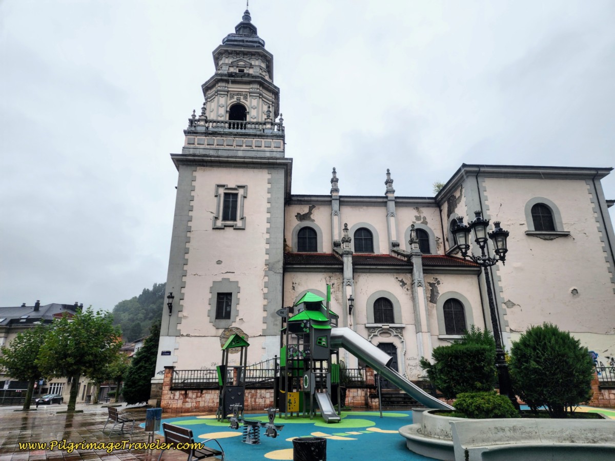 Left Turn Toward St. John the Baptist Church
However, this is where I end this stage, after 20.7 kilometers. We actually walked 3.7 kilometers onward to the Casa Alba (+34 624 83 34 03) as described at the beginning of this stage.
There are many accommodations within Mieres, if you wish to stay here instead of the university albergue. Click here for a list of them on booking.com.
There is another accommodation, just south of the church (turning right at the intersection just described), the H.Albar Mieres.
The Hotel Mieres del Camino is just another 3/4 kilometer past the intersection, farther along the AS-375 to the north. It is a triangular-shaped building on a corner by a large intersection. Another option for the night.
And just two kilometers onward is the hostal in La Peña, The Orange Teddy Bear Hostel, also previously mentioned.
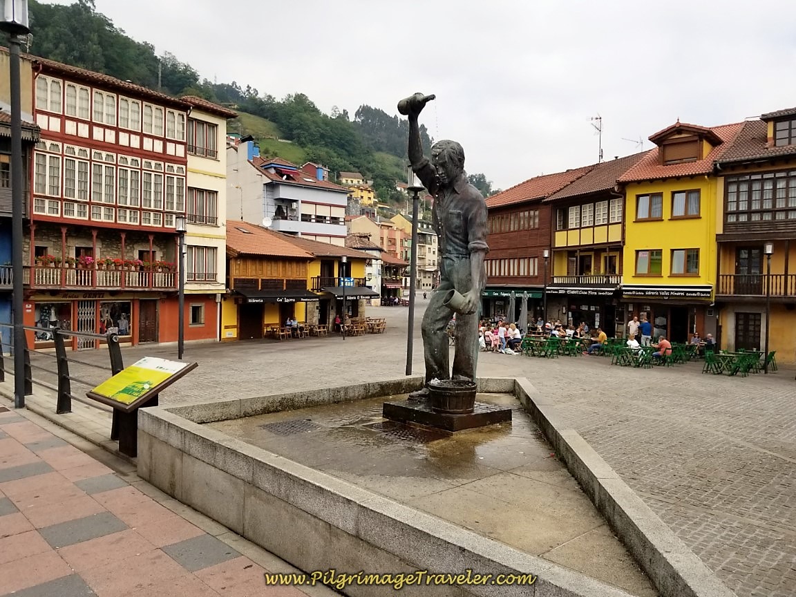
Just after the church, is the Plaza de Requexu with the statue of a man pouring the cider, known as an escanciador, shown below. The typical Asturian houses surrounding the square are cider houses. If you are unfamiliar with the Asturian cider tradition, and the famous pouring maneuver, see my Oviedo article where I describe it fully! It is something you must try! Plan a stop here to witness the event if you plan to stay in town for the night.
We ended up eating a marvelous lunch at the Sidrería Restaurante Casa Fulgencio on the square and it was an amazing surprise! If you are stopping for the night in Mieres, you may wish to visit this restaurant or spend some time in the area.
Reflections on Day Five of the Camino de San Salvador
As I stated above, this day was not my favorite. My left knee was giving me woes, the many long stretches on the pavement were quite boring and difficult for my knee and the sound of the traffic from the highway we followed all day was not pleasant. However, if you want to get to Oviedo, you must put your head down and just do it!
While I did very little complaining, my heart did not want to complete this day. I just wasn't feeling it! My spiritual training of accepting and including all that comes my way did not work well for me. I did not want to accept nor include. And so it is and was.
For most of the day, I just wanted it to be over. Where was my "symbol and image of an active life?"
I couldn't help wondering what I was doing to myself. I did not want to create a more permanent situation with my knee. Yet I carried on because my brain believed that it was all just a repetitive motion problem that would go away. I had merely pushed myself too hard and walked too far the prior day. Time would tell, wouldn't it?
Salutation
May your own day five on the Camino de San Salvador be a wonderful road, as the novelist George Sand reminds us: It is the symbol and the image of an active and varied life. May you feel this road, and may it be beautiful for you as you walk to Oviedo! Ultreia!
Camino de San Salvador Stages:
Please Consider Showing Your Support
Many readers contact me, Elle, to thank me for all the time and care that I have spent creating this informative website. If you have been truly blessed by my efforts, have not purchased an eBook, yet wish to contribute, I am exeedingly grateful. Thank you!
Search This Website:
🙋♀️ Why Trust Us at the Pilgrimage Traveler?

We’re not a travel agency ~ we’re fellow pilgrims! (See About Us)
We've trekked Pilgrimage Routes Across Europe since 2014!
💬 We’ve:
- Gotten lost so you don’t have to. 😉
- Followed waymarks in the glowing sunlight, the pouring rain and by moonlight. ☀️🌧️🌙
- Slept in albergues, hostels & casa rurals. Ate and drank in cafés along the way. 🛌 😴
- Created comprehensive and downloadable GPS maps and eBook Guides, full of must-have information based on real pilgrimage travels. 🧭 🗺️
- Shared our complete journeys, step by step to help YOU plan your ultimate pilgrimage and walk with your own Heart and Soul. 💙✨
Every detail is from our own experiences. Just fellow pilgrims sharing the Way. We have added a touch of spirituality, heartfelt insights and practical guidance from the road ~ offering a genuine connection to the spirit of pilgrimage. Tap into the wisdom of seasoned pilgrims!
Ultreia and Safe Pilgrimage Travels, Caminante! 💫 💚 🤍
Follow Me on Pinterest:
Find the Pilgrimage Traveler on Facebook:
Like / Share this page on Facebook:
***All Banners, Amazon, Roamless and Booking.com links on this website are affiliate links. As an Amazon associate and a Booking.com associate, the Pilgrimage Traveler website will earn from qualifying purchases when you click on these links, at no cost to you. We sincerely thank you as this is a pilgrim-supported website***
PS: Our eBook Guide books are of our own creation and we appreciate your purchase of those too!!
Shroud Yourself in Mystery, along the Via de Francesco!
Walk in the Footsteps of St. Francis, and Connect Deeply with the Saint and to Nature in the Marvelous Italian Countryside!
Need suggestions on what to pack for your next pilgrimage? Click Here or on the photo below!
Find the Best Hotel Deals Using This Tool!
Carbon Trekking Poles ~ My Favorites!
Carbon fiber construction (not aluminum) in a trekking pole makes them ultra lightweight. We like the Z-Pole style from Black Diamond so we can hide our poles in our pack from potential thieves before getting to our albergue! There are many to choose from! (See more of our gear recommendations! )
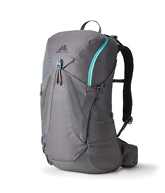
Gregory BackPack ~ My Favorite Brand
Do not forget your quick-dry microfiber towel!






Your Opinion Matters! Comments
Have you had a similar experience, have some advice to give, or have something else you'd like to share? We would love to hear from you! Please leave us a comment in the box below.