- ~ Home
- ~ Camino Primitivo (The Original Way)
- Day Three, La Doriga to La Espina
Jump to Camino Primitivo Stages
Day Three on the Camino Primitivo ~ La Doriga to La Espina, 22.9 Kilometers (14.23 Miles)
Disclosure: the PilgrimageTraveler.com is an associate of Booking.com, Roamless, and Amazon. As associates of these merchants, we earn from qualifying purchases from our links.
If adversity builds character, then day three on our Camino Primitivo was a character-building day for me! It only took my husband and I until the 3rd stage of the Original Way to run out of our emergency food. Combine this lack of preparedness with the lack of support facilities on the Camino Primitivo, and the set-up for a miserable morning was in place.
People travel to wonder at the height of mountains, at huge waves of the sea, at the long courses of rivers, at the vast compass of the ocean, at the circular motion of the stars...and they pass by themselves without wondering. ~ St. Augustine, Confessions
🙋♀️ Why Trust Us at the Pilgrimage Traveler?
We’re not a travel agency ~ we’re fellow pilgrims! (See About Us)
We've trekked Pilgrimage Routes Across Europe since 2014!
💬 We’ve:
- Gotten lost so you don’t have to. 😉
- Followed waymarks in the glowing sunlight, the pouring rain and by moonlight. ☀️🌧️🌙
- Slept in albergues, hostels & casa rurals. Ate and drank in cafés along the way. 🛌 😴
- Created comprehensive and downloadable GPS maps and eBook Guides, full of must-have information based on real pilgrimage travels. 🧭 🗺️
- Shared our complete journeys, step by step to help YOU plan your ultimate pilgrimage and walk with your own Heart and Soul. 💙✨
Every detail is from our own experiences. Just fellow pilgrims sharing the Way. We have added a touch of spirituality, heartfelt insights and practical guidance from the road ~ offering a genuine connection to the spirit of pilgrimage. Tap into the wisdom of seasoned pilgrims!
Ultreia and Safe Pilgrimage Travels, Caminante! 💫 💚 🤍
Day Three, Camino Primitivo Maps and Stats
Here is our Google map of the GPS tracks for our day three on the Camino Primitivo. Fortunately, for our aching feet and shin splints, the pavement walking was only about 50%. We encountered more lovely forest paths on this stage of the Original Way.
Approaching Cornellana in the beginning part of the day, there are two options for walking. A scenic alternative to the monastery is available, if you do not need anything in town - note this alternative route in orange on the map, before Cornellana. This used to be the standard route, but more recently the Camino was re-routed through town. This is a good thing if you need groceries or a café and are planning to stay overnight at the monastery.
Looking at the elevation profile map, shown below, you can see the many ups and downs of day three on the Camino Primitivo from La Doriga (3.0 km before Cornellana) to La Espina.
The long climb of about 570 meters (1870 feet), without much reprieve from the low at Llamas, about 4.5 km after Cornellana, to La Espina will feel strenuous!
👣 Camino Primitivo EBook: Offline Guide with Bonus Routes
Walk smarter with our ad-free, beautifully formatted Camino Primitivo eBook Guide, perfect for offline use. Includes daily stage details, stunning photos, and bonus routes to the one-of-a-kind Santa Eulalia de Bóveda temple, Montouto’s ancient neolithic stones, and a weather-safe alternative to the Hospitales Route via the Río Nisón detour. Our eBook Guide is unique because it's our personal journey, told with heart.
📲 Instant download. 💸 Money-back guarantee. 🔄 Free updates for 1 year.
👉 Click here for more info OR BUY NOW to begin your adventure today!
Jump to Camino Primitivo Stages
The Journey
Our day three on the Camino Primitivo started out well enough at 07:30, at daybreak on this day in August. There was no sunrise to speak of, my shins felt better, and my throat that was sore the prior day seemed to only be a bit of post-nasal drip this morning. I breathed in deeply as I walked, sending loving, healing energy to my throat on the exhale, willing it to be OK.
We left our private albergue without breakfast. We had no food in our pack, as Doriga was a tiny place with nowhere to buy food. I broke my cardinal rule of having nothing to eat when we set out for the day. (See Camino Planning Tips for more useful suggestions.) First mistake - poor planning. We should have obtained more food in Oviedo or Escamplero.
The sole proprietor of the albergue was working so hard the day before, a Sunday, with a full house that was partying all day and well into the evening. He would have gotten up early for us to ensure our breakfast, but he looked so exhausted on Sunday night that we told him we could walk the 3 km to Cornellana for breakfast, without a problem. Hmm, second mistake.
In hindsight, what we could have done was ask if he had any food we could purchase from the bar the night before to keep for the next morning. We have also learned to carry packets of Nescafe, or tea bags for a hot (or sometimes cold beverage) to go along with bread (pan) or muffins (magdalenas) in the morning. Some pilgrims even carry a heating coil and mugs to heat water for hot beverages, ramen noodles and instant soups. Live and learn!
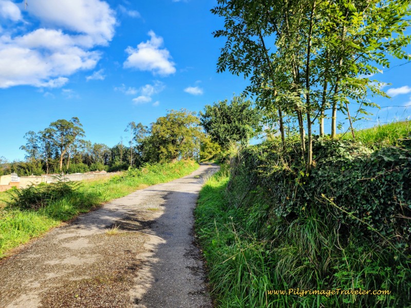
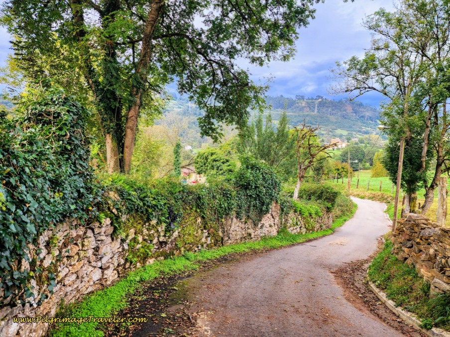
Our day three on the Camino Primitivo started out on a nice semi-paved road as it climbed up and out of La Dóriga, below. This country lane was lined with wonderful juicy blackberries. We stopped to pick and eat several handfuls for our breakfast. After passing the town cemetery on your left hand side, which you can see in the photo below, and after about 600 meters, arrive at a T-intersection with a gravel lane where you turn left.
About 150 meters later, walk under an overpass of the A-63, below.
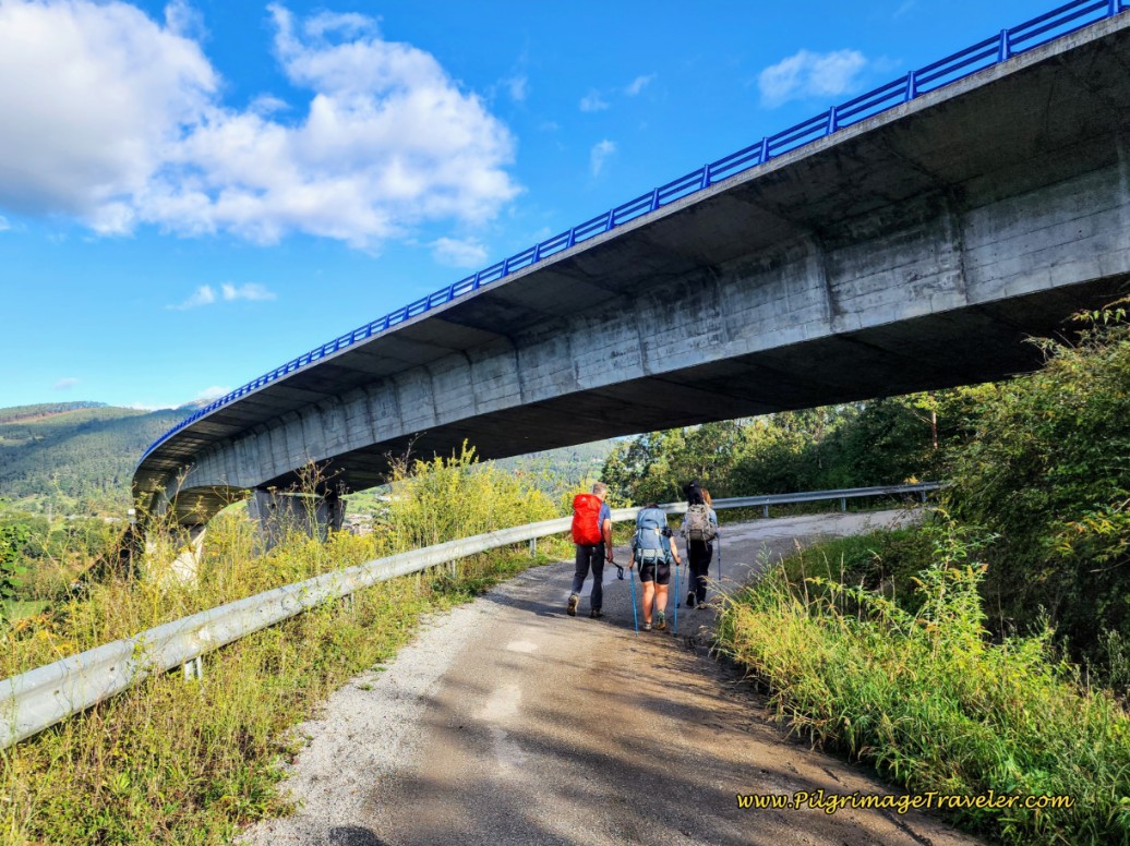 Walk Under the A-63 Flyover
On the other side of the A-63, come to a T-intersection with another road, barely 50 meters later. Just before the intersection, look for a path to your left, leaving the country lane diagonally for what appears to be an entrance to a tangled mess, below.
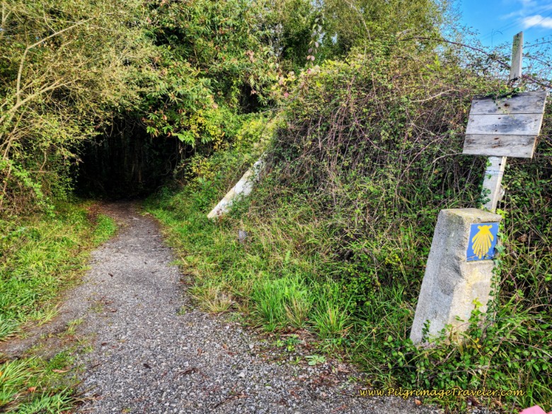 Look For Path Into Forest
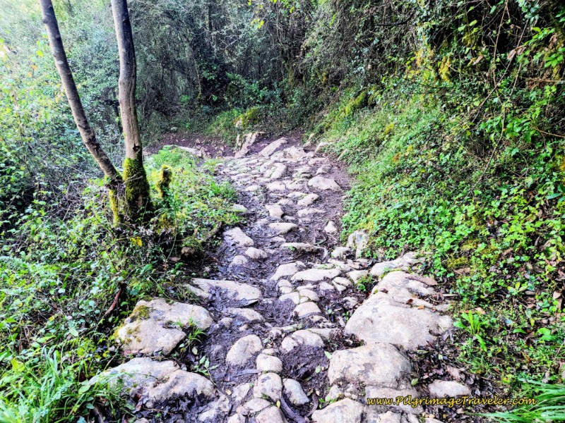
This path enters a nice, cool forest, and sure enough, you will soon notice that it is an old Roman road when you approach a preserved section of it. This rocky Roman Road is quite uneven and difficult to walk upon, and if wet, is quite slippery!
After a zig zag down the slope in the forest, you will come to the forest’s edge and join a fence line. Enter the hamlet of La Ponte - Casas del Puente and walk through some homes on the way to joining the AS-15 after about 650 meters total on the path.
There is a building on your right at the intersection with the AS-15 highway, with a clock on it and a nice bench under it to rest, see the photo below. By the bench is a water fountain that is labeled as potable water. This is an inviting place to take a pause if you need it. Notice the Buen Camino Peregrino sign and the Camino shells and the lacy roofline embellishment! I just love these little Camino touches that support pilgrims, with no motivation other than kindness!
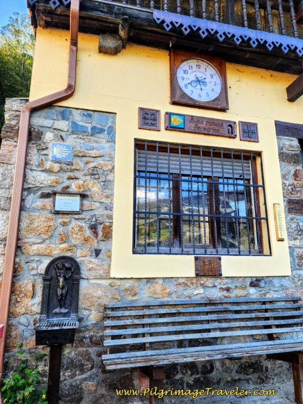 Buen Camino Peregrino - Rest Area
After the row of houses on the right side of the highway and when the nice shoulder ends, cross to the other side of the highway and pick up a worn pilgrim's path.
About 200 meters later there is a designated pilgrim’s path with a guardrail between the path and the highway, where you can walk safely for the remainder of the 3/4 kilometer that you are on it, until intersecting with the N-634. Along the way, pass the town sign signalling that you are entering La Rodriga.
It is at this intersection’s large roundabout that you will find the Donativo Albergue Roca Madre, (+34 638 176 862), a few steps off the highway, after about 2.2 kilometers from La Doriga, with communal vegetarian meals included. Look for the white signs beside the giant hórreo if you wish to stay here, see the photo below. The proprietors took a ruined place with historic hórreos and remodeled it into a pilgrim’s albergue. Visitors here give their hospitality nothing but very high praise.
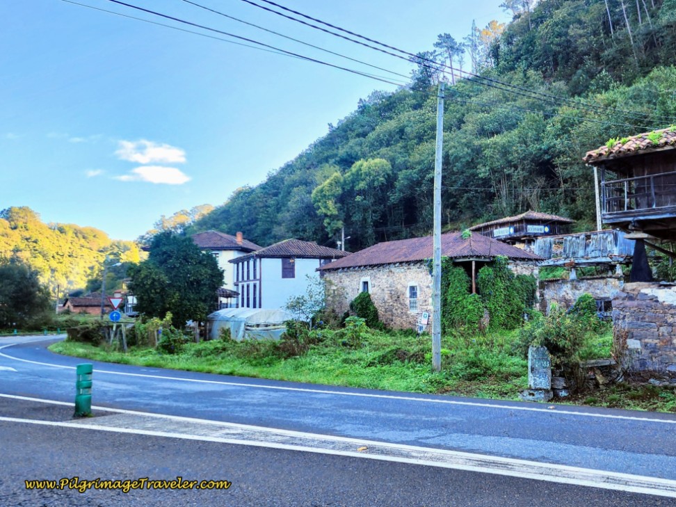 Albergue Roca Madre
Stay to the left of the roundabout, walking on the wide shoulder and turn left, leaving the AS-15 to join the N-634 (which the Camino follows nearby for most of the day). Pass a lovely park with picnic tables on your left, pass La Rodriga town exit sign and 300 meters later, cross the River Narcea on the highway bridge into Cornellana.
Immediately after crossing the bridge, is an alternative route along the river, shown as the more southerly orange route on the map above. You can see the sign for the path to the monastery above the Camino sign in the photo, below. It says, “Monasterio de San Salvador, 900 m,” and indicates a turn to the left.
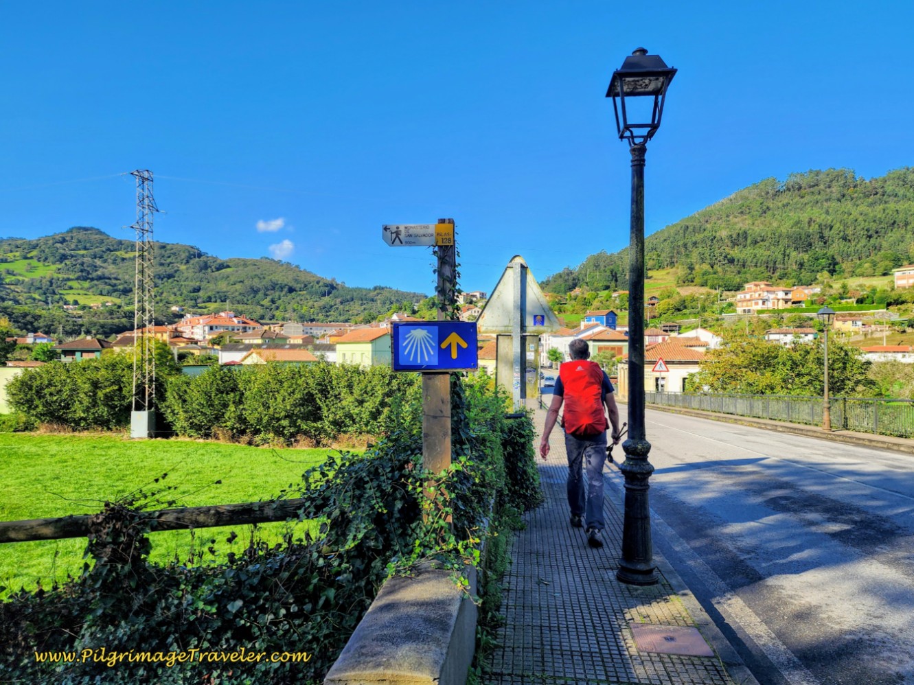 Decision Point After River Crossing
This was the old route, turning left after the bridge to follow a lovely footpath by the river towards the monastery, photo below. We have taken the river path and it is quite nice, and what I recommend if you don’t need a stop in town. It is not a shortcut, but about the same distance as the standard route through town.
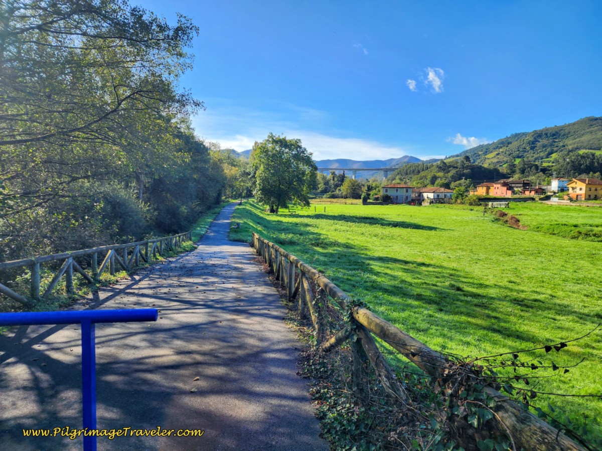 Path Along the River to the Monastery
We have also walked the route through town, and if you choose this standard route, you will pass by many cafés and a supermarket on your way to the albergue in the monastery. Just stay straight after the bridge to walk into the heart of Cornellana.
After about 1/2 kilometer from the decision point by the bridge, along the N-634 and by all the cafés, you turn left, or south and head for the monastery which you will encounter after another 1/4 kilometer and a total of about 3.5 kilometers from La Doriga. The supermarket is just after the turn.
The Albergue del Monasterio de San Salvador, (+34 635 485 932), has 26 places and I have heard lovely reports about staying here from fellow pilgrims.
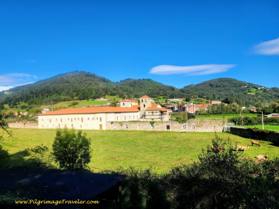
As we approached the monastery from the alternative river path, its hugeness was a surprise!
The view pictured next, is how the monastery appears entering from town.
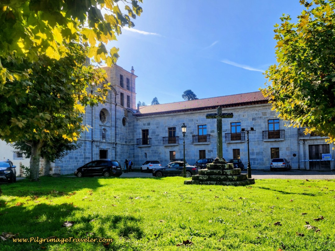 The Monastery of San Salvador de Cornellana
The monastery is a UNESCO world heritage site. The oldest tower within the complex is from the 10th century. The Romanesque church’s interior was built in the 12th Century and the façade in the 17th Century.
We hung around the monastery for about 15 minutes, absorbing the energy of the place. I wondered how the other peregrinos liked their stay here. I felt some regret that we had not. It was a fantastic place. (We have been inside the monastery church during a mass at another, later time and indeed, it is a wonderful and peaceful place.)
It was 8:15. The monastery was on the outskirts of town. We guessed that a walk into town was about a quarter kilometer or more. Our experience was that very few café bars open up prior to 9:00 or 10:00. We made the decision to keep on going, thinking there would be another open bar along the way soon. Third mistake. (There are now several bars in town that may open at 07:00, with the explosion of peregrinos now on this route. Yes, we are changing the culture.)
Because of the blackberries that we had already eaten earlier, my stomach was content in this moment. We went onward.
After the monastery, we turned right onto the SL-7 and began the second climb of the day, which is 1.7 kilometers long and towards Sobrerriba, the next hamlet.
The sunlight was dancing on the monastery as we climbed along the SL-7, pictured below.
You will walk under the A-63 through a tunnel just before entering the town. It is after about 1.2 kilometers on the single-lane, paved SL-7 from the turn by the monastery and just before a big bend in the road, that the Way turns left onto a side road that shortcuts the same bend, below.
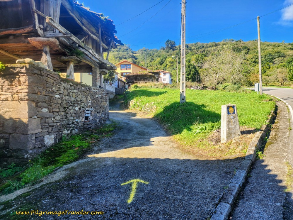 Shortcut Lane in Sobrerriba, Day Three Along the Camino Primitivo
Less than 100 meters later, the shortcut crosses over the SL-7 and carries straight-on, and onto an off-road path into the wooded countryside. This path is after about 5.0 kilometers into the day.
Shortly after walking through Sobrerriba, the Way provided an apple tree. It was going on 9:00 a.m. and without food except for a few berries, I agreed that my husband could pick me an apple. Even though I felt like I was stealing, I did note that many apples were falling to the ground. Indeed, the tree looked unattended. I guess I would be forgiven if I ate the apple! (No parallels intended here!)
As the saying goes, whatever the pilgrimage traveler needs, the Camino will provide. Indeed, the tart apple, though gnarled and small, was a welcome respite to my empty belly.
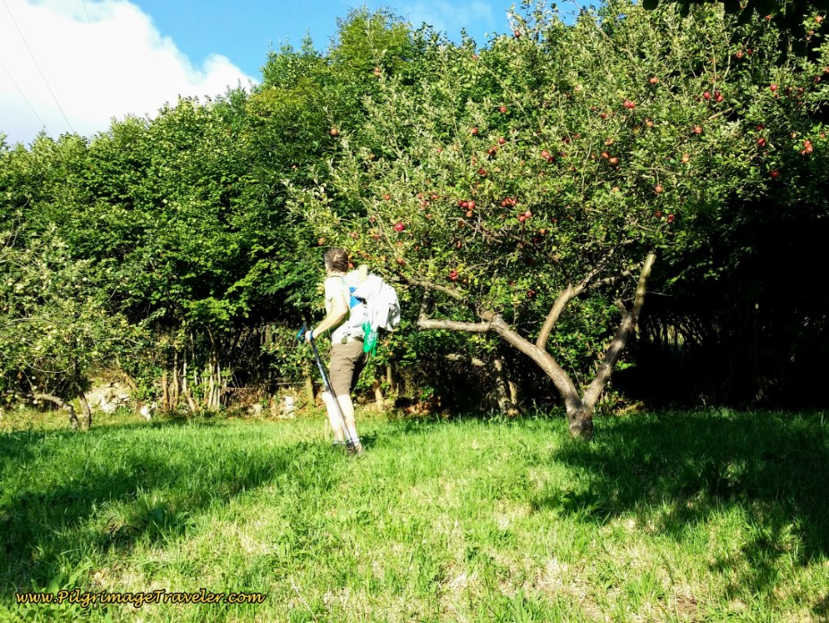 The Camino Provides Apples
The path from the SL-7, led us into the woods, for an almost 2.0 kilometer reprieve on our feet and shins. Any path that diverts off the pavement is a good one! On day three along the Camino Primitivo, the way was almost entirely on pavement up to this point. My shins still hurt, but not quite as badly today. Finally they were adapting to all the pavement walking. If you look closely at the photos of my husband, you will notice that he moved his elastic supports from his knees to his shins! Ha ha!
The path continues to climb up along a ridge, on another Roman-appearing roadway again. You will know you have reached the top of the second climb when you see the power line tower, below, after about 5.4 kilometers into this day.
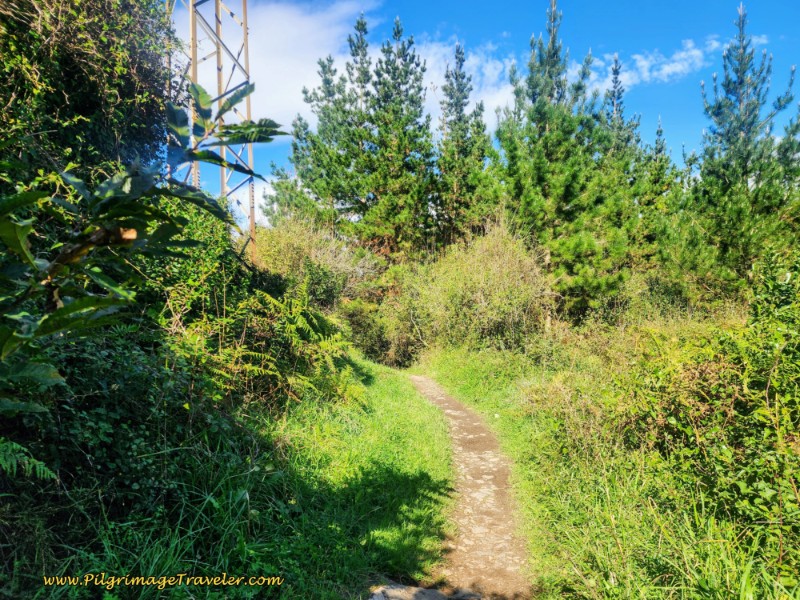 Top of Second Climb at Power Tower
As you walk down the ridge on the other side, more Roman road presents itself, below.
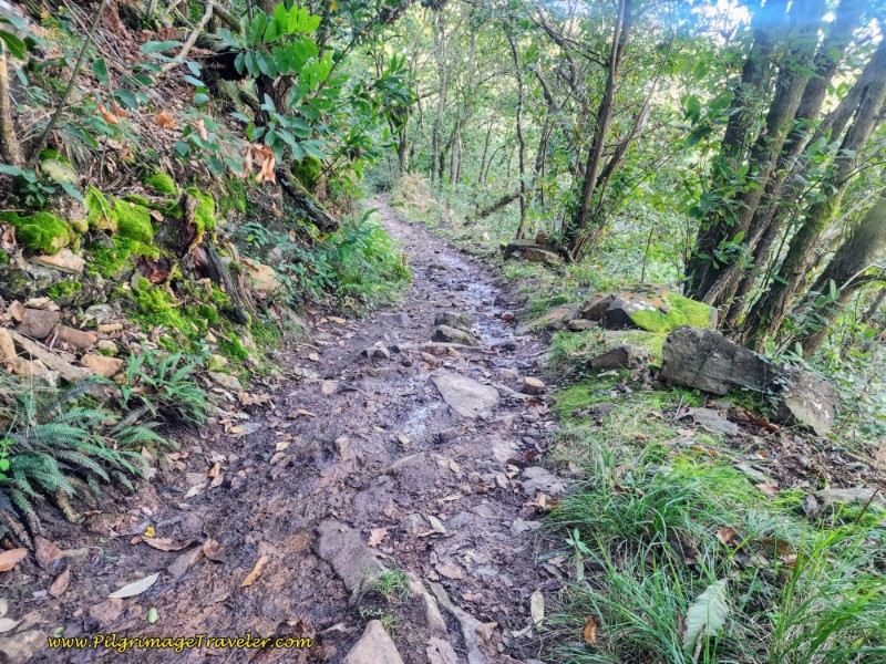 Roman Road Continues
A bit more than one kilometer from the top, you will notice something white through the trees. And then the Camino comes out by a silica quarry, but turns to the left onto a forest road, for another 150 meters or so, skirting the quarry to the south. When you come to the next intersection, take the path in the middle.
By the west end of the quarry, you will come to an intersection, where the Camino stays to the left, joining another quiet paved road. 100 meters after joining the road, pass by a large building, with a little rest area with vending machines supplying coffee and cold beverages. (This was not present at the time of our story).
A bit later down the road as we approached the next hamlet of Llamas, Rich stops and says, "Check out these!" There were nuts on the ground below his feet. I had totally missed them. He cracked one open, and ate it. It was a hazelnut! While it was a bit difficult shelling them, we did eat quite a few of the hazelnuts. Yum!
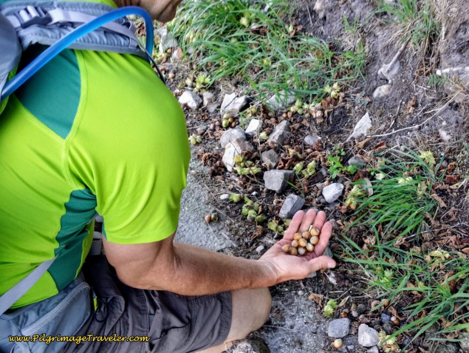 The Camino Provides Hazelnuts
A few steps later, at a Y-Intersection, the Camino stays low and to the right, where there is a lovely Asturian raised hórreo.
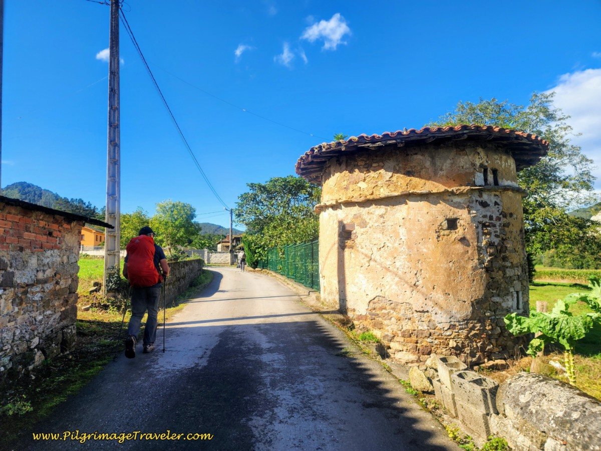
On your way to Llamas, pass by this historic dovecote, pictured below, with openings up under the eaves; these buildings were used to house doves for human consumption. The openings allowed the doves to come and go freely!
A few meters after the dovecote, arrive at a crossroads in the center of Llamas, after about 7.2 kilometers total on day three of the Camino Primitivo. Here, there is a sign on the wall that gives you the option to turn left to visit the small chapel, the Capilla de Nuestra Señora de los Dolores, only 30 meters off-Camino, below. This delightful little chapel with its simple altar was unlocked for pilgrims, to pray and express their gratitude. I was grateful for this, as well as the bench outside to take a rest if needed. There are no services in this town.
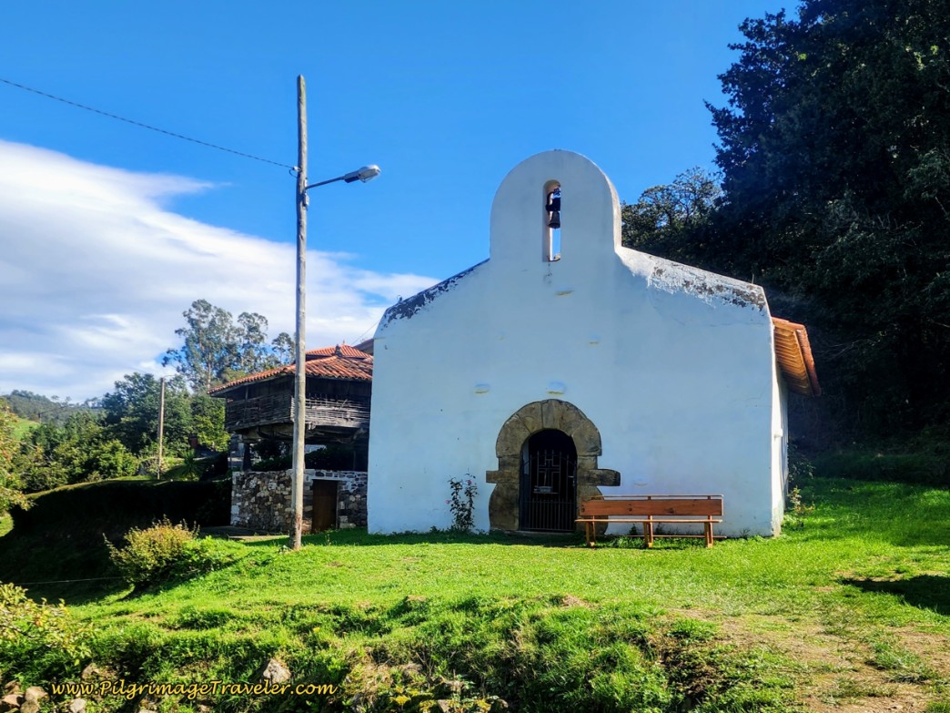 Capilla de Nuestra Señora de los Dolores
The Camino ambles through Llamas, where the paved road turns to a dirt lane 1/2 kilometer west of town, then alternates between farmer’s lanes, pavement and dirt roads on the two kilometer walk through the countryside towards the next town of Villazón. The waymarks are very easy to follow through this segment, essentially staying straight and westward at the next four intersections.
You will know you are heading in the right direction, because an ugly white quarry/mine will be visible on the mountain slope on your right shoulder almost the entire distance from Llamas to Villazón, as well as the path of the N-634 highway.
When you come to your first T-intersection after about 8.25 kilometers, turn right. Less than one hundred meters later, turn left onto another long dirt road, below. You can see the quarry and the highway clearly in this photo.
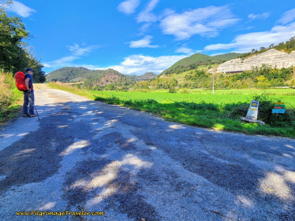 Mine Dominates the View Toward Villazón
After about 1/4 kilometer, stay straight at a faint crossroads with another dirt lane, and a few meters later the Iglesia de Villazón and the town dominate the view ahead instead of the mine and the highway.
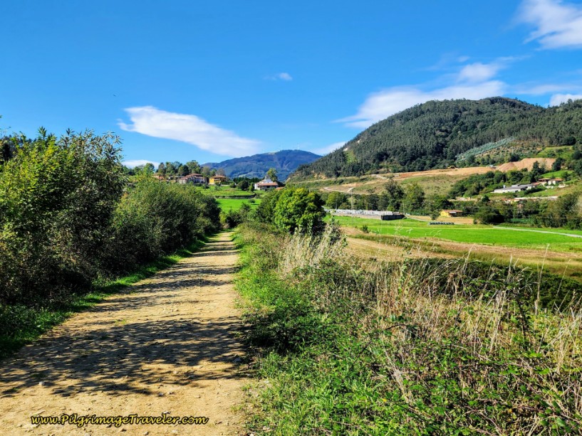 Villazón, Church and Cemetery Ahead on Day Three of the Camino Primitivo
When the dirt lane makes a strong bend to the left, away from the town cemetery ahead, look for a casual path through the field to your right to take a 150 meter shortcut, directly towards the church. You will turn right when you meet the paved road on the other side of the field.
Otherwise, stay on the dirt lane a few more meters, and when the dirt lane reaches Villazón, the Camino avoids walking into town, by taking a sharp right onto a paved road at a 5-point intersection, to parallel Villazón to the east. A few meters later, below the church uphill, is where the shortcut joins the pavement.
One-quarter kilometer later, at the next intersection, the Camino goes to the left where there is a fuente (fountain), the Fuente de Santiago, with a foot pool, and very nicely shaded picnic tables, see photo below, after approximately 9.5 kms total.
 Fuente de Santiago, Villazón
As we continued on the lane from Villazón, we passed several really nice hórreos, including this very ruined one, below. I understand that the Spanish government considers these to be of historic value and there are grants to restore them, if one applies! Hopefully this will soon be one of them.
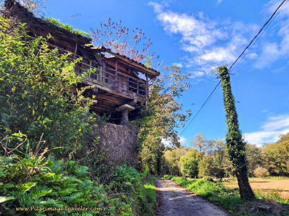 Ruined Raised Hórreo Along the Lane
2/3 kilometer after the Fuente de Santiago, you encounter yet another rest area, with a fountain and a rain shelter for pilgrims, called the Fuente Caliente, not pictured. Without any food, we did not stop. It sure didn't stop me from thinking about my plight, however. It was around 10:00 and my stomach was really gnawing on me! The more I tried to forget about my empty stomach, the more impossible it became.
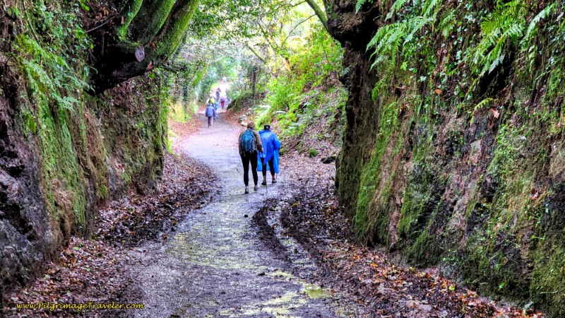
At least my feet and shins were relatively happy, as a few meters after the Fuente Calinte, the Way turns left, once again diverting onto a path into the forest for about another kilometer or so. It was a nice, gradual uphill as well through here, which relieved my shins. The forest is lovely through this section, and does not seem to be a preserved ancient road, but if it has recently rained expect lots of mud.
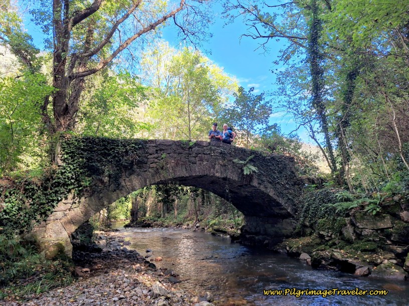
You have almost completed the forest walking section, when you cross the picturesque bridge, the 17th century Puente de Casazorrina, over the Nonaya River, below.
Jump to Camino Primitivo Stages
When the Original Way comes out of the forest at a T-intersection, you will turn left to rejoin the pavement. Several meters later you walk by a mill-like building adjacent to the Rio Nonaya.
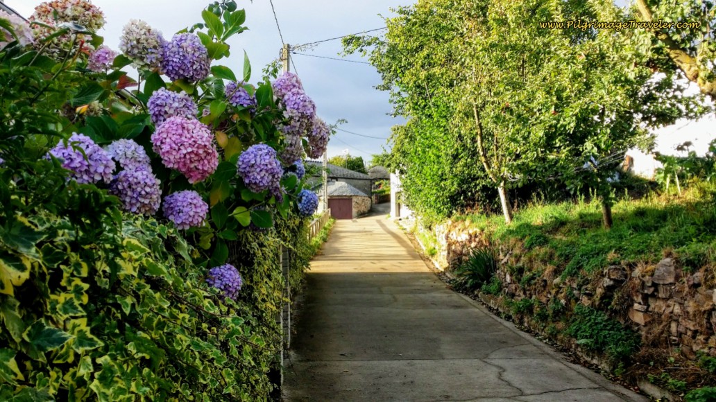
Only 1/4 kilometer later, at the entrance to the hamlet of Casazorrina, look for a turn to the left onto a scenic, narrow lane through town, see the next photo.
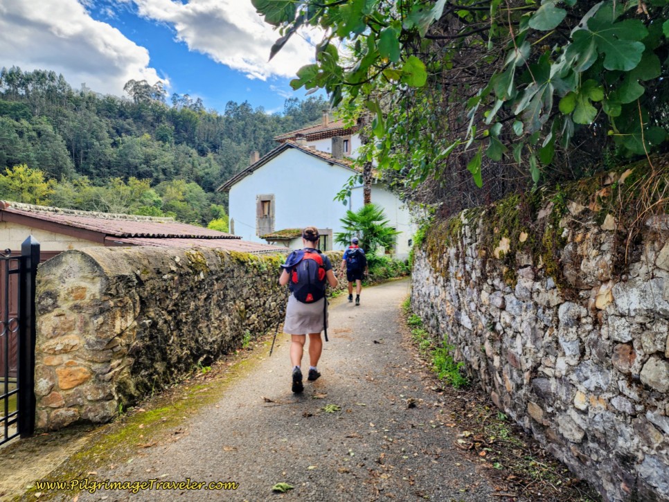 The Hamlet of Casazorrina
And barely 125 meters later, at a Y-intersection, where the Camino goes to the left, you will see a sign for the Albergue La Figal de Xugabolos, with dormitory beds and private rooms, but more importantly, a bar and food. Unfortunately, at the time of this story, this was not available! At the time, only a restaurant at a Repsol station along the N-634 to the north, 300 meters off-Camino was available.
By Casazorrina, we had walked about 11.4 kilometers with very little food. I actually thought that it was only a bit more than a kilometer to Salas from Casazorrina. (Wishful thinking as it is almost three). Since I had already come this far without food, I thought I may as well go onward. We agreed to push onward to Salas instead of adding the extra distance to our walk. It was 10:20 (But who was tracking, other than my stomach??)
When you leave the buildings of town behind, the Way becomes a dirt and gravel lane as once again you are in the open countryside. You will cross the Nonaya River once again, on a footbridge, the Pasarela de la Dehesa, below.
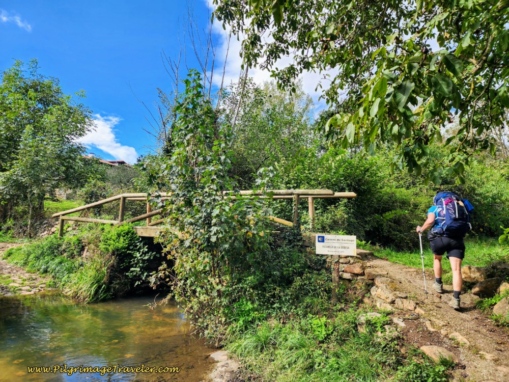 Pasarela de la Dehesa
Not quite 1/2 kilometer later, the Camino makes a right turn onto another gravel lane and crosses under the A-63 through a tunnel, then a few meters later turns right again to cross over the N-634, below.
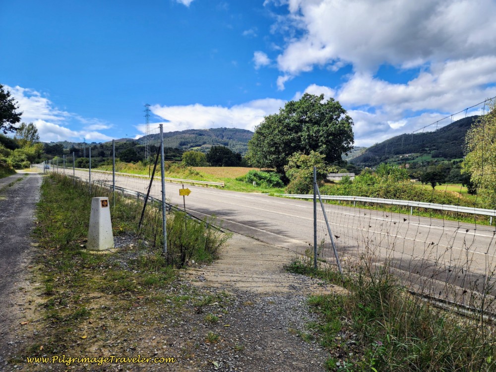 Cross Over the N-634
On the other side, you will pick up a nice dirt track that is mostly shaded, below, walking through the countryside until the town of Mallecín.
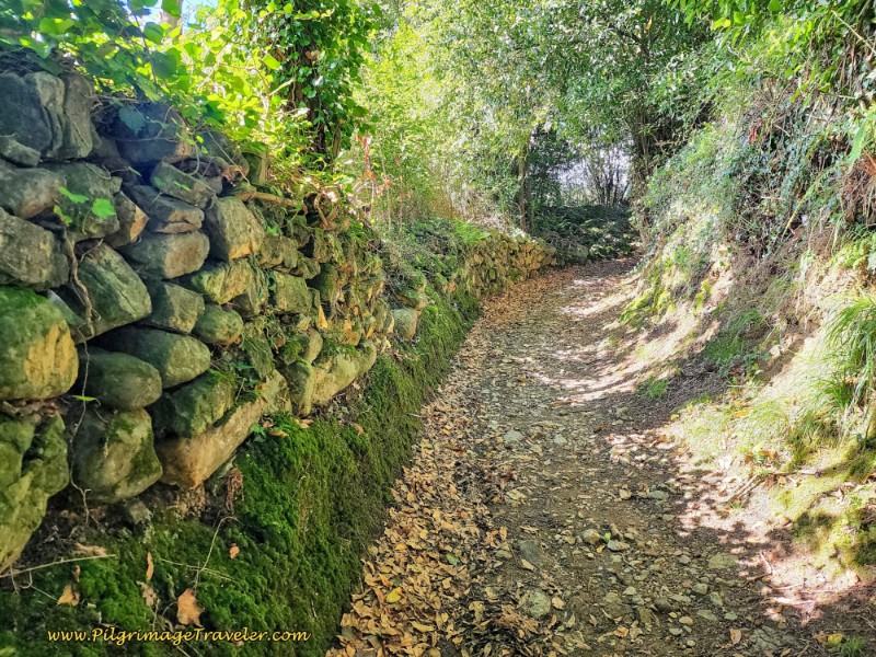 Dirt Track Toward Salas
Meander through town on lanes, until coming to this intersection with the AS-370, below, after about 1.1 kilometers. The town of Salas is just ahead.
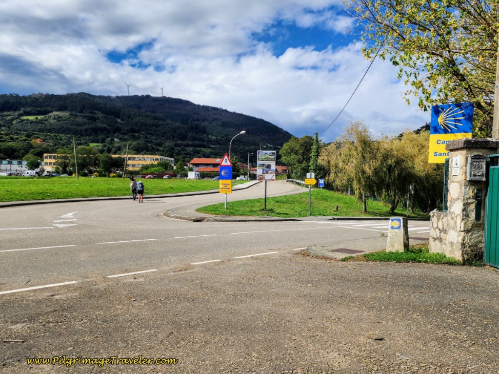 Cross the AS-370
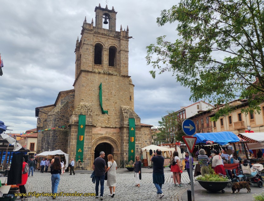
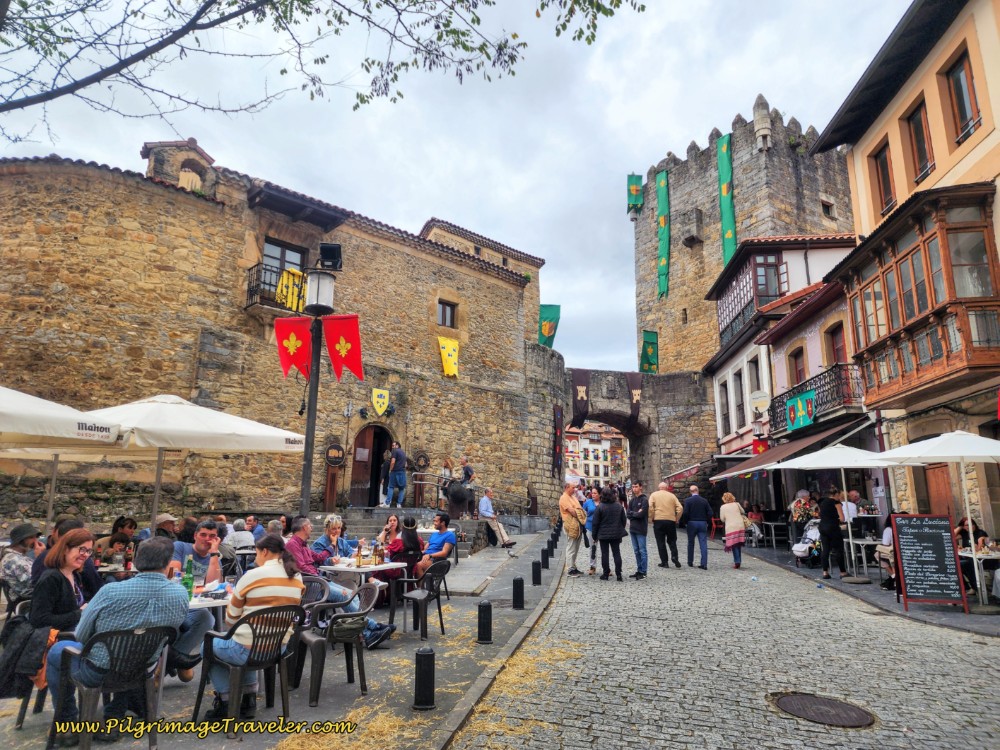
750 meters later, walking along the Avenida del Llaniello, we arrived in the center of Salas at the church square, the Colegiata de Santa María la Mayor, after about 14.5 kilometers into the day. (These photos of Salas, below, are from a recent trip, when a wonderful medieval festival was happening in the town. I used them for this update since they are better than my original photos.)
We rejoiced to find the Bar La Luciana at the foot of the fortifications, just across the square from the church. It was 11:00. We had walked the full 14.5 kilometers on a few handfuls of blackberries, a small apple and a few hazelnuts! I think I ordered everything on the menu!
The 14th century Tower, the Torre de Valdés Salas and palace connected to it by an arched bridge, below, was the birthplace of Fernando de Valdés-Salas who was the founder of the University of Oviedo, Archbishop of Seville and an Inquisitor General of Spain. The onward Camino goes right through this archway.
Eventually, pilgrims that we had just met joined us, and several more that we would meet that day. Most of these folks would go on to be our Camino family for most of the Original Way. By day three on the Camino Primitivo, our "family" was becoming well formed. We felt very grateful that we were able to stop, eat and rest in this most historic place!
After our lunch we took a few minutes to have a look at the 16th Century church, the Colegiata de Santa Maria la Mayor in the main square that we had just passed. Not very ornate or brilliant, but impressive, nonetheless.
While waiting for our food to be served, I took a spin through the mini-market close to the church and bought lots of snacks for the road. As we set off, my belly was quite full and content, and my pack was full of lots of food!
If you decide to end your day here, there are six albergues, the municipal Albergue de Peregrinos de Salas, (+34 684 60 97 96), a few blocks north of the center, one donativo the Albergue El Rey Casto (+34 670 44 09 09), and four private ones, the Albergue Valle del Nonaya (also with private rooms - we stayed in a clean and comfortable, very large room, in an old house tastefully redone, with a sink in the room), the Albergue el Tulipán de Salas, and the Albergue La Campa, all clustered around the center. The fourth private albergue, the Albergue Casa Sueño (also has private rooms, click here for the hotel) is another 300 meters after the castle gateway, along the Camino. There are also two hotels in the center, the Hotel Castillo Valdes Salas, (+34 985 83 01 73,) and the Hotel Soto (+34 985 830 037).
If you are leaving Salas in the morning, you should have no problem finding a café that opens early.
The afternoon took us through the castle gateway in Salas, where 150 meters later, we stayed right at a Y-intersection. About 300 meters later and after passing the Casa Sueño, the pavement gives way to a beautiful large track that lasts about 2.5 kms with no pavement, see photos below.
After Salas, it is a long, steady uphill, following the valley of the Nonaya River. It was during the afternoon sometime that my right big toe started hurting. More settling in, I suppose. Dang, this was harder than I thought! Even with a full belly! I could at least be grateful that it wasn't raining. It was indeed a gorgeous, clear day.
Pass the historic Fuente de Paín after another quarter kilometer, and a total of 15.2 kilometers, not pictured. Through this section, you may notice an old grist mill and the A-63 highway bridge up to the left of you.
After about 16.5 kilometers into the day, cross the first historic bridge, the Puente de Borra, below.
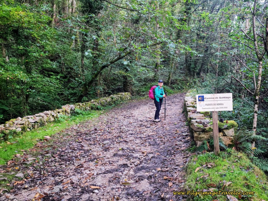 Elle on the Puente de Borra, Day Three, Camino Primitivo
And the strong climb continues.
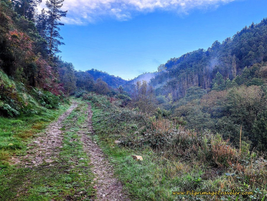 The Steady Climb West of Salas
After about 800 meters more, you will arrive at this intersection, shown below. In the photo, Rich is returning back up from the waterfall. It is a nice front view of him for a change! Ha ha.
 Turn-Off for the Cascada Nonaya
If you take the turn to the right, a short diversion of about 250 meters will take you to a waterfall, the Cascada de Nonaya, below. It is a pleasant and shady walk downhill, with a loss of only 20 meters.
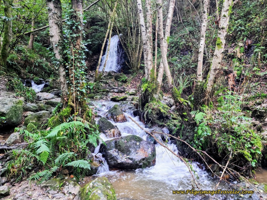
However, for me, the most interesting part of this brief diversion was not the waterfall, but the view of the 17th century bridge, the Puente del Carcabón from the trail that walks below it, below. I didn’t really notice how dramatic the bridge was, until the return! The view from below gave it a whole new perspective.
 The Puente del Carcabón from Below
Back on the Camino de Santiago at the turnoff, from above, you will cross this same bridge, after about 17.3 kilometers into the day. From above, it appears almost identical to the prior bridge, the Puente de Borra and I have not pictured it.
The Way continues to climb after the waterfall turnoff, with a final steep, switchbacking ascent over 300 meters, below, up and away from the Nonaya River valley and towards the N-634 national highway.
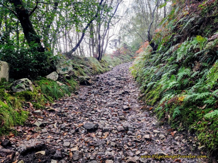 Final Steep Ascent Towards National Highway
When the Camino reaches the N-634, it crosses it and turns to the right. It continues along the highway for 850 meters, see photo below, as it goes under the motorway, the A-63. This section of roadway is very busy with blind bends and no shoulder, so be careful! The one good thing is that at least the climb levels out for this highway section.
 N-634 Under the Motorway
After approximately 18.5 kilometers total, leave the roadway, and turn to the left onto another track, pictured below, mostly through the forest, climbing strongly again.
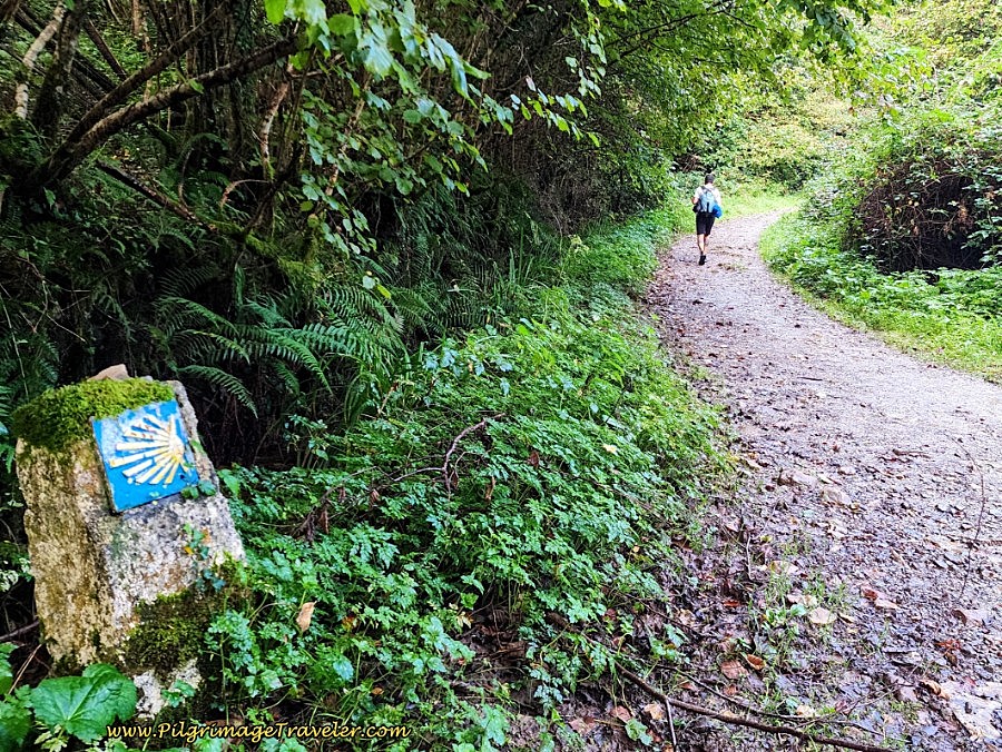 Leave the N-634 on this Track Into the Forest
You will remain on this track for about 1.1 kilometers, eventually approximating the path of the A-63 in a parallel course. While you really don’t see the highway through here, you may hear it. The lower lying portions of this section can be a real mud bath if rain is involved! But at higher elevations, the gravel and the runoff are more efficient.
After about one kilometer, pass a bridge over the A-63 to your left with a blue railing, but continue straight onwards. About 100 meters after the bridge, you are directed to turn right onto yet another lane, shown below, to finish the final section of the long climb for the day towards the next town of Porciles.
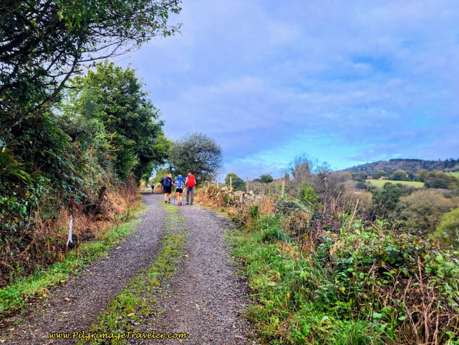 Climbing Towards Porciles
Despite the hardships of day three on the Camino Primitivo, with about an hour left to go, all-in-all I felt wonderful! This was in spite of the fact that it is a significant climb from Salas to La Espina, an elevation gain of about 500 meters (approx 1600 feet) in the first six kilometers. Not for the faint of heart!
The countryside shimmered with the green of late summer as the sun continued to shine brightly on our walk. I felt lucky. My outlook had greatly improved with a full belly. Plus the uphill climb actually invigorated me in this particular moment!
By the time you arrive at this intersection in Porciles, below, you have walked 20.1 kilometers from La Doriga. You never really see the town itself, and there are no services.
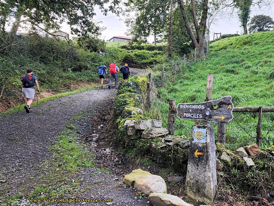 Arriving at Intersection in Porciles
However, as the sign in Porciles notes, the donativo albergue, the Posada de Peregrinos Fontenonaya, (+34 653 24 70 07), is to the right, then after 200 meters, turn right onto the N-634 and after another 125 meters, arrive at the Posada for about 325 meters total. The accommodation gets almost all positive reviews and serves communal meals. This is the nearest choice if the albergues in Salas are booked full, which happens.
There are two more accommodations in Porciles, also off-camino, but only one that is practical for the pilgrim. If you have a group of six, you may want to check out the Casa Nueva Salas. There is also the Casa Cinco Robles, but it is very expensive and requires a four night minimum!
The Camino continues to the left up the lane for the final steps of the climb. Barely 50 meters later, come to a T-intersection where you will turn right onto a country road towards Bodenaya, shown below. The town is still another 1.6 kilometers away.
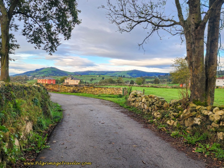 Road to Bodenaya
After joining this quiet paved road, arrive at a crossroads after about one-quarter kilometer and continue straight onwards onto a gravel lane. This lane shortly becomes a frontage-type road along the A-63 highway to your left, but on the other side of a high fence. Not a very nice place to walk.
After another 3/4 kilometer on the gravel lane, walk under a road through a tunnel and arrive at a T-intersection with a paved road. Turn left and 100 meters later arrive at the Bodenya cemetery, not pictured. There is a 20th Century cross, the Cruceiro de Bodenaya, marked by a Camino sign, just beyond the cemetery, which I found to be unimpressive.
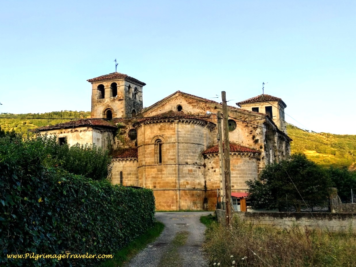
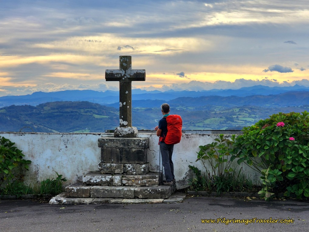
And just after the cruceiro is the equally unimpressive but quaint Iglesia de Santa Marina, below, keeping to the right both before and after it. The church was actually unlocked and we stopped briefly for a prayer of gratitude at the simple altar.
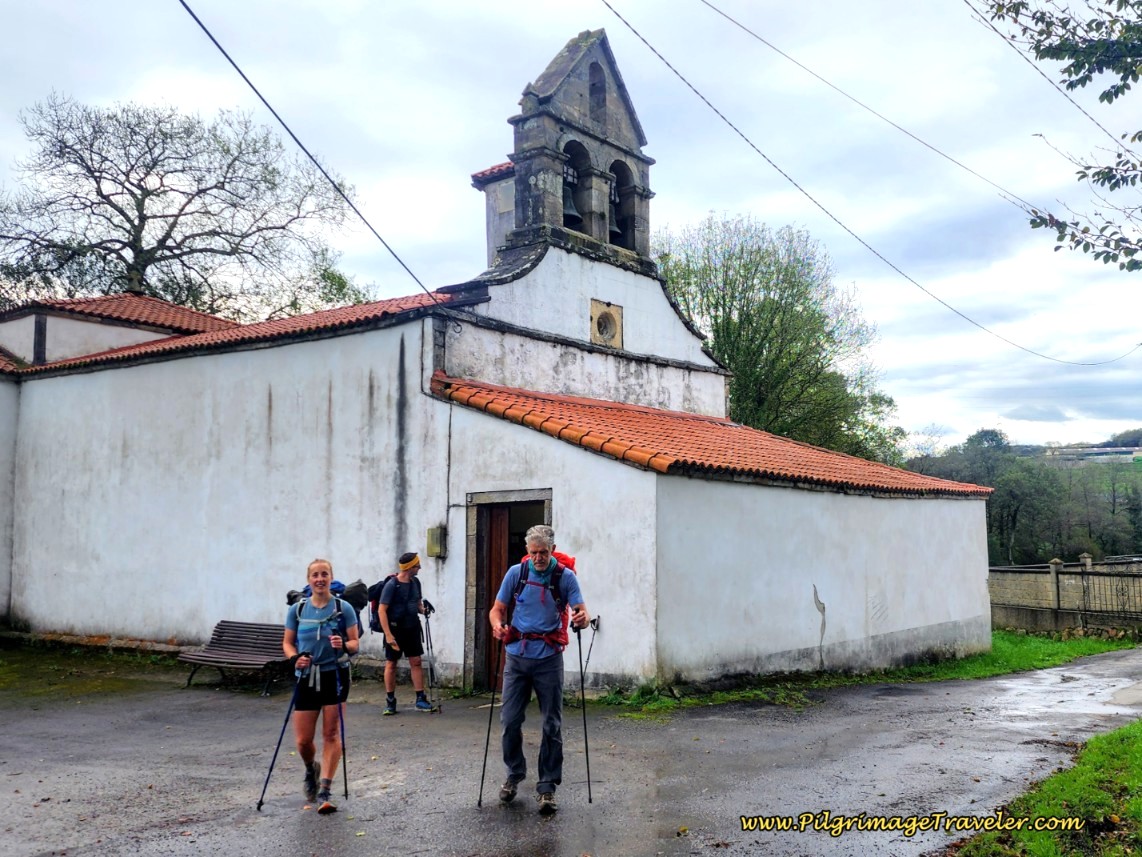 Iglesia de Santa Marina
By these two landmarks, you have officially arrived in Bodenaya. La Espina is just a kilometer away on quiet secondary lanes. A few meters past the church, you will walk right by the donativo, Albergue de Peregrinos de Bodenaya, (+34 645 88 89 84), below, after 21.6 kilometers from La Doriga and 7.1 kilometers from Salas. It is one of the most highly recommended albergues on the Primitivo, despite having changed hands in recent years. The donativo does not have internet service, and Rich’s mother was ill in a nursing facility and we felt that we needed a channel for communication, so we continued on for one more kilometer to La Espina.
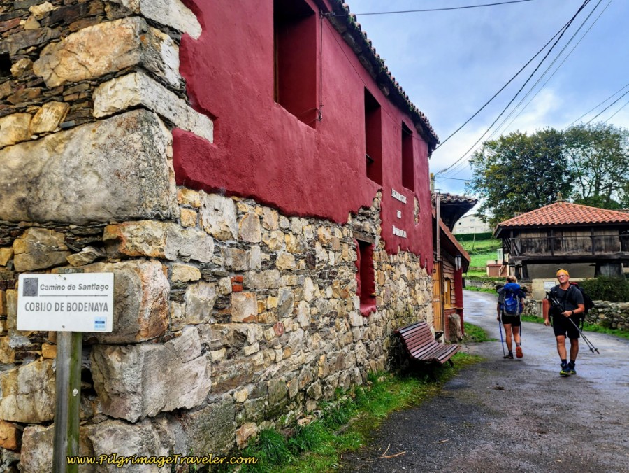 Albergue de Peregrinos de Bodenaya
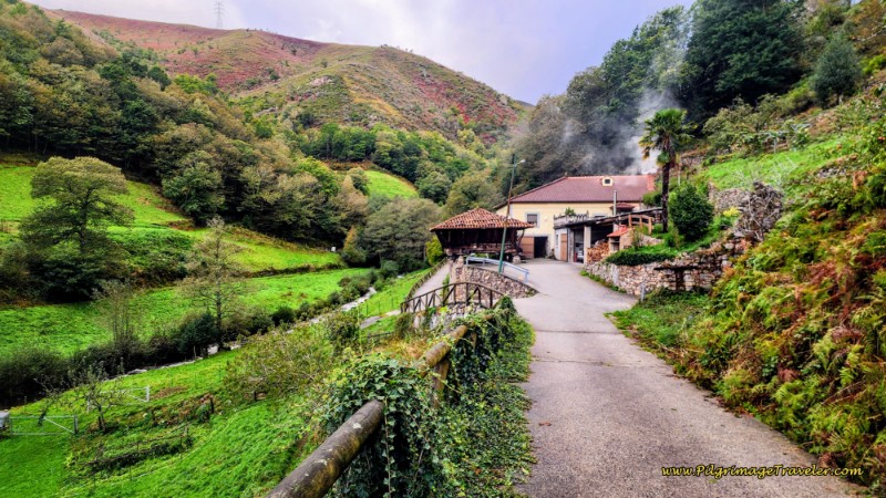
A few steps after the albergue, cross over the N-634 and continue through the remainder of town. Stay to the left at the next Y-intersection, walking onto a nice tractor lane. The lane onward from Bodenaya is peaceful and inviting, below.
 Lane Towards La Espina
Arrive into La Espina at this intersection, below, where you can see the wooden sign for the donativo albergue, El Texu, (+34 603 75 19 06), our destination for the night.
 Straight Onward for the Albergue El Texu
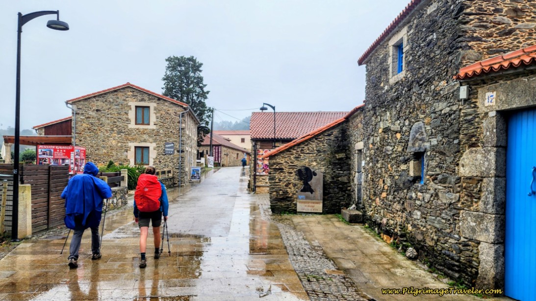
Also, you can see the large yellow sign announcing La Parada del Peregrino, The Pilgrim’s Stop. Our group, below, didn’t even think twice, but took the turn to the left, off-Camino to head into town for a coffee break.
There is an abundance of cafés in La Espina, and you will be sure to find one open. La Parada del Peregrino, is the first one on the main street, the N-634, the green building in the photo. You will want to take this turn if you are staying at one of the accommodations in the center of town.
 Left Turn for Town
There are a total of four accommodations in La Espina, El Texu, (+34 603 75 19 06), previously mentioned, the very economical privado, the Albergue Casa Aladino, with 18 places and the budget Pensión Dakar, with 6 places in three rooms, right in the center of town along the N-634 and another donativo, the Albergue de Peregrinos El Cruce, (+34 602 465 316), a bit farther along the Camino on the west end of town, with only 10 places.
Our first time through here we stayed at El Texu, but it has changed hands very recently. There is both a dormitory and three private rooms, and community dinner and breakfast available. If you were to stay walking on the Camino, which takes the street parallel to the N-634, you will walk right by the albergue.
After El Texu, only a few meters onward, come to a T-intersection, turn left and walk to the intersection with the N-634, shown below. The Camino turns to the right.
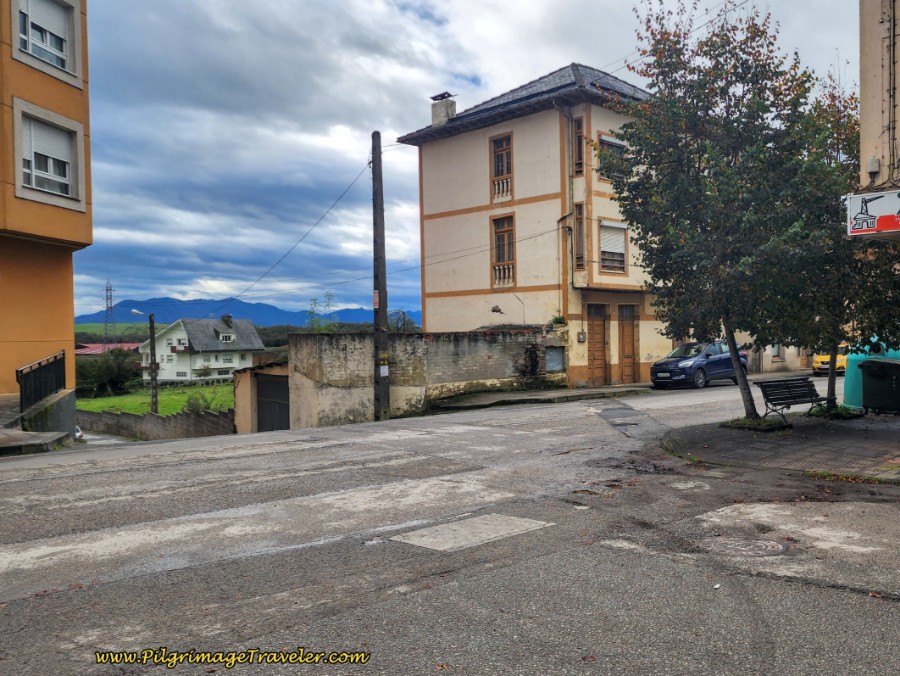 The Way Turns Right Here, Joining the N-634
The Albergue de Peregrinos El Cruce is just a few steps ahead. It is in the Coviran supermarket building, so look for it if that is your destination.
But here is where I will conclude this day’s narrative.
In addition, another easy 1.3 kilometers farther along on the Camino, is the private Albergue el Minero (+34 607 31 47 46), in the town of La Pareda if needed, see day four.
This day three on the Camino Primitivo was a hard one for me. The Original Way is more uphill and downhill than my actual body realized it was going to be. My mind knew it, from all my reading, but my body really needed to acclimate as I pushed through the day.
We enjoyed a lovely meal, that we cooked at the albergue, before there were community meals, with new friends to end our day three of the Camino Primitivo. They all confirmed that staying at the monastery in Cornellana is an experience not to be missed!
Reflections From Day Three on the Camino Primitivo
As I reflected later about my morning without food, I thought that I would have been a lousy pilgrimage traveler in days of yore. I simply could not get my mind off my hunger. The medieval pilgrims must have suffered tremendously, relying on the charity of the townsfolk along The Way, never knowing where they would get their next meal.
Clearly, I was nowhere near starving, but I was quite grouchy, even though I kept it to myself. Whether or not it was a purely mental obsession with food, I was so close to sitting down and saying to my husband that I just could not go on. Yet what good would that have done?
My husband didn't seem to focus on the lack of food. I honestly think he could have gone all day without any. The combination of my shins hurting, my sinuses dripping and my belly growling was just too much for me on this day three of my Camino Primitivo! I guess I am not as spiritually mature as I think!
Somehow, I did manage to go on, despite my unhappiness. I did have it in me, because I did it. However, I vowed that never, ever again would I set out without any food in my pack.
I had to closely examine my relationship with food and what deprivation might truly look like. This may have been the closest I have ever come in my life to real hunger. Yet, what was it really in relation to world hunger?
Salutation
May your own Camino de Santiago be filled with the wonders of your own way of being. May you be prepared well, and may you face adversity with awe and wonder at your own pre-conceptions of reality.
May the wind be on your back, the sun on your shoulder and the fruit of the earth be manifested for you on your own day three of your Camino Primitivo!
The Camino Primitivo Stages
Please Consider Showing Your Support
Many readers contact me, Elle, to thank me for all the time and care that I have spent creating this informative website. If you have been truly blessed by my efforts, have not purchased an eBook, yet wish to contribute, I am exeedingly grateful. Thank you!
Search This Website:
🙋♀️ Why Trust Us at the Pilgrimage Traveler?

We’re not a travel agency ~ we’re fellow pilgrims! (See About Us)
We've trekked Pilgrimage Routes Across Europe since 2014!
💬 We’ve:
- Gotten lost so you don’t have to. 😉
- Followed waymarks in the glowing sunlight, the pouring rain and by moonlight. ☀️🌧️🌙
- Slept in albergues, hostels & casa rurals. Ate and drank in cafés along the way. 🛌 😴
- Created comprehensive and downloadable GPS maps and eBook Guides, full of must-have information based on real pilgrimage travels. 🧭 🗺️
- Shared our complete journeys, step by step to help YOU plan your ultimate pilgrimage and walk with your own Heart and Soul. 💙✨
Every detail is from our own experiences. Just fellow pilgrims sharing the Way. We have added a touch of spirituality, heartfelt insights and practical guidance from the road ~ offering a genuine connection to the spirit of pilgrimage. Tap into the wisdom of seasoned pilgrims!
Ultreia and Safe Pilgrimage Travels, Caminante! 💫 💚 🤍
Follow Me on Pinterest:
Find the Pilgrimage Traveler on Facebook:
Like / Share this page on Facebook:
***All Banners, Amazon, Roamless and Booking.com links on this website are affiliate links. As an Amazon associate and a Booking.com associate, the Pilgrimage Traveler website will earn from qualifying purchases when you click on these links, at no cost to you. We sincerely thank you as this is a pilgrim-supported website***
PS: Our eBook Guide books are of our own creation and we appreciate your purchase of those too!!
Shroud Yourself in Mystery, along the Via de Francesco!
Walk in the Footsteps of St. Francis, and Connect Deeply with the Saint and to Nature in the Marvelous Italian Countryside!
Need suggestions on what to pack for your next pilgrimage? Click Here or on the photo below!
Find the Best Hotel Deals Using This Tool!
Carbon Trekking Poles ~ My Favorites!
Carbon fiber construction (not aluminum) in a trekking pole makes them ultra lightweight. We like the Z-Pole style from Black Diamond so we can hide our poles in our pack from potential thieves before getting to our albergue! There are many to choose from! (See more of our gear recommendations! )
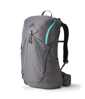
Gregory BackPack ~ My Favorite Brand
Do not forget your quick-dry microfiber towel!






Your Opinion Matters! Comments
Have you had a similar experience, have some advice to give, or have something else you'd like to share? We would love to hear from you! Please leave us a comment in the box below.